File:RFN 900 000.png
(Redirected from File:Bahnstrecke Culoz–Modane.png)

Size of this preview: 547 × 599 pixels. Other resolutions: 219 × 240 pixels | 438 × 480 pixels | 701 × 768 pixels | 935 × 1,024 pixels | 2,339 × 2,561 pixels.
Original file (2,339 × 2,561 pixels, file size: 676 KB, MIME type: image/png)
Captions
Captions
Add a one-line explanation of what this file represents
Summary edit
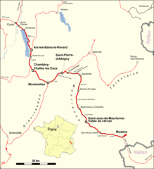
| Description | Karte der Maurienne-Strecke (Culoz - Aix-les-Bains - Chambéry - Modane) |
| Date | |
| Source |
Map was created by using
|
| Author |
|
| Permission (Reusing this file) |
Map data (c) OpenStreetMap (and) contributors, CC-BY-SA |
Licensing edit
I, the copyright holder of this work, hereby publish it under the following license:
This file is licensed under the Creative Commons Attribution 3.0 Unported license.
- You are free:
- to share – to copy, distribute and transmit the work
- to remix – to adapt the work
- Under the following conditions:
- attribution – You must give appropriate credit, provide a link to the license, and indicate if changes were made. You may do so in any reasonable manner, but not in any way that suggests the licensor endorses you or your use.
| This work is licensed under the Open Database License (summary). |
File history
Click on a date/time to view the file as it appeared at that time.
| Date/Time | Thumbnail | Dimensions | User | Comment | |
|---|---|---|---|---|---|
| current | 21:27, 6 June 2016 | | 2,339 × 2,561 (676 KB) | Pechristener (talk | contribs) | == {{int:filedesc}} == {{Information |Description=Karte der Maurienne-Strecke (Culoz - Aix-les-Bains - Chambéry - Modane) |Source=Map was created by using * [http://www.openstreetmap.org/ Open Street Map] Data * Locaton map [[:File:France location ma... |
You cannot overwrite this file.
File usage on Commons
The following 6 pages use this file:
- User:Chumwa/OgreBot/Potential transport maps/2016 June 1-10
- User:Chumwa/OgreBot/Public transport information/2016 June 1-10
- User:Chumwa/OgreBot/Transport Maps/2016 June 1-10
- User:Chumwa/OgreBot/Travel and communication maps/2016 June 1-10
- User:Hoff1980/Rail transport in France/2016 June 1-10
- File:Bahnstrecke Culoz–Modane.png (file redirect)
File usage on other wikis
The following other wikis use this file:
- Usage on de.wikipedia.org