File:Bahnstrecke Naumburg-Teuchern Karte.png

Size of this preview: 800 × 565 pixels. Other resolutions: 320 × 226 pixels | 640 × 452 pixels | 1,024 × 724 pixels | 1,280 × 905 pixels | 2,100 × 1,484 pixels.
Original file (2,100 × 1,484 pixels, file size: 4.08 MB, MIME type: image/png)
Captions
Captions
Add a one-line explanation of what this file represents
Summary
edit
| Description |
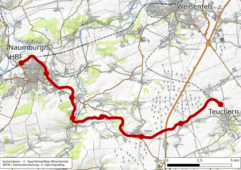
Darstellung Der Bahnstrecke Naumburg-Teuchern in OpenTopoMap - einer topographische Karte aus Daten der OpenStreetMap This map of Naumburg (Saale) was created from OpenStreetMap project data, collected by the community. This map may be incomplete, and may contain errors. Don't rely solely on it for navigation. |
|||||||||
| Date | ||||||||||
| Source | You may find a page on the OpenStreetMap wiki page for OpenTopoMap | |||||||||
| Creator | ||||||||||
| Permission (Reusing this file) |
OpenStreetMap data is available under the Open Database License (details). Standard style map tiles are licensed as ODbL Produced Works.
|
|||||||||
| Geotemporal data | ||||||||||
| Bounding box |
|
|||||||||
| Georeferencing | If inappropriate please set warp_status = skip to hide. | |||||||||
Licensing
edit
I, the copyright holder of this work, hereby publish it under the following license:
This file is licensed under the Creative Commons Attribution-Share Alike 3.0 Unported license.
- You are free:
- to share – to copy, distribute and transmit the work
- to remix – to adapt the work
- Under the following conditions:
- attribution – You must give appropriate credit, provide a link to the license, and indicate if changes were made. You may do so in any reasonable manner, but not in any way that suggests the licensor endorses you or your use.
- share alike – If you remix, transform, or build upon the material, you must distribute your contributions under the same or compatible license as the original.
File history
Click on a date/time to view the file as it appeared at that time.
| Date/Time | Thumbnail | Dimensions | User | Comment | |
|---|---|---|---|---|---|
| current | 14:56, 31 March 2022 | | 2,100 × 1,484 (4.08 MB) | Pomfuttge (talk | contribs) | +License Note |
| 14:08, 31 March 2022 |  | 2,000 × 1,414 (3.91 MB) | Pomfuttge (talk | contribs) | {{OpenStreetMap |name =OpenTopoMap |location = Naumburg (Saale) |description = Darstellung Der Bahnstrecke Naumburg-Teuchern in OpenTopoMap - einer topographische Karte aus Daten der OpenStreetMap |top = 51.20 |bottom = 51.08 |left = 11.88 |right = 12.02 |date =2022-03-31 |authors = OpenTopoMap design, Pomfuttge {{Created with QGIS}}{{Created with GIMP}} |other_versions = |warp_status... |
You cannot overwrite this file.
File usage on Commons
There are no pages that use this file.
File usage on other wikis
The following other wikis use this file:
- Usage on de.wikipedia.org
- Usage on nl.wikipedia.org