File:Bahnstrecke Spreewitz–Graustein.svg

Size of this PNG preview of this SVG file: 385 × 599 pixels. Other resolutions: 154 × 240 pixels | 308 × 480 pixels | 493 × 768 pixels | 658 × 1,024 pixels | 1,315 × 2,048 pixels | 627 × 976 pixels.
Original file (SVG file, nominally 627 × 976 pixels, file size: 1.27 MB)
Captions
Captions
Add a one-line explanation of what this file represents
Summary edit
| Description |
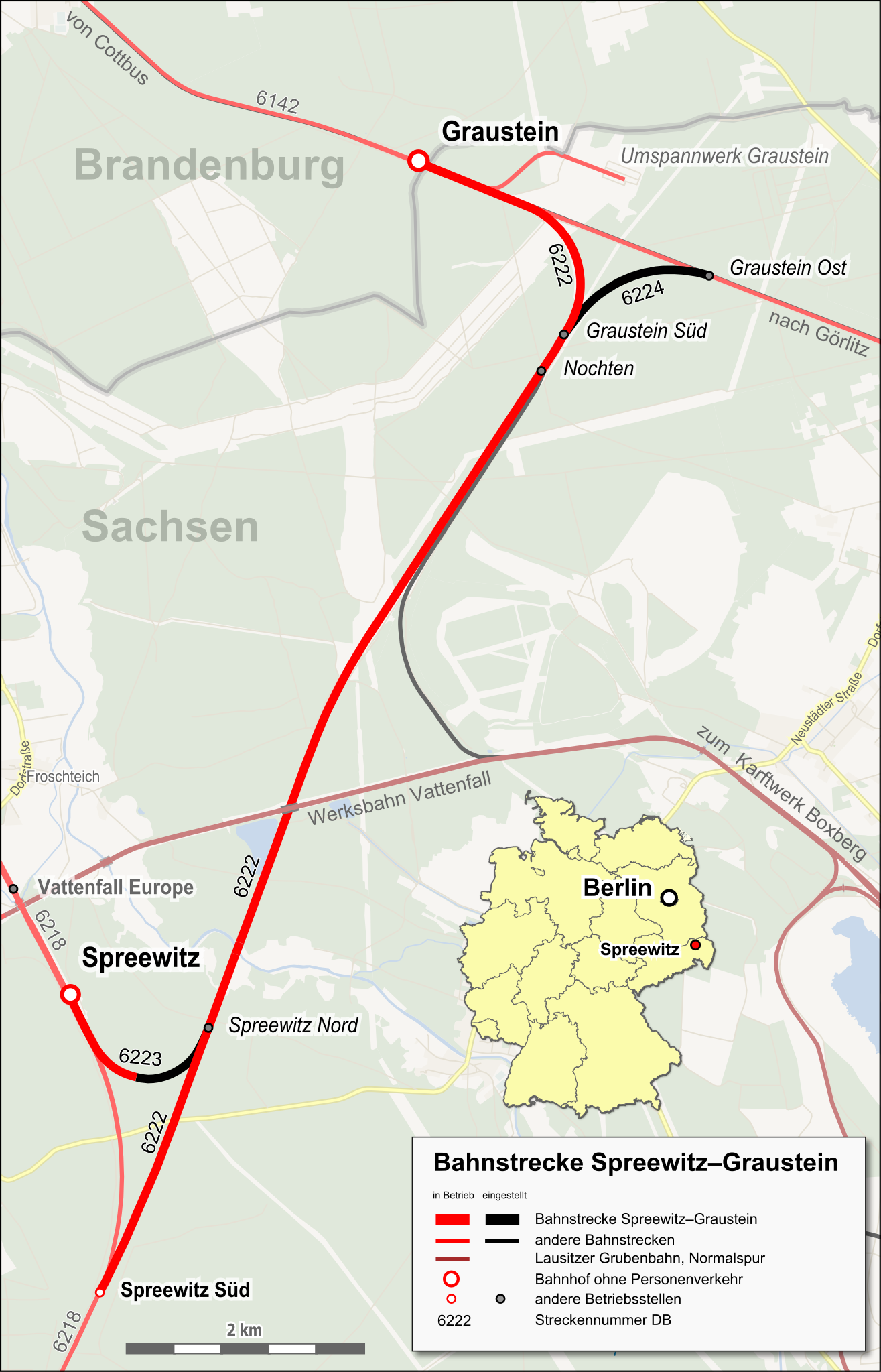
Deutsch: Lagekarte der Bahnstrecke Spreewitz–Graustein |
| Date | |
| Source |
Map was created using:
|
| Creator | |
| Permission (Reusing this file) |
Map data (c) OpenStreetMap (and) contributors, CC-BY-SA |
| Georeferencing | If inappropriate please set warp_status = skip to hide. |
Licensing edit
| This work is licensed under the Open Database License (summary). |
This file is licensed under the Creative Commons Attribution-Share Alike 2.0 Generic license.
Attribution: Peter Christener
- You are free:
- to share – to copy, distribute and transmit the work
- to remix – to adapt the work
- Under the following conditions:
- attribution – You must give appropriate credit, provide a link to the license, and indicate if changes were made. You may do so in any reasonable manner, but not in any way that suggests the licensor endorses you or your use.
- share alike – If you remix, transform, or build upon the material, you must distribute your contributions under the same or compatible license as the original.
File history
Click on a date/time to view the file as it appeared at that time.
| Date/Time | Thumbnail | Dimensions | User | Comment | |
|---|---|---|---|---|---|
| current | 06:01, 11 June 2017 | | 627 × 976 (1.27 MB) | Pechristener (talk | contribs) | == {{int:filedesc}} == {{map |Description ={{de|1=Lagekarte der {{w|Bahnstrecke Spreewitz–Graustein||de}}}} |Source = Map was created using: *[http://www.openstreetmap.org/ Open Street Map] *[[:File:Germany location map.svg|Germany locat... |
You cannot overwrite this file.
File usage on Commons
There are no pages that use this file.
File usage on other wikis
The following other wikis use this file:
- Usage on de.wikipedia.org
- Usage on www.wikidata.org