File:Bali map region.jpg
Size of this preview: 800 × 553 pixels. Other resolutions: 320 × 221 pixels | 640 × 443 pixels | 1,024 × 708 pixels | 1,280 × 885 pixels | 1,628 × 1,126 pixels.
Original file (1,628 × 1,126 pixels, file size: 446 KB, MIME type: image/jpeg)
Captions
Captions
Add a one-line explanation of what this file represents
Summary edit
| Description |
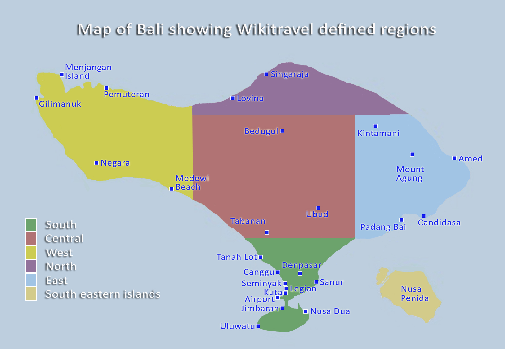
English: Map of Bali showing colour coded regions. |
| Date | |
| Source | Own work based on OpenStreetMap.org [1]. |
| Author | Burmesedays |

|
This file has been superseded by Bali regions map.png. It is recommended to use the other file. Please note that deleting superseded images requires consent. Reason to use the other file: "A PNG version of this file is now available."
|

|
Licensing edit
This file is licensed under the Creative Commons Attribution-Share Alike 4.0 International, 3.0 Unported, 2.5 Generic, 2.0 Generic and 1.0 Generic license.
- You are free:
- to share – to copy, distribute and transmit the work
- to remix – to adapt the work
- Under the following conditions:
- attribution – You must give appropriate credit, provide a link to the license, and indicate if changes were made. You may do so in any reasonable manner, but not in any way that suggests the licensor endorses you or your use.
- share alike – If you remix, transform, or build upon the material, you must distribute your contributions under the same or compatible license as the original.
Original upload log edit
| This file was imported from Wikivoyage WTS. |
The original description page was here. All following user names refer to wts.wikivoyage-old.
- 2009-09-09 14:37 (WT-shared) Burmesedays[dead link] 1628×1126 (260493 bytes) Map of Bali with Wikitravel regions colour coded. (Import from wikitravel.org/shared)
- 2009-09-10 06:34 (WT-shared) Burmesedays[dead link] 1628×1126 (422054 bytes) {{Imagecredit|credit=|captureDate=September 2009|location=Bali |source=|caption=Map of Bali showing Wikitravel defined regions|description=} (Import from wikitravel.org/shared)
- 2009-09-10 06:37 (WT-shared) Burmesedays[dead link] 1628×1126 (421736 bytes) {{Imagecredit|credit=|captureDate=September 2009|location=Bali |source=|caption=Map of Bali showing Wikitravel defined regions|description=} (Import from wikitravel.org/shared)
- 2009-09-11 02:55 (WT-shared) Burmesedays[dead link] 1628×1126 (437522 bytes) (Import from wikitravel.org/shared)
- 2009-09-11 04:35 (WT-shared) Burmesedays[dead link] 1628×1126 (439212 bytes) Bali regional map updated with more locations and west region boundary adjusted (Import from wikitravel.org/shared)
- 2009-09-19 05:44 (WT-shared) Burmesedays[dead link] 1628×1126 (456852 bytes) uploaded new version with Tabanan included (Import from wikitravel.org/shared)
File history
Click on a date/time to view the file as it appeared at that time.
| Date/Time | Thumbnail | Dimensions | User | Comment | |
|---|---|---|---|---|---|
| current | 05:26, 21 November 2012 | | 1,628 × 1,126 (446 KB) | OgreBot (talk | contribs) | (BOT): Reverting to most recent version before archival |
| 05:26, 21 November 2012 |  | 1,628 × 1,126 (429 KB) | OgreBot (talk | contribs) | (BOT): Uploading old version of file from wts.wikivoyage; originally uploaded on 2009-09-11 04:35:49 by (WT-shared) Burmesedays | |
| 05:26, 21 November 2012 |  | 1,628 × 1,126 (427 KB) | OgreBot (talk | contribs) | (BOT): Uploading old version of file from wts.wikivoyage; originally uploaded on 2009-09-11 02:55:45 by (WT-shared) Burmesedays | |
| 05:26, 21 November 2012 |  | 1,628 × 1,126 (412 KB) | OgreBot (talk | contribs) | (BOT): Uploading old version of file from wts.wikivoyage; originally uploaded on 2009-09-10 06:37:54 by (WT-shared) Burmesedays | |
| 05:26, 21 November 2012 |  | 1,628 × 1,126 (412 KB) | OgreBot (talk | contribs) | (BOT): Uploading old version of file from wts.wikivoyage; originally uploaded on 2009-09-10 06:34:47 by (WT-shared) Burmesedays | |
| 05:26, 21 November 2012 |  | 1,628 × 1,126 (254 KB) | OgreBot (talk | contribs) | (BOT): Uploading old version of file from wts.wikivoyage; originally uploaded on 2009-09-09 14:37:56 by (WT-shared) Burmesedays | |
| 22:04, 17 November 2012 |  | 1,628 × 1,126 (446 KB) | MGA73bot2 (talk | contribs) | {{BotMoveToCommons|wts.oldwikivoyage|year={{subst:CURRENTYEAR}}|month={{subst:CURRENTMONTHNAME}}|day={{subst:CURRENTDAY}}}} == {{int:filedesc}} == {{Information |description=MAp of Bali showing colour coded regions. , Bali * Map of: Bali¤ |date=Septem... |
You cannot overwrite this file.
File usage on Commons
There are no pages that use this file.