File:Balkans 4087 cut solunsko.png

Size of this preview: 800 × 423 pixels. Other resolutions: 320 × 169 pixels | 640 × 338 pixels | 1,024 × 541 pixels | 1,280 × 677 pixels | 2,560 × 1,353 pixels | 4,220 × 2,231 pixels.
Original file (4,220 × 2,231 pixels, file size: 11.14 MB, MIME type: image/png)
Captions
Captions
Add a one-line explanation of what this file represents
Summary edit
| Description |
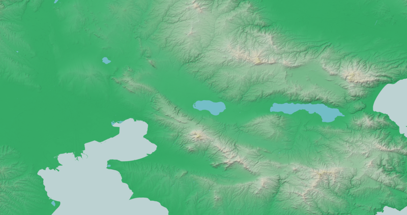
Български: релефна карта на Солунско в Гърция
English: map of Thessaloniki region in Greece |
| Source | Own work |
| Author | Deyan Vasilev ( Dido3 ) |
| Permission (Reusing this file) |
Elevation data: "The original data used for this product have been supplied by JAXA’s AW3D." Water body polygons: "© OpenStreetMap Contributors, CC-BY-SA" |
Licensing edit
Deyan Vasilev ( Dido3 ), the copyright holder of this work, hereby publishes it under the following licenses:

|
Permission is granted to copy, distribute and/or modify this document under the terms of the GNU Free Documentation License, Version 1.2 or any later version published by the Free Software Foundation; with no Invariant Sections, no Front-Cover Texts, and no Back-Cover Texts. A copy of the license is included in the section entitled GNU Free Documentation License. |
This file is licensed under the Creative Commons Attribution-Share Alike 3.0 Unported, 2.5 Generic, 2.0 Generic and 1.0 Generic license.
Attribution: Deyan Vasilev ( Dido3 )
- You are free:
- to share – to copy, distribute and transmit the work
- to remix – to adapt the work
- Under the following conditions:
- attribution – You must give appropriate credit, provide a link to the license, and indicate if changes were made. You may do so in any reasonable manner, but not in any way that suggests the licensor endorses you or your use.
- share alike – If you remix, transform, or build upon the material, you must distribute your contributions under the same or compatible license as the original.
You may select the license of your choice.
File history
Click on a date/time to view the file as it appeared at that time.
| Date/Time | Thumbnail | Dimensions | User | Comment | |
|---|---|---|---|---|---|
| current | 12:41, 8 March 2021 | | 4,220 × 2,231 (11.14 MB) | Dido3 (talk | contribs) | == {{int:filedesc}} == {{Information |Description= {{bg|релефна карта на Солунско в Гърция}} {{en|map of Thessaloniki region in Greece}} |Source={{own}} |Date= |Author=Deyan Vasilev ( Dido3 ) |Permission=Elevation data: "The original data used for this product have been supplied by JAXA’s AW3D." Water body polygons: "© OpenStreetMap Contributors, CC-BY-SA" |other_versions= }} == {{int:license-header}} == {{self|GFDL|cc-by-sa-3.0,2.5,2.0,1.0|author=[[User:Dido3|Deyan Vasilev (... |
You cannot overwrite this file.
File usage on Commons
There are no pages that use this file.
File usage on other wikis
The following other wikis use this file:
- Usage on bg.wikipedia.org
- Лахна
- Висока (дем Лъгадина)
- Богданска планина
- Ставрос (дем Бешичко езеро)
- Ано Ставрос
- Сухо
- Зарово
- Негован (дем Лъгадина)
- Хортач
- Айватово
- Наръш
- Бугариево
- Градобор
- Коритен (дем Илиджиево)
- Балевец
- Василика
- Даутбал
- Юнчии
- Неа Малгара
- Кангалич
- Коняри (дем Делта)
- Колопанци
- Солунско поле
- Илиджиево
- Ватилък
- Ингилизово
- Топчиево
- Каваклиево
- Дремиглава
- Балджа
- Гвоздово
- Чохалари
- Аспровалта
- Неа Врасна
- Като Перистера
- Ново село (дем Лъгадина)
- Ново село (дем Даутбал)
- Карипци
- Кърджалиево
- Дърмица
- Зорбатово
- Даутово
- Саръчево
- Доганджиево
- Караглово
- Ехлово
- Ексамили
- Маврорахи
- Гнойна
- Богдана
View more global usage of this file.