File:Ballteige Burrow - geograph.org.uk - 1372041.jpg
No higher resolution available.
Ballteige_Burrow_-_geograph.org.uk_-_1372041.jpg (600 × 450 pixels, file size: 244 KB, MIME type: image/jpeg)
Captions
Captions
Add a one-line explanation of what this file represents
Summary edit
| Description |
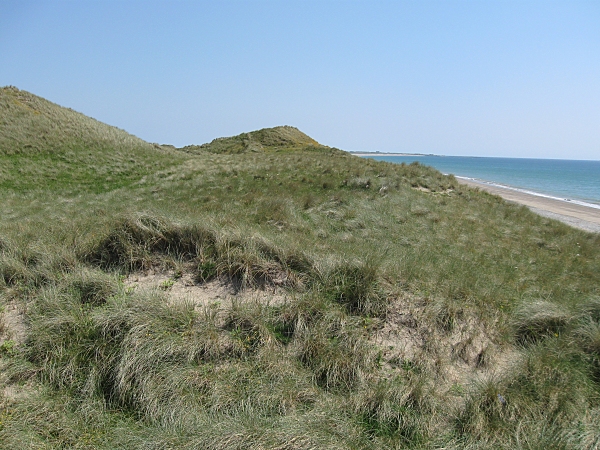
English: Ballteige Burrow The highest dune (14m) at Ballyteige Beach. |
| Date | |
| Source | From geograph.org.uk |
| Author | kevin higgins |
| Attribution (required by the license) | kevin higgins / Ballteige Burrow / |
| Camera location | | View this and other nearby images on: OpenStreetMap |
|---|
_heading:112.00&language=en)
| Object location | | View this and other nearby images on: OpenStreetMap |
|---|
_heading:112.00&language=en)
Licensing edit

|
This image was taken from the Geograph project collection. See this photograph's page on the Geograph website for the photographer's contact details. The copyright on this image is owned by kevin higgins and is licensed for reuse under the Creative Commons Attribution-ShareAlike 2.0 license.
|
This file is licensed under the Creative Commons Attribution-Share Alike 2.0 Generic license.
Attribution: kevin higgins
- You are free:
- to share – to copy, distribute and transmit the work
- to remix – to adapt the work
- Under the following conditions:
- attribution – You must give appropriate credit, provide a link to the license, and indicate if changes were made. You may do so in any reasonable manner, but not in any way that suggests the licensor endorses you or your use.
- share alike – If you remix, transform, or build upon the material, you must distribute your contributions under the same or compatible license as the original.
File history
Click on a date/time to view the file as it appeared at that time.
| Date/Time | Thumbnail | Dimensions | User | Comment | |
|---|---|---|---|---|---|
| current | 14:03, 28 February 2011 | | 600 × 450 (244 KB) | GeographBot (talk | contribs) | == {{int:filedesc}} == {{Information |description={{en|1=Ballteige Burrow The highest dune (14m) at Ballyteige Beach.}} |date=2009-06-24 |source=From [http://www.geograph.org.uk/photo/1372041 geograph.org.uk] |author=[http://www.geograph.org.uk/profile/15 |
You cannot overwrite this file.
File usage on Commons
The following 5 pages use this file:
- Commons:Wiki Loves Earth 2020 in Ireland/List of National Parks, Nature Reserves and Geoparks
- Commons:Wiki Loves Earth 2021 in Ireland/List of sites in Leinster
- Commons:Wiki Loves Earth 2022 in Ireland/List of sites in Leinster
- Commons:Wiki Loves Earth 2023 in Ireland/List of sites in Leinster
- Category:Ballyteigue Burrow
File usage on other wikis
The following other wikis use this file:
- Usage on de.wikipedia.org
- Usage on en.wikipedia.org
- Usage on www.wikidata.org