File:Baltic Sea (MODIS 06202008).jpg
Size of this preview: 800 × 600 pixels. Other resolutions: 320 × 240 pixels | 640 × 480 pixels | 1,024 × 768 pixels | 1,280 × 960 pixels | 2,560 × 1,920 pixels | 3,840 × 2,880 pixels.
Original file (3,840 × 2,880 pixels, file size: 2.46 MB, MIME type: image/jpeg)
Captions
Captions
Add a one-line explanation of what this file represents
| Description |
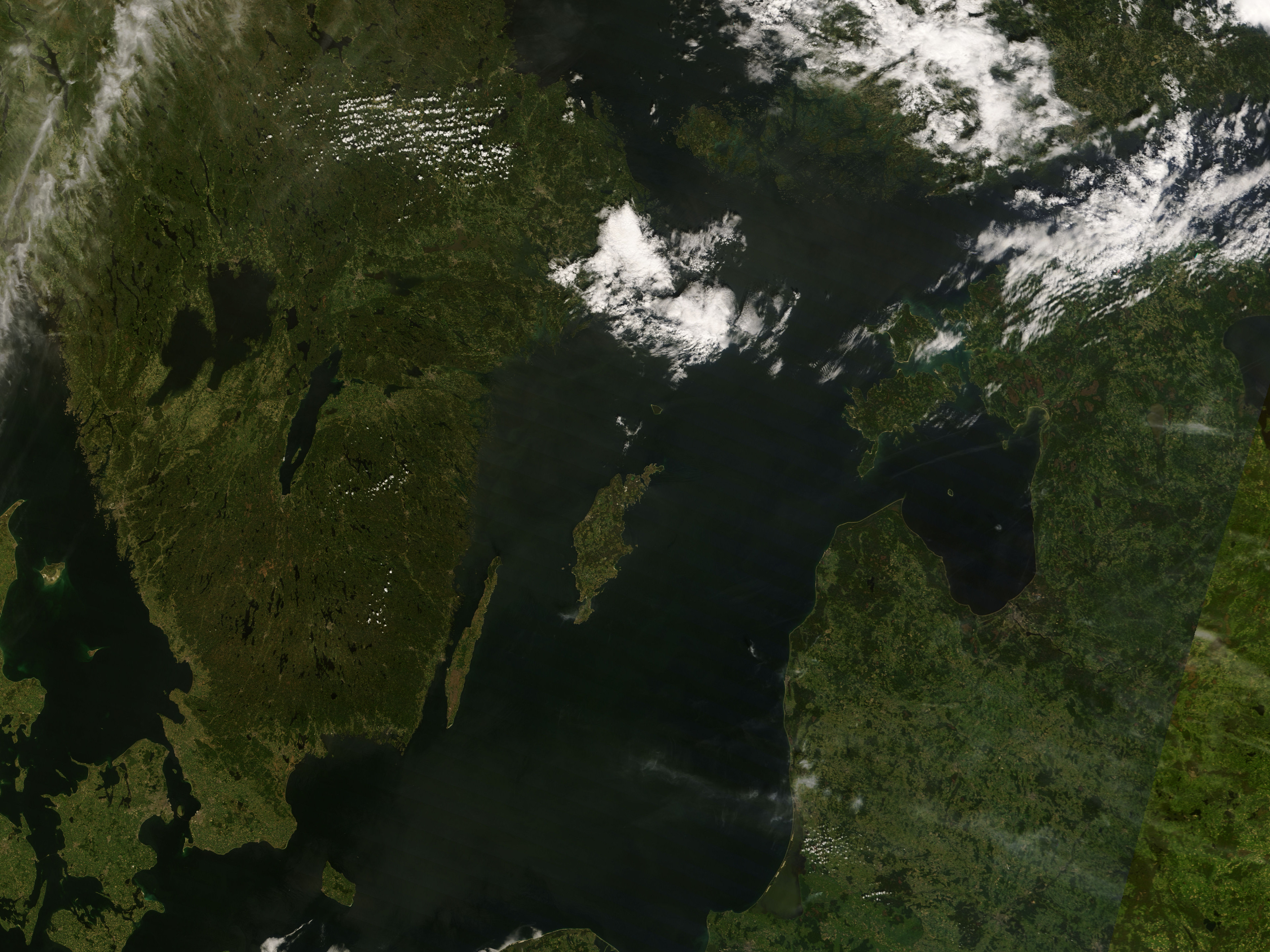
English: Shown are parts of Scandanavia, all covered in varying shades of green vegetation. At lower right is Lithuania (bottom), Latvia and the Gulf of Riga (middle), and Estonia (upper middle). These countries are separated from Sweden by the Baltic Sea. There are several prominent islands in the Baltic Sea. In the center of it is Gotland - and just west of Gotland, closer to Sweden is Oland. The city of Stockholm, in Sweden would be visible except for the large cloud that covers it.
Finland is in the top right hand corner, with the Gulf of Bothnia between it and Sweden. Southwest of Sweden is Denmark. Only part of it is visible in the bottom left, though you can see the city of Copenhagen, which is located on Zealand and Amager Islands. |
|||||
| Date | ||||||
| Source | http://modis.gsfc.nasa.gov/gallery/individual.php?db_date=2008-06-20 | |||||
| Author | Terra satellite | |||||
| Permission (Reusing this file) |
|
|||||
| Other versions | File:Soutern Sweden (cropped from MODIS 06202008).jpg |

.jpg)
File history
Click on a date/time to view the file as it appeared at that time.
| Date/Time | Thumbnail | Dimensions | User | Comment | |
|---|---|---|---|---|---|
| current | 18:26, 5 January 2012 | | 3,840 × 2,880 (2.46 MB) | Pieter Kuiper (talk | contribs) | {{Information |Description ={{en|1=Shown are parts of Scandanavia, all covered in varying shades of green vegetation. At lower right is Lithuania (bottom), Latvia and the Gulf of Riga (middle), and Estonia (upper middle). These countries are separated |
You cannot overwrite this file.
File usage on Commons
The following page uses this file:
.jpg&oldid=816036771)