File:Baltic Sea Map-Masry.PNG
Size of this preview: 560 × 600 pixels. Other resolutions: 224 × 240 pixels | 448 × 480 pixels | 717 × 768 pixels | 956 × 1,024 pixels | 1,500 × 1,606 pixels.
Original file (1,500 × 1,606 pixels, file size: 663 KB, MIME type: image/png)
Captions
Captions
Add a one-line explanation of what this file represents
| Description |
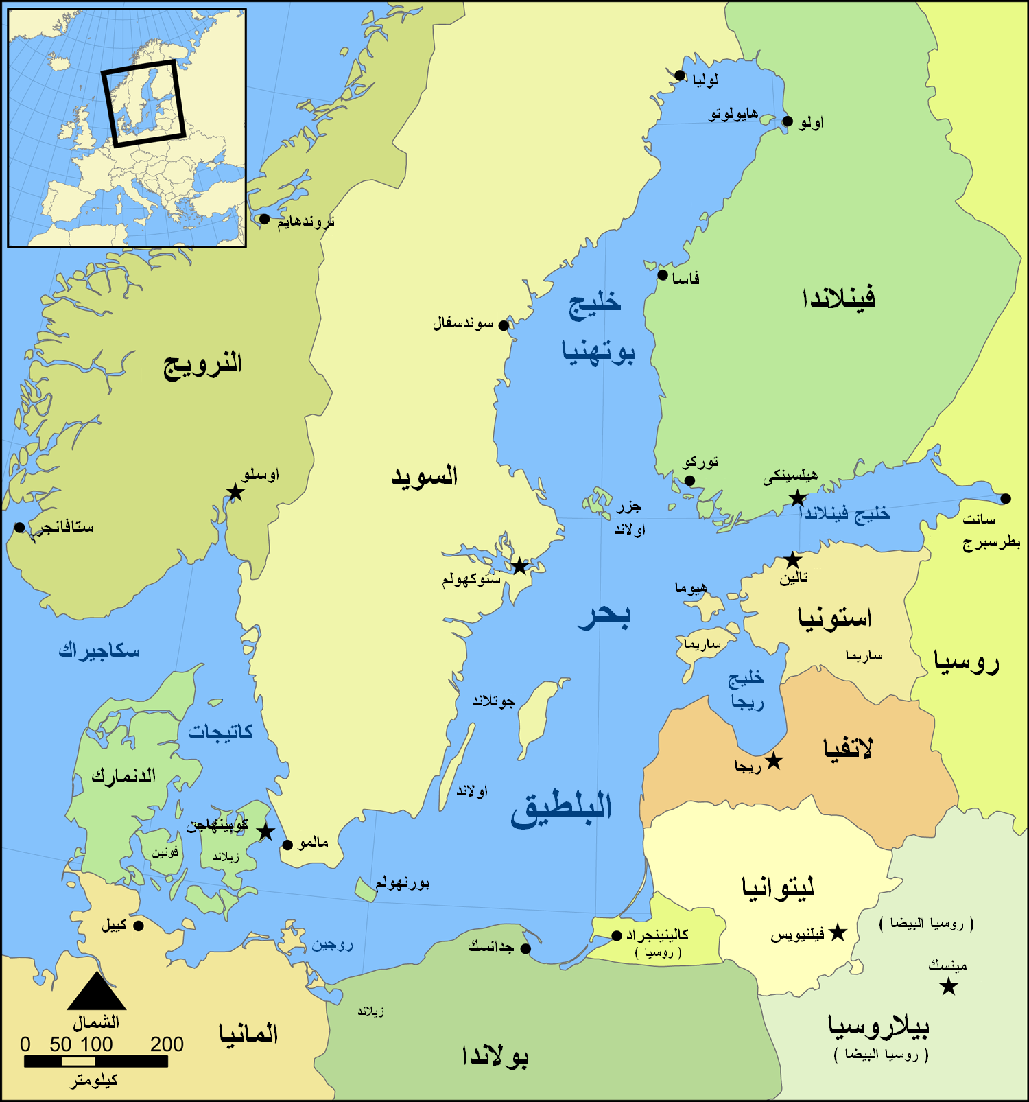
English: This is a map of the Baltic Sea, Arabic/Masry version |
| Date | |
| Source | Own work (based on Baltic Sea map.png by NormanEinstein) |
| Author | NormanEinstein (derivative work: Ramsis II) |
| Other versions |
[]
|


I, the copyright holder of this work, hereby publish it under the following license:

|
Permission is granted to copy, distribute and/or modify this document under the terms of the GNU Free Documentation License, Version 1.2 or any later version published by the Free Software Foundation; with no Invariant Sections, no Front-Cover Texts, and no Back-Cover Texts. A copy of the license is included in the section entitled GNU Free Documentation License. |
| This file is licensed under the Creative Commons Attribution-Share Alike 3.0 Unported license. | ||
| ||
| This licensing tag was added to this file as part of the GFDL licensing update. |
| This is a retouched picture, which means that it has been digitally altered from its original version. Modifications: masry Translation. The original can be viewed here: ArchipelagoSeaInBalticSea.png:
|
Original upload log
edit
This image is a derivative work of the following images:
- File:ArchipelagoSeaInBalticSea.png licensed with GFDL, GFDL
- 2008-08-14T10:17:42Z Suncheng125 1500x1606 (798387 Bytes) {{Information |Description=This is a map of the [[Baltic Sea]] with the [[Archipelago Sea]] marked. It is a slightly modified version of the file "Baltic Sea map.png". |Source=English Wikipedia |Date=August 8th, 2008 |Author=
Uploaded with derivativeFX
File history
Click on a date/time to view the file as it appeared at that time.
| Date/Time | Thumbnail | Dimensions | User | Comment | |
|---|---|---|---|---|---|
| current | 02:18, 21 July 2009 | | 1,500 × 1,606 (663 KB) | Ramsis II (talk | contribs) | {{Information |Description=This is a map of the Baltic Sea with the Archipelago Sea marked. It is a slightly modified version of the file "Baltic Sea map.png". |Source=*File:ArchipelagoSeaInBalticSea.png |Date=2009-07-21 02:17 (UTC) |Author= |
You cannot overwrite this file.
File usage on Commons
The following 11 pages use this file:
- File:Baltic Sea Map-Masry.PNG
- File:Baltic Sea map-sv.png
- File:Baltic Sea map.png
- File:Baltic Sea map CZ.svg
- File:Baltic Sea map Urdu.svg
- File:Baltic Sea map cy PNG.png
- File:Baltic Sea map hr.svg
- File:Baltic Sea map ru.svg
- File:Baltık denizi.png
- File:Mar Baltico mappa.jpg
- Template:Other versions/Baltic Sea Map
File usage on other wikis
The following other wikis use this file:
- Usage on ar.wikipedia.org
- Usage on arz.wikipedia.org
- Usage on pl.wiktionary.org
- Usage on so.wikipedia.org