File:Baltic sea cities (2).jpg

Size of this preview: 800 × 600 pixels. Other resolutions: 320 × 240 pixels | 640 × 480 pixels | 1,024 × 768 pixels | 1,280 × 960 pixels | 2,400 × 1,800 pixels.
Original file (2,400 × 1,800 pixels, file size: 601 KB, MIME type: image/jpeg)
Captions
Captions
Add a one-line explanation of what this file represents
Summary edit
| Description |
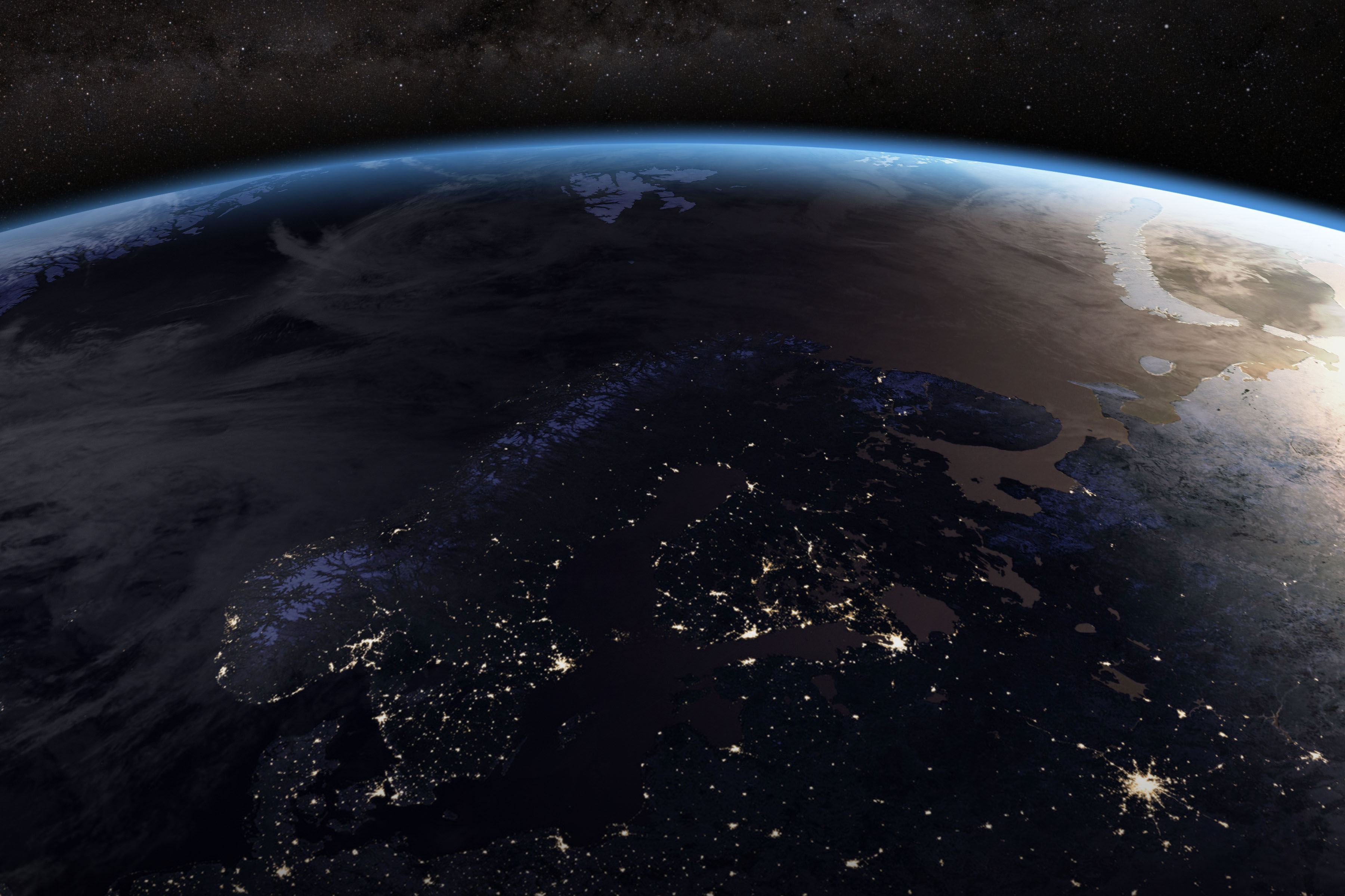
English: The image is part of a global composite assembled from data acquired in 2016 by the NOAA-NASA Suomi National Polar-orbiting Partnership (Suomi NPP) satellite.
This nighttime view of far northern Europe was made possible by the “day-night band” of the Visible Infrared Imaging Radiometer Suite. |
| Date | |
| Source |
https://eoimages.gsfc.nasa.gov/images/imagerecords/149000/149235/soumi_vir_2016_lrg.jpg https://earthobservatory.nasa.gov/images/149235/seeing-suomi |
| Author | Unknown author |
| Other versions |

.jpg&action=edit§ion=1)
Licensing edit
.jpg&action=edit§ion=2)
| This file is in the public domain in the United States because it was solely created by NASA. NASA copyright policy states that "NASA material is not protected by copyright unless noted". (See Template:PD-USGov, NASA copyright policy page or JPL Image Use Policy.) | ||
 |
Warnings:
|
File history
Click on a date/time to view the file as it appeared at that time.
| Date/Time | Thumbnail | Dimensions | User | Comment | |
|---|---|---|---|---|---|
| current | 16:06, 8 April 2024 | | 2,400 × 1,800 (601 KB) | Respublik (talk | contribs) | File:Baltic sea cities.jpg cropped 33 % horizontally, 25 % vertically using CropTool with precise mode. |
You cannot overwrite this file.
File usage on Commons
The following page uses this file:
.jpg&oldid=866827954)