File:Baltikum 1686.png
Size of this preview: 758 × 600 pixels. Other resolutions: 304 × 240 pixels | 607 × 480 pixels | 885 × 700 pixels.
Original file (885 × 700 pixels, file size: 88 KB, MIME type: image/png)
Captions
Captions
Add a one-line explanation of what this file represents
Summary
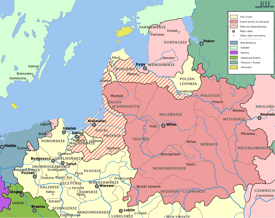
edit| Description | The Baltic area in the late 17th century | ||||||||
| Date | |||||||||
| Source | Image:Rzeczpospolita_voivodships.png | ||||||||
| Author | myself | ||||||||
| Permission (Reusing this file) |
|


|
This historical map image could be re-created using vector graphics as an SVG file. This has several advantages; see Commons:Media for cleanup for more information. If an SVG form of this image is available, please upload it and afterwards replace this template with
{{vector version available|new image name}}.
It is recommended to name the SVG file “Baltikum 1686.svg”—then the template Vector version available (or Vva) does not need the new image name parameter. |
File history
Click on a date/time to view the file as it appeared at that time.
| Date/Time | Thumbnail | Dimensions | User | Comment | |
|---|---|---|---|---|---|
| current | 00:31, 3 February 2007 | | 885 × 700 (88 KB) | Der Eberswalder (talk | contribs) | {{Information |Description=The Baltic area in the late 17th century |Source=Image:Rzeczpospolita_voivodships.png |Date=3 Feb 2007 |Author=myself |Permission=GFDL |other_versions= }} Maps of the history of Latvia Maps of the history of Lithuania |
You cannot overwrite this file.
File usage on Commons
There are no pages that use this file.
File usage on other wikis
The following other wikis use this file:
- Usage on et.wikipedia.org
- Usage on ja.wikipedia.org
- Usage on ka.wikipedia.org
- Usage on ru.wikipedia.org
- Usage on sk.wikipedia.org