File:Baltimore City Historical Growth (1977).pdf

Size of this JPG preview of this PDF file: 388 × 600 pixels. Other resolutions: 155 × 240 pixels | 310 × 480 pixels | 497 × 768 pixels | 662 × 1,024 pixels | 1,650 × 2,550 pixels.
Original file (1,650 × 2,550 pixels, file size: 1.13 MB, MIME type: application/pdf)
Captions
Captions
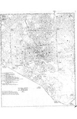
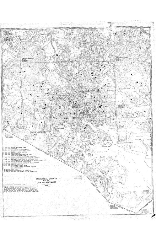
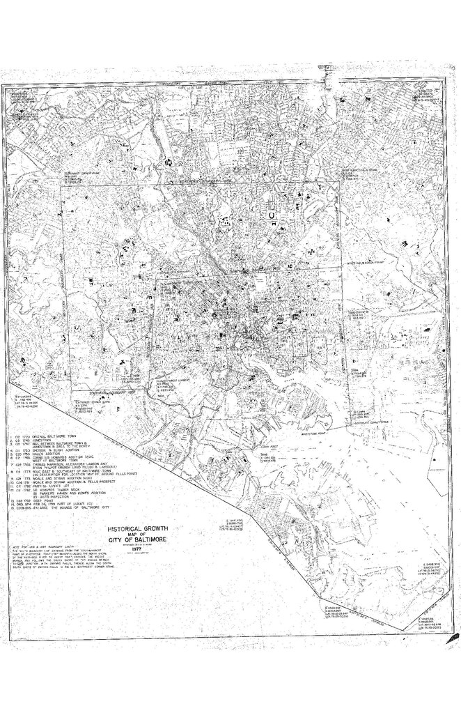
Baltimore City Historical Growth (1977)
Summary edit
| Description |
English: Baltimore City Historical Growth (1977)
Map by the Baltimore City Department of Public Works, originally printed matter distributed for free. Public domain per Maryland laws on map data published by municipal governments within the state. |
| Date | |
| Source | https://msa.maryland.gov/bca/research-at-the-baltimore-city-archives/the-geography-of-baltimore-city-sources/index.html |
| Creator |
Baltimore City Department of Public Works |
| Georeferencing | If inappropriate please set warp_status = skip to hide. |
| Camera location | | View this and other nearby images on: OpenStreetMap |
|---|
Licensing edit
This work is in the public domain in the U.S. because it is created by a legislative or judicial officer of a U.S. state or local government in the course of their legislative or judicial duties. See § 313.6(C)(2) of Compendium of U.S. Copyright Office Practices. Such works, known as "edicts of government", include:
|
File history
Click on a date/time to view the file as it appeared at that time.
| Date/Time | Thumbnail | Dimensions | User | Comment | |
|---|---|---|---|---|---|
| current | 19:30, 2 October 2022 |  | 1,650 × 2,550 (1.13 MB) | عُثمان (talk | contribs) | Uploaded a work by Baltimore City Department of Public Works from https://msa.maryland.gov/bca/research-at-the-baltimore-city-archives/the-geography-of-baltimore-city-sources/index.html with UploadWizard |
You cannot overwrite this file.
File usage on Commons
There are no pages that use this file.