File:Bangladesh Satellite View.jpg
Size of this preview: 761 × 600 pixels. Other resolutions: 305 × 240 pixels | 609 × 480 pixels | 975 × 768 pixels | 1,280 × 1,008 pixels | 2,560 × 2,017 pixels | 6,600 × 5,200 pixels.
Original file (6,600 × 5,200 pixels, file size: 11.02 MB, MIME type: image/jpeg)
Captions
Captions
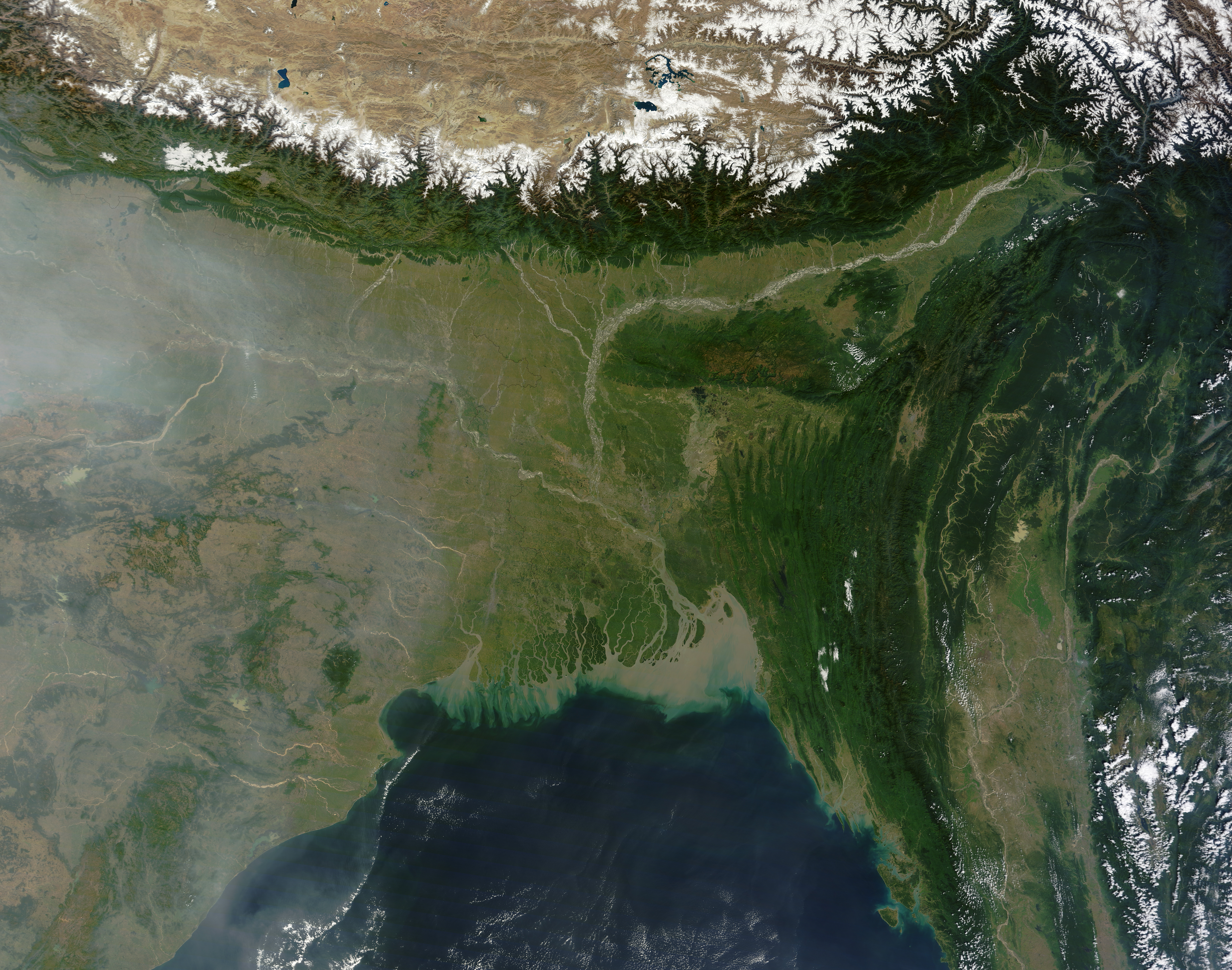
Satellite view of Bangladesh
Summary
edit
| Description |
English: A relatively small country along the Bay of Bengal, Bangladesh is nearly surrounded by India and has been shaped by it. Between 40 and 50 million years ago, India collided with Eurasia, elevating the Himalaya. Eroded by wind and water, the newly uplifted land shed sediments, which now cover almost all of Bangladesh. Tectonic activity also deformed rock layers in eastern Bangladesh. On November 9, 2011, clear skies allowed the Moderate Resolution Imaging Spectroradiometer (MODIS) on NASA’s Terra satellite an unobstructed view of Bangladesh. This natural-color image shows all of that country, as well as parts of India, Burma (Myanmar), and the Bay of Bengal. Included in the scene are the Sundarbans of the Ganges-Brahmaputra Delta. |
| Date | |
| Source | https://earthobservatory.nasa.gov/images/77364/bangladesh |
| Author | Jeff Schmaltz, LANCE/EOSDIS MODIS Rapid Response Team at NASA GSFC |
Licensing
edit
| This file is in the public domain in the United States because it was solely created by NASA. NASA copyright policy states that "NASA material is not protected by copyright unless noted". (See Template:PD-USGov, NASA copyright policy page or JPL Image Use Policy.) | ||
 |
Warnings:
|
File history
Click on a date/time to view the file as it appeared at that time.
| Date/Time | Thumbnail | Dimensions | User | Comment | |
|---|---|---|---|---|---|
| current | 06:37, 6 April 2024 | | 6,600 × 5,200 (11.02 MB) | Tahmid (talk | contribs) | Uploaded a work by Jeff Schmaltz, LANCE/EOSDIS MODIS Rapid Response Team at NASA GSFC from [Bangladesh – Earth Observatory https://earthobservatory.nasa.gov/images/77364/bangladesh] with UploadWizard |
You cannot overwrite this file.
File usage on Commons
The following page uses this file: