File:Barinas elevation map.png

Size of this preview: 800 × 332 pixels. Other resolutions: 320 × 133 pixels | 902 × 374 pixels.
Original file (902 × 374 pixels, file size: 451 KB, MIME type: image/png)
Captions
Captions
Add a one-line explanation of what this file represents
Summary
edit
| Description |
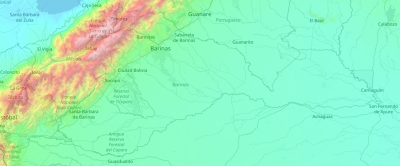
Español: Mapa topográfico de Barinas. Las Montañas están en rojo, el Piedemonte en lima, los Llanos Altos en verde, y los Llanos bajos en aguamarina. |
| Date | |
| Source | https://en-us.topographic-map.com |
| Author | TessaDEM |
Licensing
edit
| This work is licensed under the Open Database License (summary). |
File history
Click on a date/time to view the file as it appeared at that time.
| Date/Time | Thumbnail | Dimensions | User | Comment | |
|---|---|---|---|---|---|
| current | 20:10, 26 November 2023 | | 902 × 374 (451 KB) | Carlos Jesús Vitorino García (talk | contribs) | Uploaded a work by TessaDEM from https://en-us.topographic-map.com with UploadWizard |
You cannot overwrite this file.
File usage on Commons
There are no pages that use this file.