File:Barton vt highlight.png

Size of this preview: 375 × 600 pixels. Other resolutions: 150 × 240 pixels | 465 × 744 pixels.
Original file (465 × 744 pixels, file size: 35 KB, MIME type: image/png)
Captions
Captions
Add a one-line explanation of what this file represents
Summary edit

|
This locator map image could be re-created using vector graphics as an SVG file. This has several advantages; see Commons:Media for cleanup for more information. If an SVG form of this image is available, please upload it and afterwards replace this template with
{{vector version available|new image name}}.
It is recommended to name the SVG file “Barton vt highlight.svg”—then the template Vector version available (or Vva) does not need the new image name parameter. |
| Description |
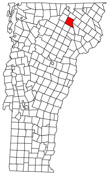
English: Description: Map of Vermont towns with Barton highlighted
Source: Map created by Jared C. Benedict on 26 March 2004. Copyright: © Jared C. Benedict. en:Category:Barton, Vermont |
| Date | 27 March 2004 (original upload date) |
| Source | Transferred from en.wikipedia |
| Author | Original uploader was Redjar at en.wikipedia |
| Permission (Reusing this file) |
GFDL-WITH-DISCLAIMERS; Released under the GNU Free Documentation License. |
Licensing edit
| This file is licensed under the Creative Commons Attribution-Share Alike 3.0 Unported license. Subject to disclaimers. | ||
| ||
| This licensing tag was added to this file as part of the GFDL licensing update. |

|
Permission is granted to copy, distribute and/or modify this document under the terms of the GNU Free Documentation License, Version 1.2 or any later version published by the Free Software Foundation; with no Invariant Sections, no Front-Cover Texts, and no Back-Cover Texts. A copy of the license is included in the section entitled GNU Free Documentation License. Subject to disclaimers. |
Original upload log edit
The original description page was here. All following user names refer to en.wikipedia.
- 2004-03-27 12:04 Redjar 465×744×8 (35769 bytes) Vermont town map with town highlight
File history
Click on a date/time to view the file as it appeared at that time.
| Date/Time | Thumbnail | Dimensions | User | Comment | |
|---|---|---|---|---|---|
| current | 01:21, 2 April 2008 | | 465 × 744 (35 KB) | Smeira (talk | contribs) | {{Information |Description={{en|'''Description:''' Map of Vermont towns with Barton highlighted '''Source:''' Map created by [http://redjar.org/jared Jared C. Benedict] on 26 March 2004. '''Copyright:''' © Jared C. Benedict. [[:en:Category:Barton, Ve |
You cannot overwrite this file.
File usage on Commons
The following page uses this file:
File usage on other wikis
The following other wikis use this file:
- Usage on ar.wikipedia.org
- Usage on ca.wikipedia.org
- Usage on cy.wikipedia.org
- Usage on en.wikipedia.org
- Usage on eu.wikipedia.org
- Usage on fr.wikipedia.org
- Usage on ht.wikipedia.org
- Usage on it.wikipedia.org
- Usage on sh.wikipedia.org
- Usage on sr.wikipedia.org
- Usage on sv.wikipedia.org
- Usage on tt.wikipedia.org
- Usage on ur.wikipedia.org
- Usage on www.wikidata.org
- Usage on zh-min-nan.wikipedia.org