File:Battle of Pea Ridge 1.png
Original file (2,000 × 1,462 pixels, file size: 2.03 MB, MIME type: image/png)
Captions
Captions
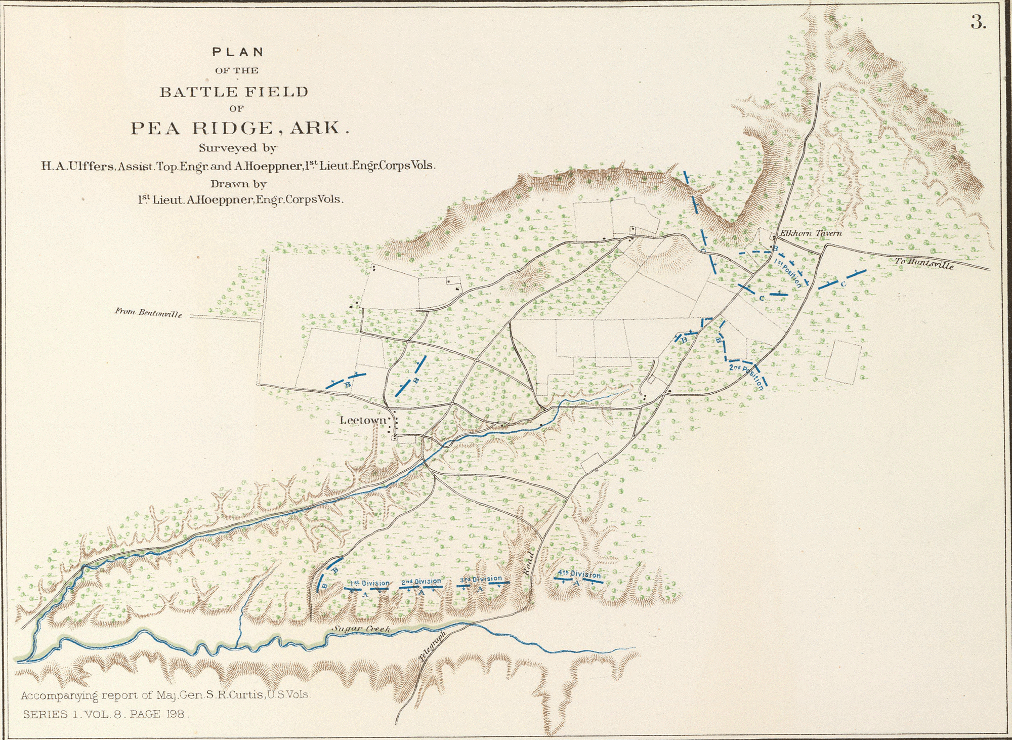
- English: Plan of the battle-field of Pea Ridge, Ark. Surveyed by H.A. Ulffers ... and A. Hoeppner
- Julius Bien & Co., Lith., N.Y. (1891-1895)
- Author: United States. War Department
- Date: 1895
- Higher-resolution version available from the David Rumsey Historical Map Collection
|
This work is in the public domain in its country of origin and other countries and areas where the copyright term is the author's life plus 70 years or fewer.
| |
| This file has been identified as being free of known restrictions under copyright law, including all related and neighboring rights. | |
File history
Click on a date/time to view the file as it appeared at that time.
| Date/Time | Thumbnail | Dimensions | User | Comment | |
|---|---|---|---|---|---|
| current | 10:22, 13 June 2005 | | 2,000 × 1,462 (2.03 MB) | ¡0-8-15! (talk | contribs) | *Map showing the system of rebel fortifications on the Mississippi River at Island No. 10 and New Madrid, also the operations of the U.S. forces under General John Pope against these positions. *Route from Keetsville to Fayetteville, Ark. *Plan of the bat |
You cannot overwrite this file.
File usage on Commons
The following page uses this file:
File usage on other wikis
The following other wikis use this file:
- Usage on en.wikipedia.org
- Usage on fr.wikipedia.org
- Usage on hu.wikipedia.org
- Usage on it.wikipedia.org
- Usage on ja.wikipedia.org
- Usage on nl.wikipedia.org
- Usage on pl.wikipedia.org
- Usage on ru.wikipedia.org
- Usage on zh.wikipedia.org