File:Battle of Surabaya (1677) 4.VEL 1279.jpg

Size of this preview: 800 × 571 pixels. Other resolutions: 320 × 228 pixels | 640 × 457 pixels | 1,024 × 731 pixels | 1,280 × 914 pixels | 2,560 × 1,827 pixels | 8,889 × 6,344 pixels.
Original file (8,889 × 6,344 pixels, file size: 9.54 MB, MIME type: image/jpeg)
Captions
Captions
Add a one-line explanation of what this file represents
Summary edit
_4.VEL_1279.jpg&action=edit§ion=1)
| Description |
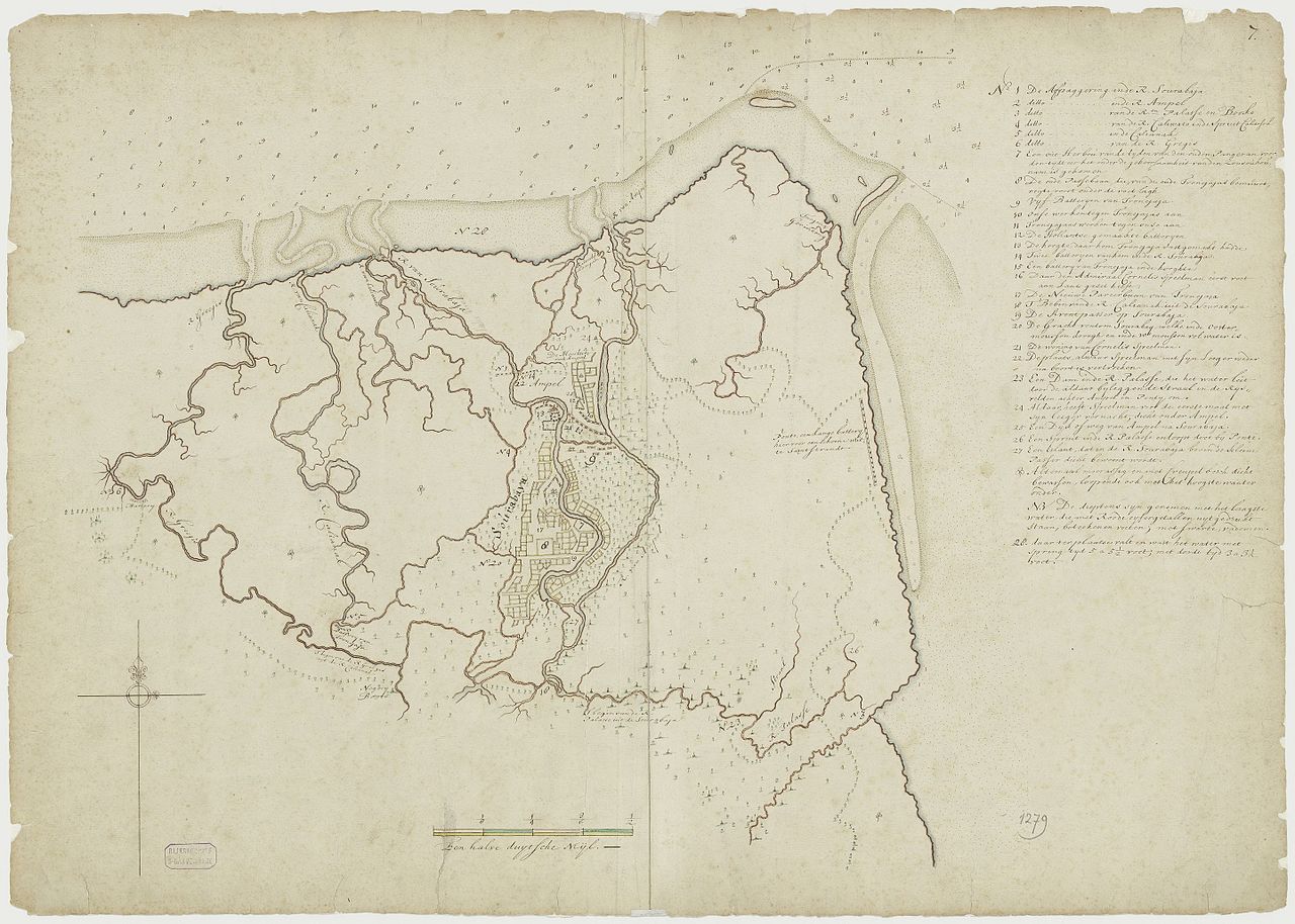
English: Map of Battle of Surabaya (1677) when the battle is in progress.
Positions of Trunajaya and Dutch forces, including artillery batteries, fortifications and structures are depicted At this point the Dutch has taken Ampel but Trunajaya still control the city center. |
| Date | |
| Source |
|
| Author | Dutch East India Company, published by the Dutch National Archives |
Surabaya
Licensing edit
_4.VEL_1279.jpg&action=edit§ion=2)
National Archive policy released maps and document under "Public domain or CC0" [1] archive copy at the Wayback Machine. The map itself was from 1677, so in any likelihood the author died centuries ago placing the work under public domain.
| This file is made available under the Creative Commons CC0 1.0 Universal Public Domain Dedication. | |
| The person who associated a work with this deed has dedicated the work to the public domain by waiving all of their rights to the work worldwide under copyright law, including all related and neighboring rights, to the extent allowed by law. You can copy, modify, distribute and perform the work, even for commercial purposes, all without asking permission.
|
File history
Click on a date/time to view the file as it appeared at that time.
| Date/Time | Thumbnail | Dimensions | User | Comment | |
|---|---|---|---|---|---|
| current | 07:49, 8 April 2017 | | 8,889 × 6,344 (9.54 MB) | HaEr48 (talk | contribs) | User created page with UploadWizard |
You cannot overwrite this file.
File usage on Commons
There are no pages that use this file.
File usage on other wikis
The following other wikis use this file:
- Usage on en.wikipedia.org
- Usage on fr.wikipedia.org
- Usage on id.wikipedia.org
_4.VEL_1279.jpg&oldid=819735004)