File:Beauplan special frag6.gif
Size of this preview: 781 × 600 pixels. Other resolutions: 313 × 240 pixels | 625 × 480 pixels | 1,001 × 768 pixels | 1,280 × 983 pixels | 2,560 × 1,965 pixels | 3,500 × 2,687 pixels.
Original file (3,500 × 2,687 pixels, file size: 440 KB, MIME type: image/gif)
Captions
Captions
Add a one-line explanation of what this file represents
Summary
edit
| Description |
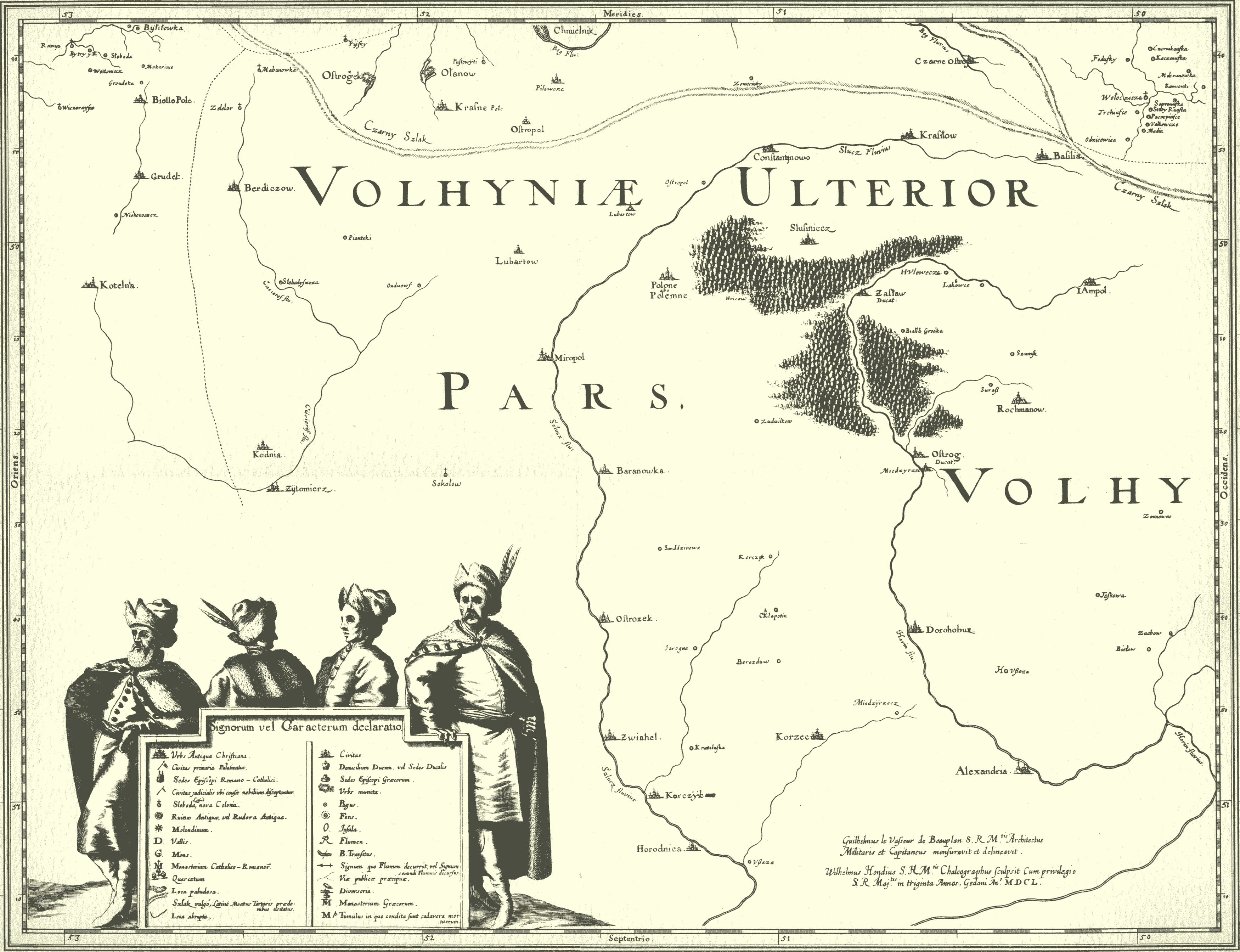
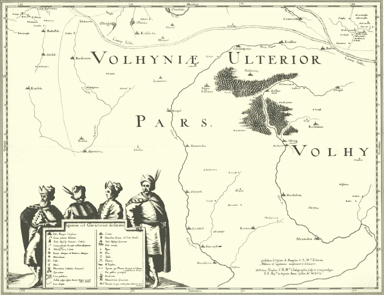
Русский: Фрагмент из альбома «Общий план Диких полей, проще говоря Украйны», («Delineatio Generalis Camporum Desertorum vulgo Ukraina»), 1650 год, внимание, на данной карте юг вверху, а север внизу, де Боплан, 1650 Беларуская: Карта Украіны працы Баплана Українська: Фрагмент Спеціальної карти України Боплана, 1650 |
|||||||||||||||||||
| Date | ||||||||||||||||||||
| Source | http://foto.meta.ua/allsize/4346215/orig/ | |||||||||||||||||||
| Author |
|
|||||||||||||||||||
Licensing
edit
|
This is a faithful photographic reproduction of a two-dimensional, public domain work of art. The work of art itself is in the public domain for the following reason:
The official position taken by the Wikimedia Foundation is that "faithful reproductions of two-dimensional public domain works of art are public domain".
This photographic reproduction is therefore also considered to be in the public domain in the United States. In other jurisdictions, re-use of this content may be restricted; see Reuse of PD-Art photographs for details. | ||||
File history
Click on a date/time to view the file as it appeared at that time.
| Date/Time | Thumbnail | Dimensions | User | Comment | |
|---|---|---|---|---|---|
| current | 19:12, 3 July 2014 | | 3,500 × 2,687 (440 KB) | McZusatz (talk | contribs) | (uploaded using chunked upload script) |
You cannot overwrite this file.
File usage on Commons
The following page uses this file:
- File:Beauplan special frag6.jpg.gif (file redirect)
File usage on other wikis
The following other wikis use this file:
- Usage on ru.wikipedia.org
- Usage on uk.wikipedia.org