File:BeershebaNorthNegev.svg

Size of this PNG preview of this SVG file: 800 × 518 pixels. Other resolutions: 320 × 207 pixels | 640 × 414 pixels | 1,024 × 663 pixels | 1,280 × 829 pixels | 2,560 × 1,658 pixels | 2,100 × 1,360 pixels.
Original file (SVG file, nominally 2,100 × 1,360 pixels, file size: 543 KB)
Captions
Captions
Add a one-line explanation of what this file represents
This is correct
Summary edit
| Description |
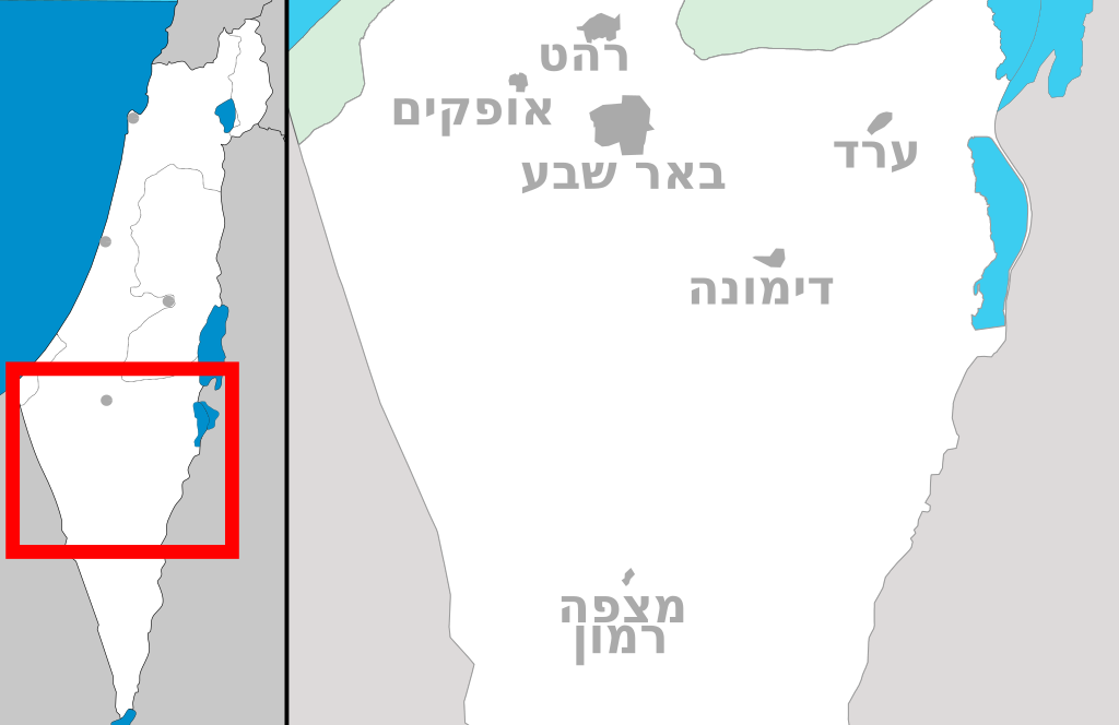
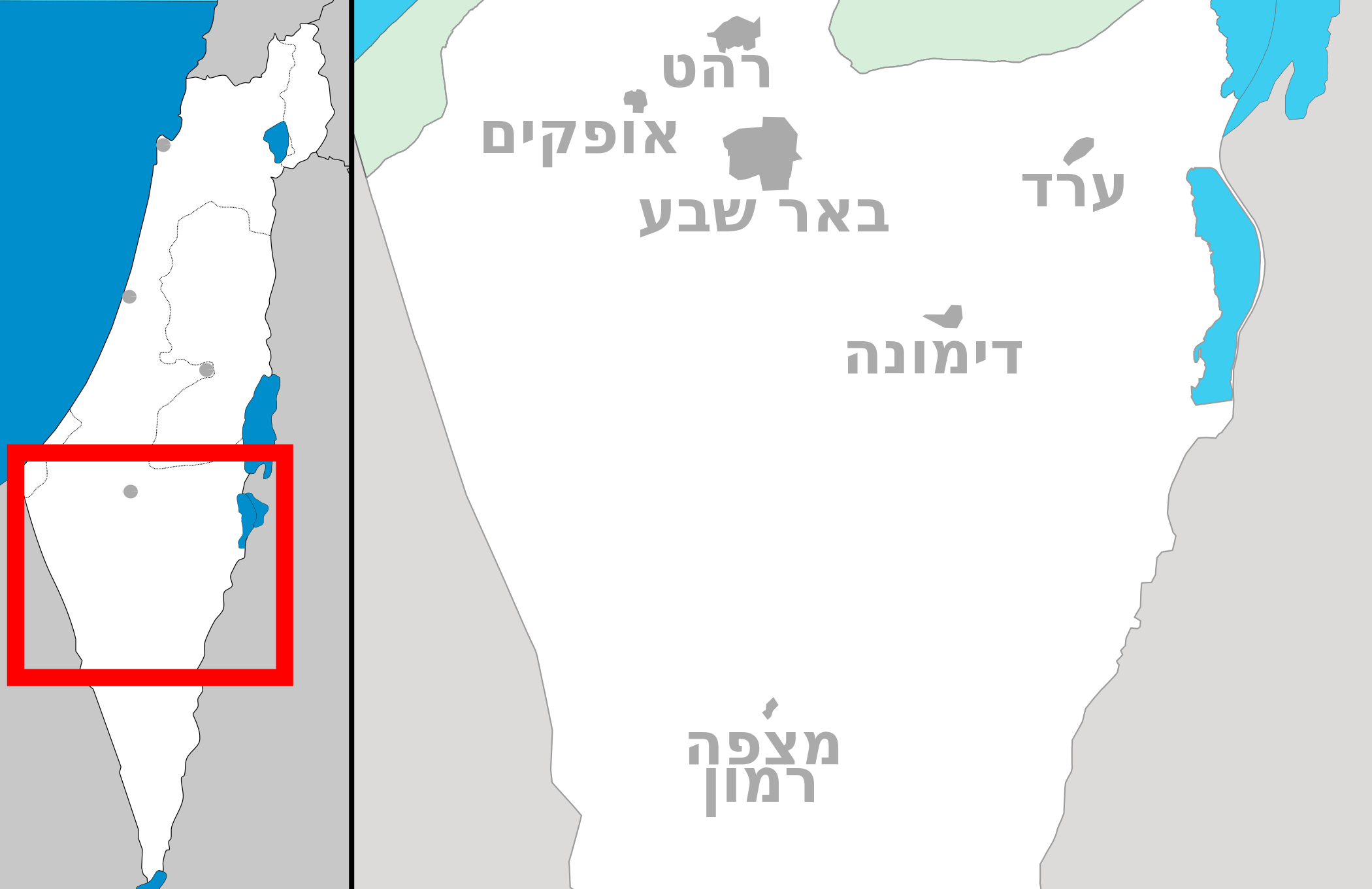
English: Map of Beersheba and North Negev area
עברית: מפה של אזור באר שבע וצפון הנגב |
| Date | |
| Source | Own work |
| Author | Costello + DMY |
Licensing edit
I, the copyright holder of this work, hereby publish it under the following licenses:
This file is licensed under the Creative Commons Attribution-Share Alike 3.0 Unported license.
- You are free:
- to share – to copy, distribute and transmit the work
- to remix – to adapt the work
- Under the following conditions:
- attribution – You must give appropriate credit, provide a link to the license, and indicate if changes were made. You may do so in any reasonable manner, but not in any way that suggests the licensor endorses you or your use.
- share alike – If you remix, transform, or build upon the material, you must distribute your contributions under the same or compatible license as the original.

|
Permission is granted to copy, distribute and/or modify this document under the terms of the GNU Free Documentation License, Version 1.2 or any later version published by the Free Software Foundation; with no Invariant Sections, no Front-Cover Texts, and no Back-Cover Texts. A copy of the license is included in the section entitled GNU Free Documentation License. |
You may select the license of your choice.
File history
Click on a date/time to view the file as it appeared at that time.
| Date/Time | Thumbnail | Dimensions | User | Comment | |
|---|---|---|---|---|---|
| current | 11:47, 1 October 2011 | | 2,100 × 1,360 (543 KB) | DMY (talk | contribs) | הזזה |
| 11:45, 1 October 2011 |  | 2,100 × 1,360 (543 KB) | DMY (talk | contribs) | שמות מתחת לעיר | |
| 10:52, 1 October 2011 |  | 2,100 × 1,360 (543 KB) | DMY (talk | contribs) | מצפה רמון שמאלה | |
| 10:49, 1 October 2011 |  | 2,100 × 1,360 (543 KB) | DMY (talk | contribs) | הזזת טקסט | |
| 10:48, 1 October 2011 |  | 2,100 × 1,360 (543 KB) | DMY (talk | contribs) | עוד שמאלה | |
| 10:46, 1 October 2011 |  | 2,100 × 1,360 (543 KB) | DMY (talk | contribs) | עוד שמאלה | |
| 10:45, 1 October 2011 |  | 2,100 × 1,360 (543 KB) | DMY (talk | contribs) | טקסט עוד שמאלה | |
| 10:41, 1 October 2011 |  | 2,100 × 1,360 (543 KB) | DMY (talk | contribs) | טקסט שמאלה | |
| 10:34, 1 October 2011 |  | 2,100 × 1,360 (544 KB) | DMY (talk | contribs) | == {{int:filedesc}} == {{Information |Description={{en|1=Map of Beersheba and North Negev area}} {{he|1=מפה של איזור באר שבע וצפון הנגב}} |Source={{Own}} |Author=Costello + DMY |Date=1 October 2011 |
You cannot overwrite this file.
File usage on Commons
There are no pages that use this file.
File usage on other wikis
The following other wikis use this file:
- Usage on ar.wikipedia.org
- Usage on he.wikipedia.org
- מצפה רמון
- המכתש הקטן
- המכתש הגדול
- ערד
- שדה בוקר
- אוניברסיטת בן-גוריון בנגב
- באר שבע
- דימונה
- תל שבע
- חורה
- ירוחם
- כסייפה
- לקייה
- מיתר (יישוב)
- עומר (יישוב)
- ערערה בנגב
- שגב שלום
- מצדה
- אבשלום (יישוב)
- הקריה למחקר גרעיני – נגב
- אנדרטת חטיבת הנגב
- טבח מעלה עקרבים
- מועצה אזורית רמת הנגב
- רביבים
- עבדת
- דקל (מושב)
- חולות חלוצה
- צריף בן-גוריון
- חבל שלום
- יבול (מושב)
- משאבי שדה
- נבטים (מושב)
- עזוז
- תל ערד
- ניצנה
- בית הספר לקצינים של צה"ל
- נחל צין
- קסר א-סיר
- ישיבת ההסדר ירוחם
- תלמי יוסף
- הר מחיה
- אשלים
- טללים
- צאלים
- נחל הרועה
- נאות חובב
- רמת מטרד
View more global usage of this file.