File:Belgian Railway Line 165.png

Size of this preview: 800 × 582 pixels. Other resolutions: 320 × 233 pixels | 640 × 466 pixels | 1,024 × 746 pixels | 1,280 × 932 pixels | 1,482 × 1,079 pixels.
Original file (1,482 × 1,079 pixels, file size: 1.38 MB, MIME type: image/png)
Captions
Captions
Add a one-line explanation of what this file represents
Summary
edit
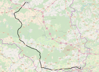
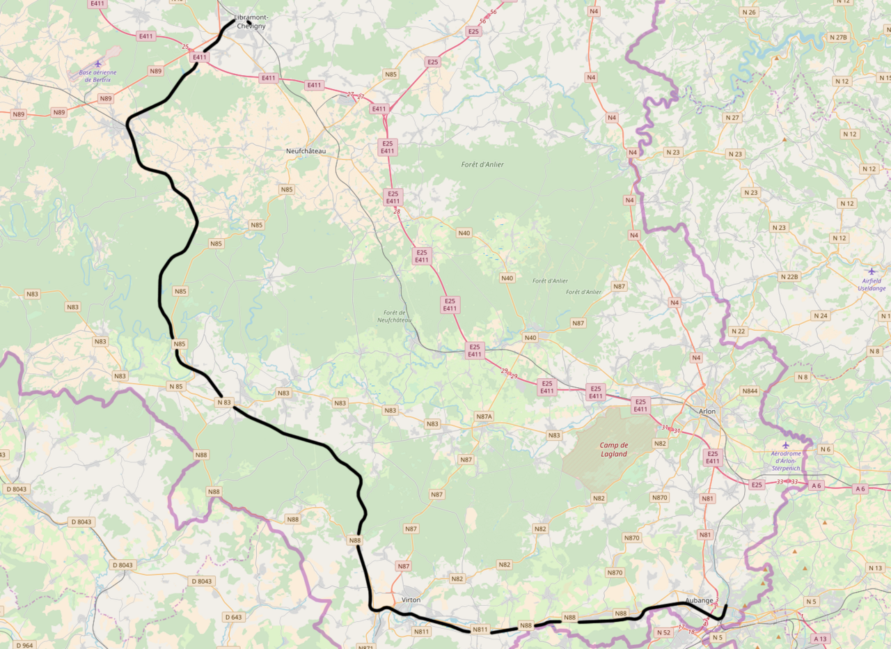
| Description | Belgian Railway Line 165, Libramont - Athus |
| Date | |
| Source | openstreetmap.org. |
| Author | OpenStreetMap contributors |
| Permission (Reusing this file) |
All OpenStreetMap data and maps are Creative Commons "CC-BY-SA 2.0" licensed |
Licensing
edit
This file is licensed under the Creative Commons Attribution-Share Alike 2.0 Generic license.
- You are free:
- to share – to copy, distribute and transmit the work
- to remix – to adapt the work
- Under the following conditions:
- attribution – You must give appropriate credit, provide a link to the license, and indicate if changes were made. You may do so in any reasonable manner, but not in any way that suggests the licensor endorses you or your use.
- share alike – If you remix, transform, or build upon the material, you must distribute your contributions under the same or compatible license as the original.
File history
Click on a date/time to view the file as it appeared at that time.
| Date/Time | Thumbnail | Dimensions | User | Comment | |
|---|---|---|---|---|---|
| current | 12:02, 11 April 2018 | | 1,482 × 1,079 (1.38 MB) | Vunz (talk | contribs) | fix |
| 19:43, 7 April 2011 |  | 1,066 × 814 (990 KB) | Vunz (talk | contribs) | Open Street Map | |
| 18:20, 4 June 2009 |  | 520 × 390 (111 KB) | Vunz (talk | contribs) | improved version spoorlijn 165 spoorlijn 165 spoorlijn 165 spoorlijn 165 | |
| 20:50, 17 March 2007 |  | 640 × 480 (188 KB) | Arafi (talk | contribs) | {{Information |Description=Schematische voorstelling van de spoorlijn 165 in België |Source=eigen werk (gebaseerd op http://www.demis.nl/wms/mapclip.htm) |Date=17 maart 2007 |Author='''Rafaël Delaedt''' (Arafi) |Permission={{PD-Demis}} }} |
You cannot overwrite this file.
File usage on Commons
The following 8 pages use this file:
- User:Arafi/Kaarten
- User:Chumwa/OgreBot/Potential transport maps/2018 April 11-20
- User:Chumwa/OgreBot/Public transport information/2018 April 11-20
- User:Chumwa/OgreBot/Transport Maps/2018 April 11-20
- User:Chumwa/OgreBot/Travel and communication maps/2018 April 11-20
- File:Spoorlijn165.png (file redirect)
- Category:Line 165 (Infrabel)
File usage on other wikis
The following other wikis use this file:
- Usage on de.wikipedia.org
- Usage on fr.wikipedia.org
- Usage on nl.wikipedia.org
- Usage on www.wikidata.org