File:Benares, Map India and Pakistan 1-250,000 Tile NG 44-12 Banaras (cropped).jpg
Size of this preview: 762 × 600 pixels. Other resolutions: 305 × 240 pixels | 610 × 480 pixels | 976 × 768 pixels | 1,060 × 834 pixels.
Original file (1,060 × 834 pixels, file size: 281 KB, MIME type: image/jpeg)
Captions
Captions
Add a one-line explanation of what this file represents
| Description |
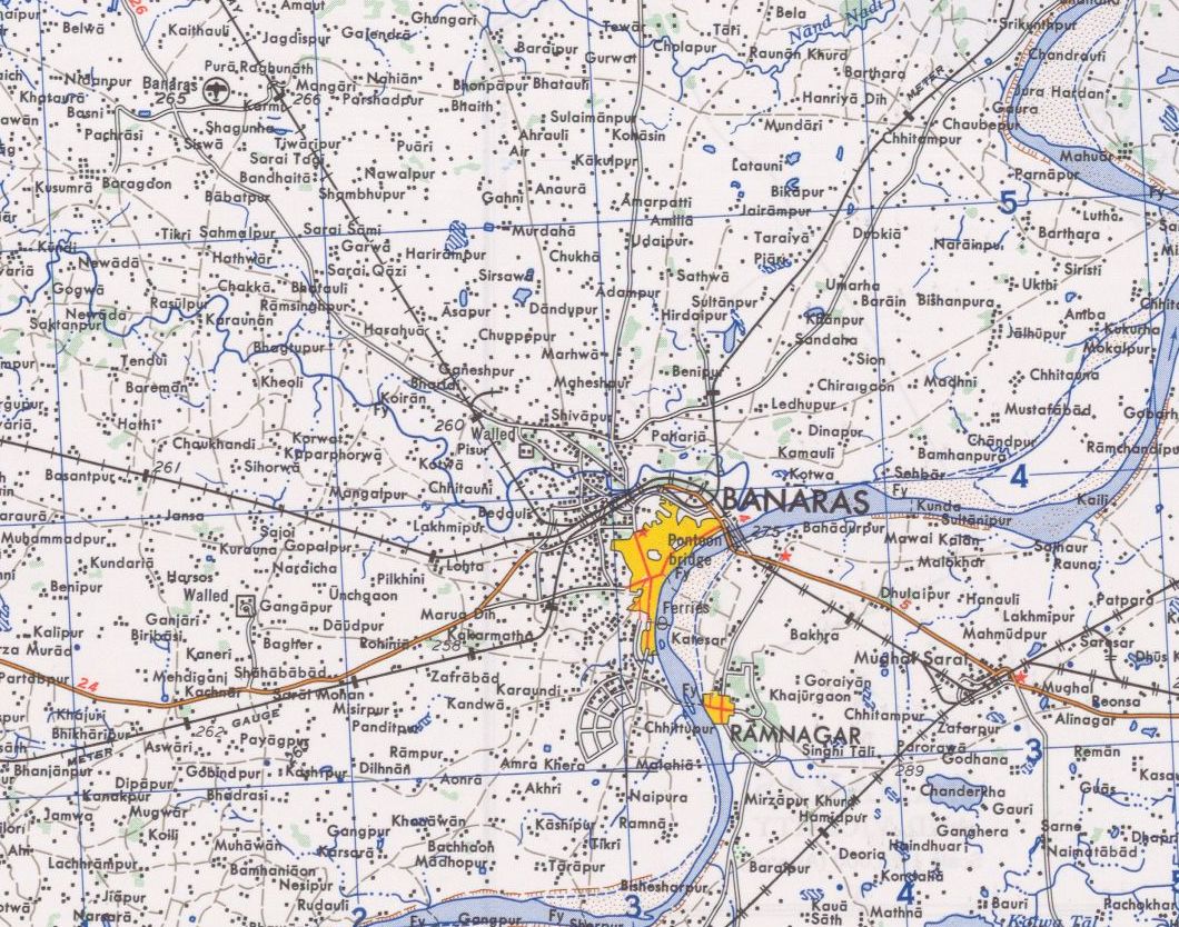
English: NG 44-12 Banaras. Tile of the Map India and Pakistan 1:250,000. Series U502, U.S. Army Map Service, 1955 |
||||||
| Date | |||||||
| Source | https://www.lib.utexas.edu/maps/ams/india/ [1] | ||||||
| Creator |
English: U.S. Army Map Service |
||||||
| Permission (Reusing this file) |
|
||||||
| Georeferencing | If inappropriate please set warp_status = skip to hide. | ||||||
| Other versions |
|
||||||


![[1]](http://www.lib.utexas.edu/maps/ams/india/ng-44-12a.jpg)
File history
Click on a date/time to view the file as it appeared at that time.
| Date/Time | Thumbnail | Dimensions | User | Comment | |
|---|---|---|---|---|---|
| current | 23:33, 23 February 2019 | | 1,060 × 834 (281 KB) | Oo91 (talk | contribs) | File:Map India and Pakistan 1-250,000 Tile NG 44-12 Banaras.jpg cropped 79 % horizontally, 79 % vertically using CropTool with precise mode. |
You cannot overwrite this file.
File usage on Commons
The following page uses this file:
.jpg&oldid=820907149)