File:Benue Trough faults.svg

Size of this PNG preview of this SVG file: 411 × 308 pixels. Other resolutions: 320 × 240 pixels | 640 × 480 pixels | 1,024 × 767 pixels | 1,280 × 959 pixels | 2,560 × 1,918 pixels.
Original file (SVG file, nominally 411 × 308 pixels, file size: 14 KB)
Captions
Captions
Add a one-line explanation of what this file represents
Summary edit
| Description |
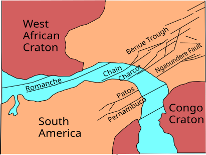
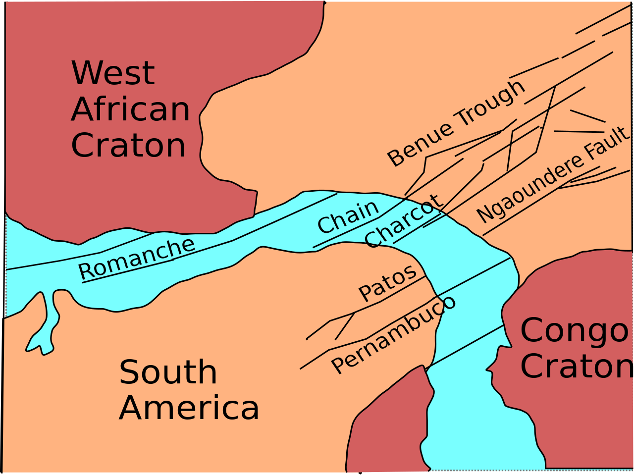
English: Sketch map of Benue Trough and Atlantic fracture zones |
| Date | |
| Source | Own work |
| Author | Aymatth2 |
Licensing edit
| I, the copyright holder of this work, release this work into the public domain. This applies worldwide. In some countries this may not be legally possible; if so: I grant anyone the right to use this work for any purpose, without any conditions, unless such conditions are required by law. |
File history
Click on a date/time to view the file as it appeared at that time.
| Date/Time | Thumbnail | Dimensions | User | Comment | |
|---|---|---|---|---|---|
| current | 02:14, 30 January 2011 | | 411 × 308 (14 KB) | Aymatth2 (talk | contribs) | Last try |
| 02:02, 30 January 2011 |  | 411 × 307 (19 KB) | Aymatth2 (talk | contribs) | try again | |
| 02:00, 30 January 2011 |  | 225 × 176 (15 KB) | Aymatth2 (talk | contribs) | try again | |
| 01:57, 30 January 2011 |  | 221 × 176 (19 KB) | Aymatth2 (talk | contribs) | another shot | |
| 01:54, 30 January 2011 |  | 215 × 173 (14 KB) | Aymatth2 (talk | contribs) | font fixes | |
| 01:48, 30 January 2011 |  | 215 × 173 (14 KB) | Aymatth2 (talk | contribs) | {{Information |Description ={{en|1=Sketch map of Benue Trough and Atlantic fracture zones}} |Source ={{own}} |Author =Aymatth2 |Date =2011-01-29 |Permission = |other_versions = }} [[Category:Geology of A |
You cannot overwrite this file.
File usage on Commons
There are no pages that use this file.
File usage on other wikis
The following other wikis use this file:
- Usage on en.wikipedia.org
- Usage on fr.wikipedia.org
- Usage on zh.wikipedia.org