File:Bergamo 1816, Giuseppe Manzini (Città Alta).jpg
Size of this preview: 800 × 524 pixels. Other resolutions: 320 × 210 pixels | 640 × 419 pixels | 1,024 × 671 pixels | 1,262 × 827 pixels.
Original file (1,262 × 827 pixels, file size: 539 KB, MIME type: image/jpeg)
Captions
Captions
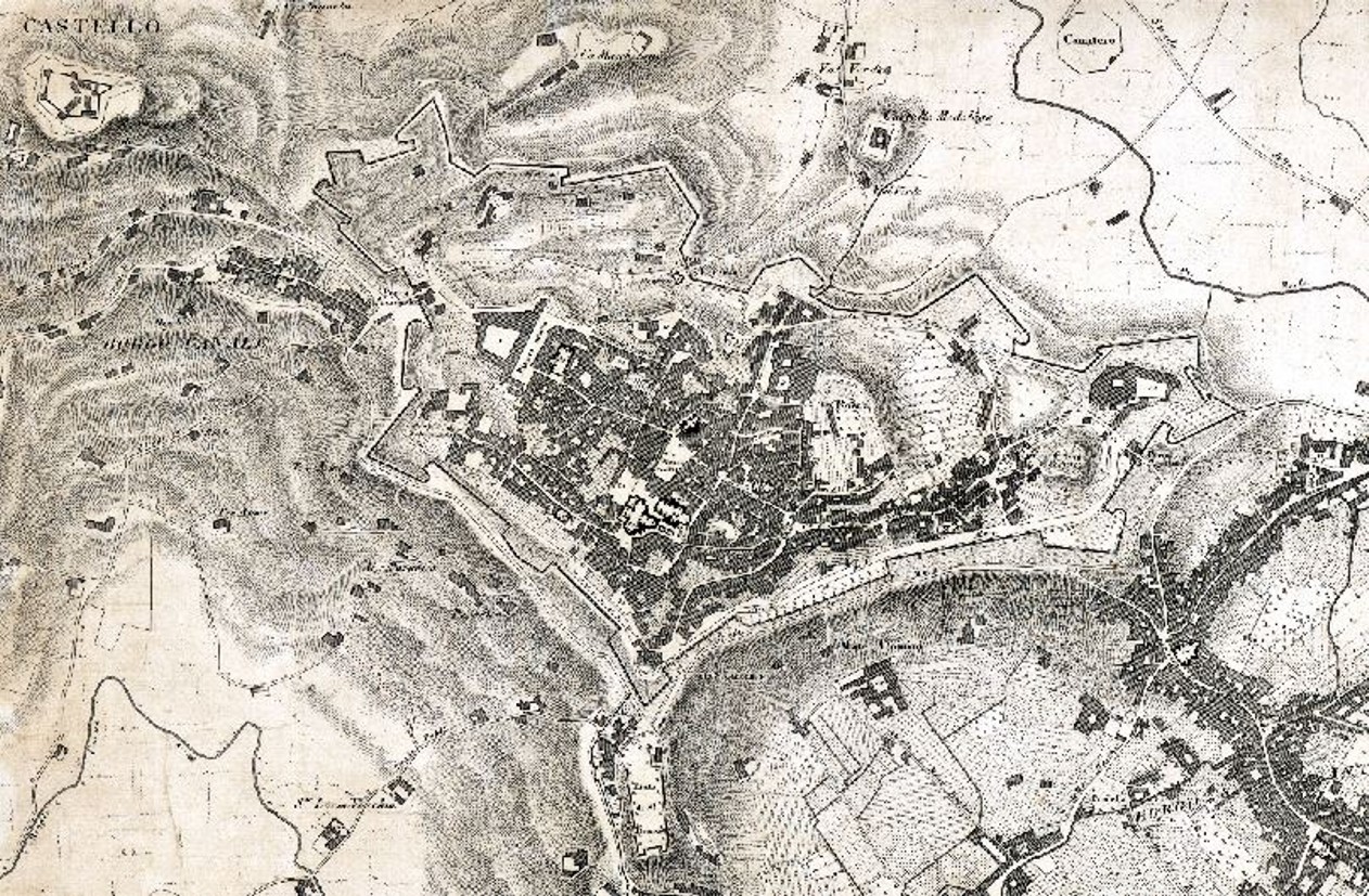
Bergamo 1816, Giuseppe Manzini (Città Alta)
Summary
edit| Description |
English: “Pianta della città e dei Borghi esterni” disegnata dall’ingegner e architetto Manzini nel 1816. Una delle prima rappresentazioni scientifiche di Bergamo, pochi anni dopo la realizzazione del catasto napoleonico. Dettaglio di Città Alta con le Mura Venete |
| Date | |
| Source | amici delle mura di bergamo, [1] |
| Author | Ing. Giuseppe Manzini |
| Other versions |

.jpg&action=edit§ion=1)
![[1]](https://amicidellemura-bergamo.myblog.it/wp-content/uploads/sites/245871/2012/02/1816-Mura-1816-Manzini-b.jpg)
Licensing
edit.jpg&action=edit§ion=2)
|
This work is in the public domain in its country of origin and other countries and areas where the copyright term is the author's life plus 100 years or fewer. This work is in the public domain in the United States because it was published (or registered with the U.S. Copyright Office) before January 1, 1929. | |
| This file has been identified as being free of known restrictions under copyright law, including all related and neighboring rights. | |
File history
Click on a date/time to view the file as it appeared at that time.
| Date/Time | Thumbnail | Dimensions | User | Comment | |
|---|---|---|---|---|---|
| current | 20:10, 18 October 2020 | | 1,262 × 827 (539 KB) | Dans (talk | contribs) | Uploaded a work by Various from [https://amicidellemura-bergamo.myblog.it/antiche-mappe/ amici delle mura di bergamo] with UploadWizard |
You cannot overwrite this file.
File usage on Commons
The following 2 pages use this file:
.jpg&oldid=821497491)