File:Bering Land Bridge National Preserve.png
Bering_Land_Bridge_National_Preserve.png (791 × 509 pixels, file size: 104 KB, MIME type: image/png)
File information
Structured data
Captions
Captions
Add a one-line explanation of what this file represents
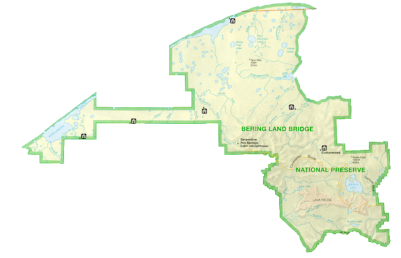
| DescriptionBering Land Bridge National Preserve.png | Map of the Bering Land Bridge National Preserve in Alaska |
| Source | nps.gov |
| Author | NPS |
| Permission (Reusing this file) |
PD-USGov-NPS |
| Public domainPublic domainfalsefalse |
| This image or media file contains material based on a work of a National Park Service employee, created as part of that person's official duties. As a work of the U.S. federal government, such work is in the public domain in the United States. See the NPS website and NPS copyright policy for more information. |  |
Original upload log edit
| Date/Time | Dimensions | User | Comment |
|---|---|---|---|
| 15 April 2008, 11:01:47 | 791 × 509 (121605 bytes) | Aconcagua (talk · contribs) | {{Information |Description=Map of the Bering Land Bridge National Preserve in Alaska |Source=[http://www.nps.gov/archive/bela/images/p_map3.gif nps.gov] |Date= |Author=NPS |Permission=PD-USGov-NPS |other_versions= }} {{PD-USGov-NPS}} [[Category:Maps of |
File history
Click on a date/time to view the file as it appeared at that time.
| Date/Time | Thumbnail | Dimensions | User | Comment | |
|---|---|---|---|---|---|
| current | 03:07, 24 August 2014 |  | 791 × 509 (104 KB) | GifTagger (talk | contribs) | Bot: Converting file to superior PNG file. (Source: Bering_Land_Bridge_National_Preserve.gif). This GIF was problematic due to transparency and non-greyscale color table. |
You cannot overwrite this file.
File usage on Commons
The following page uses this file:
- File:Bering Land Bridge National Preserve.gif (file redirect)
