File:Berlin-kottbusser-tor-karte-Mario Duhanic.png
Size of this preview: 680 × 600 pixels. Other resolutions: 272 × 240 pixels | 544 × 480 pixels | 870 × 768 pixels | 1,161 × 1,024 pixels | 1,700 × 1,500 pixels.
Original file (1,700 × 1,500 pixels, file size: 174 KB, MIME type: image/png)
Captions
Captions
Add a one-line explanation of what this file represents
Summary edit
| Camera location | | View this and other nearby images on: OpenStreetMap |
|---|
| Description |
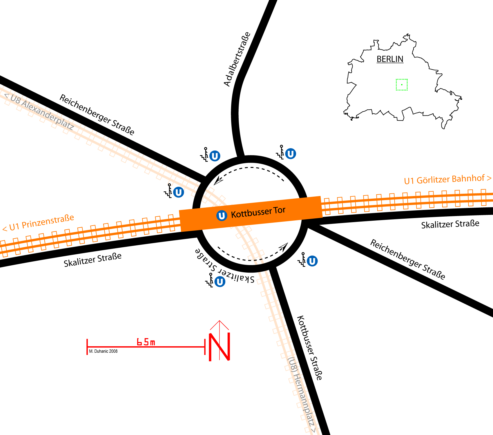
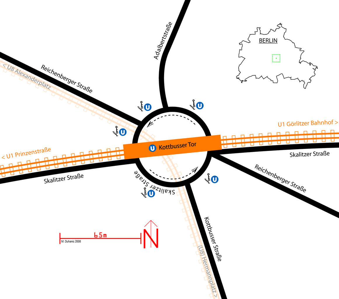
English: Simplified map of the "Kottbusser Tor" (Cottbus Gate) in Berlin-Kreuzberg with the crossroads and the metro station and its location in Berlin. The traffic is following the central roundabout counter clockwise. There are two metro lines, the U1 going from west to east and the U8 going underground from south to north, following the Kottbusser Straße (coming from Hermannplatz) and continuing the Reichsberger Straße (and later going more north towards Moritzplatz and Alexanderplatz.
Deutsch: Vereinfachte Karte vom Kottbusser Tor in Berlin-Kreuzberg. Zu sehen ist die Kreuzung und die U-Bahnstation mit den zusätzlichen U-Bahn-Eingängen. Der Verkehr um den Platz ist ein Kreisverkehr, welcher in Uhrzeigerrichtung verläuft. Es verkehren zwei U-Bahnlinien, die U1 von West nach Ost und die U8 verläuft unterirdisch in Süd-Nord-Richtung, von der Kottbusser Straße kommend (vom Hermannplatz) und dann weiter verlaufend unter der Reichenberger Straße. Rechts oben ist die Lage in Berlin vermerkt.
Français : Carte simplifiée de la "Kottbusser Tor" (Porte de Cottbus) à Berlin-Kreuzberg et le carrefour avec la station de métro et sa position à Berlin. Le cercle est une sens giratoire. Il ya deux lignes de métro, une qui va d'ouest en est et une autre, qui va souterrain du sud vers le nord. |
| Date | |
| Source | Own work |
| Author | Mario Duhanic |
Licensing edit
I, the copyright holder of this work, hereby publish it under the following license:
This file is licensed under the Creative Commons Attribution-Share Alike 3.0 Unported license.
- You are free:
- to share – to copy, distribute and transmit the work
- to remix – to adapt the work
- Under the following conditions:
- attribution – You must give appropriate credit, provide a link to the license, and indicate if changes were made. You may do so in any reasonable manner, but not in any way that suggests the licensor endorses you or your use.
- share alike – If you remix, transform, or build upon the material, you must distribute your contributions under the same or compatible license as the original.
File history
Click on a date/time to view the file as it appeared at that time.
| Date/Time | Thumbnail | Dimensions | User | Comment | |
|---|---|---|---|---|---|
| current | 04:49, 9 April 2008 | | 1,700 × 1,500 (174 KB) | Emdee (talk | contribs) | |
| 02:31, 4 April 2008 |  | 1,600 × 1,412 (139 KB) | Emdee (talk | contribs) | {{location dms|52|29|56|N|13|25|5|E}} {{Information |Description= {{en|Simplified map of the "Kottbusser Tor" (Cottbus Gate) in Berlin-Kreuzberg with the crossroads and the metro station and its location in Berlin. There is another metro line hidden from |
You cannot overwrite this file.
File usage on Commons
There are no pages that use this file.
File usage on other wikis
The following other wikis use this file:
- Usage on de.wikipedia.org
- Usage on fr.wikipedia.org
- Usage on nl.wikipedia.org
- Usage on pl.wikipedia.org