File:Betsiboka River estuary.jpg

Original file (3,484 × 2,529 pixels, file size: 3.13 MB, MIME type: image/jpeg)
Captions
Captions
Summary edit
| Description |
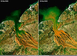
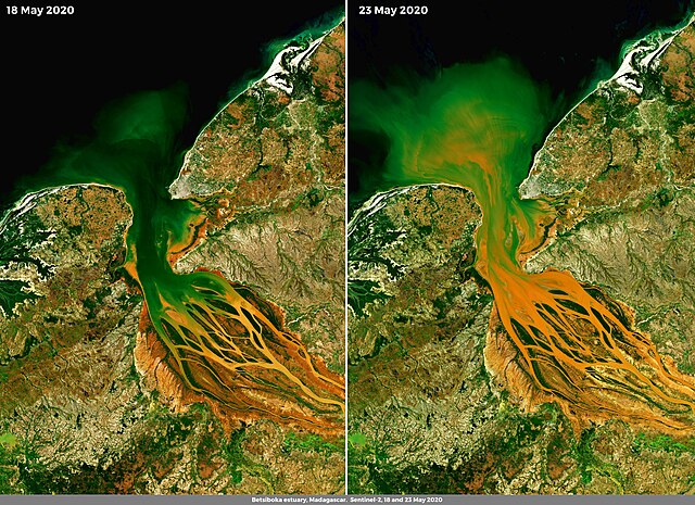
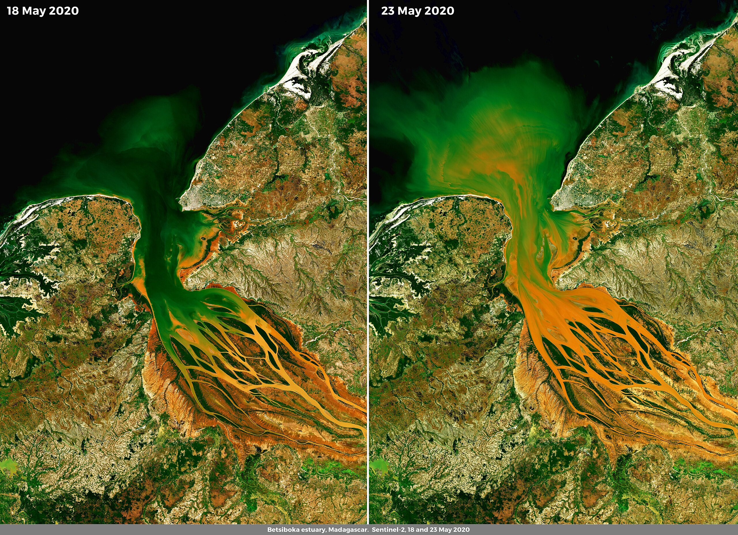
English: The Betsiboka River Estuary is the mouth of the largest river of Madagascar. Nearly a century of logging of Madagascar's rainforests and mangrove forests has resulted in complete deforestation and significant rates of land erosion. After heavy rain, the bright red soils, typical of the island, are washed away and end up in the waters of the river. This image, composed using two scenes acquired by Copernicus Sentinel-2 satellites on 18 and 23 May 2020, allows a comparison of the sediment load transported in the waters of the Betsiboka River before and after heavy rains occurred between 19 and 20 May 2020. Data obtained from the Copernicus Sentinel missions, due their multispectral characteristics, are particularly suitable for monitoring coastal and soil erosion. |
| Date | 27 May 2020 (upload date) |
| Source | Betsiboka River estuary |
| Author | European Union , Copernicus Sentinel-2 imagery |
Licensing edit

|
This image contains data from a satellite in the Copernicus Programme, such as Sentinel-1, Sentinel-2 or Sentinel-3. Attribution is required when using this image.
Attribution: Contains modified Copernicus Sentinel data 2020
The use of Copernicus Sentinel Data is regulated under EU law (Commission Delegated Regulation (EU) No 1159/2013 and Regulation (EU) No 377/2014). Relevant excerpts:
Free access shall be given to GMES dedicated data [...] made available through GMES dissemination platforms [...].
Access to GMES dedicated data [...] shall be given for the purpose of the following use in so far as it is lawful:
GMES dedicated data [...] may be used worldwide without limitations in time.
GMES dedicated data and GMES service information are provided to users without any express or implied warranty, including as regards quality and suitability for any purpose. |
File history
Click on a date/time to view the file as it appeared at that time.
| Date/Time | Thumbnail | Dimensions | User | Comment | |
|---|---|---|---|---|---|
| current | 16:37, 24 July 2023 | | 3,484 × 2,529 (3.13 MB) | OptimusPrimeBot (talk | contribs) | #Spacemedia - Upload of https://www.copernicus.eu/system/files/2020-06/image_day/38_0.jpg via Commons:Spacemedia |
You cannot overwrite this file.
File usage on Commons
The following page uses this file:
- File:Betsiboka River estuary (betsiboka-river-estuary).jpg (file redirect)
.jpg&redirect=no)