File:Bhutan location map.svg

Size of this PNG preview of this SVG file: 800 × 522 pixels. Other resolutions: 320 × 209 pixels | 640 × 417 pixels | 1,024 × 668 pixels | 1,280 × 835 pixels | 2,560 × 1,670 pixels | 874 × 570 pixels.
Original file (SVG file, nominally 874 × 570 pixels, file size: 124 KB)
Captions
Captions
Add a one-line explanation of what this file represents
Summary edit
| Description |
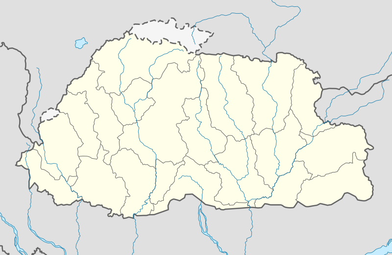
Deutsch: Positionskarte von Bhutan
Quadratische Plattkarte, N-S-Streckung 115 %. Geographische Begrenzung der Karte:
English: Location map of Bhutan
Equirectangular projection, N/S stretching 115 %. Geographic limits of the map:
|
| Date | |
| Source | own work, using United States National Imagery and Mapping Agency data |
| Author | NordNordWest |
| Other versions |
|


|
This map has been made or improved in the German Kartenwerkstatt (Map Lab). You can propose maps to improve as well.
|
Licensing edit
I, the copyright holder of this work, hereby publish it under the following licenses:

|
Permission is granted to copy, distribute and/or modify this document under the terms of the GNU Free Documentation License, Version 1.2 or any later version published by the Free Software Foundation; with no Invariant Sections, no Front-Cover Texts, and no Back-Cover Texts. A copy of the license is included in the section entitled GNU Free Documentation License. |
This file is licensed under the Creative Commons Attribution-Share Alike 3.0 Unported license.
- You are free:
- to share – to copy, distribute and transmit the work
- to remix – to adapt the work
- Under the following conditions:
- attribution – You must give appropriate credit, provide a link to the license, and indicate if changes were made. You may do so in any reasonable manner, but not in any way that suggests the licensor endorses you or your use.
- share alike – If you remix, transform, or build upon the material, you must distribute your contributions under the same or compatible license as the original.
You may select the license of your choice.
File history
Click on a date/time to view the file as it appeared at that time.
| Date/Time | Thumbnail | Dimensions | User | Comment | |
|---|---|---|---|---|---|
| current | 13:26, 24 February 2022 | | 874 × 570 (124 KB) | NordNordWest (talk | contribs) | Reverted to version as of 04:11, 5 April 2021 (UTC) |
| 13:01, 24 February 2022 |  | 874 × 570 (43 KB) | Turbo Slayer 2021 (talk | contribs) | Reverted to version as of 08:08, 15 September 2011 (UTC) | |
| 04:11, 5 April 2021 |  | 874 × 570 (124 KB) | C1MM (talk | contribs) | Added rivers | |
| 19:07, 2 December 2011 |  | 874 × 570 (51 KB) | NordNordWest (talk | contribs) | corr | |
| 15:28, 2 December 2011 |  | 874 × 570 (48 KB) | NordNordWest (talk | contribs) | upd | |
| 08:08, 15 September 2011 |  | 874 × 570 (43 KB) | NordNordWest (talk | contribs) | c | |
| 17:01, 14 September 2011 |  | 874 × 570 (42 KB) | NordNordWest (talk | contribs) | c | |
| 18:08, 31 July 2011 |  | 1,548 × 1,010 (133 KB) | JFHJr (talk | contribs) | {{Information |Description=Updates from the [http://www.election-bhutan.org.bt/index.php?option=com_content&id=132&Itemid=84 Bhutan Election and Demarcation Commissions] |Source=NordNordWest, Government of Bhutan |Date=2011 |Author=NordNordWest |P | |
| 08:22, 14 October 2008 |  | 875 × 571 (109 KB) | NordNordWest (talk | contribs) | ||
| 08:16, 14 October 2008 |  | 875 × 571 (108 KB) | NordNordWest (talk | contribs) | {{Information |Description= {{de|Positionskarte von Bhutan}} Quadratische Plattkarte, N-S-Streckung 115 %. Geographische Begrenzung der Karte: * N: 28.5° N * S: 26.4° N * W: 88.6° O * O: 92.3° O {{en|Location map of [[:en:Bhutan|Bhutan] |
You cannot overwrite this file.
File usage on Commons
The following 39 pages use this file:
- User:NordNordWest/Gallery/Location maps
- File:Bhutan (+claims), administrative divisions - Nmbrs - colored.svg
- File:Bhutan (+claims), administrative divisions - Nmbrs - monochrome.svg
- File:Bhutan (+claims), administrative divisions - de - colored.svg
- File:Bhutan (+claims), administrative divisions - de - monochrome.svg
- File:Bhutan (+claims), administrative divisions - en - monochrome.svg
- File:Bhutan (-claims), administrative divisions - Nmbrs - colored.svg
- File:Bhutan (-claims), administrative divisions - Nmbrs - monochrome.svg
- File:Bhutan (-claims), administrative divisions - de - colored.svg
- File:Bhutan (-claims), administrative divisions - de - monochrome.svg
- File:Bhutan (claims hatched), administrative divisions - Nmbrs - colored.svg
- File:Bhutan (claims hatched), administrative divisions - Nmbrs - monochrome.svg
- File:Bhutan (claims hatched), administrative divisions - de - colored.svg
- File:Bhutan (claims hatched), administrative divisions - de - monochrome.svg
- File:Bhutan relief location map.jpg
- File:Bumthang in Bhutan.svg
- File:Central Dsongdey in Bhutan.svg
- File:Chukha in Bhutan.svg
- File:Dagana in Bhutan.svg
- File:Eastern Dsongdey in Bhutan.svg
- File:Gasa in Bhutan.svg
- File:Haa in Bhutan.svg
- File:Lhuntse in Bhutan.svg
- File:Mongar in Bhutan.svg
- File:Paro in Bhutan.svg
- File:Pemagatshel in Bhutan.svg
- File:Punakha in Bhutan.svg
- File:Samdrup Jongkhar in Bhutan.svg
- File:Samtse in Bhutan.svg
- File:Sarpang in Bhutan.svg
- File:Southern Dsongdey in Bhutan.svg
- File:Thimphu in Bhutan.svg
- File:Trashigang in Bhutan.svg
- File:Trashiyangtse in Bhutan.svg
- File:Trongsa in Bhutan.svg
- File:Tsirang in Bhutan.svg
- File:Wangdue Phodrang in Bhutan.svg
- File:Western Dsongdey in Bhutan.svg
- File:Zhemgang in Bhutan.svg
,_administrative_divisions_-_Nmbrs_-_colored.svg)
,_administrative_divisions_-_Nmbrs_-_monochrome.svg)
,_administrative_divisions_-_de_-_colored.svg)
,_administrative_divisions_-_de_-_monochrome.svg)
,_administrative_divisions_-_en_-_monochrome.svg)
,_administrative_divisions_-_Nmbrs_-_colored.svg)
,_administrative_divisions_-_Nmbrs_-_monochrome.svg)
,_administrative_divisions_-_de_-_colored.svg)
,_administrative_divisions_-_de_-_monochrome.svg)
,_administrative_divisions_-_Nmbrs_-_colored.svg)
,_administrative_divisions_-_Nmbrs_-_monochrome.svg)
,_administrative_divisions_-_de_-_colored.svg)
,_administrative_divisions_-_de_-_monochrome.svg)
File usage on other wikis
The following other wikis use this file:
- Usage on af.wikipedia.org
- Usage on an.wikipedia.org
- Usage on ar.wikipedia.org
- Usage on ast.wikipedia.org
- Usage on as.wikipedia.org
- Usage on az.wikipedia.org
- Usage on ba.wikipedia.org
- Usage on be-tarask.wikipedia.org
- Usage on be.wikipedia.org
- Usage on bg.wikipedia.org
- Usage on bn.wikipedia.org
View more global usage of this file.