File:Bikini 165.39504E 11.60671N.jpg

Size of this preview: 800 × 577 pixels. Other resolutions: 320 × 231 pixels | 640 × 462 pixels | 1,024 × 739 pixels | 1,277 × 921 pixels.
Original file (1,277 × 921 pixels, file size: 324 KB, MIME type: image/jpeg)
Captions
Captions
Add a one-line explanation of what this file represents
Summary
edit
| Description |
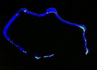
English: Geocover 2000 satellite image of Bikini Atoll, Ralik Chain, Marshall Islands, Pacific Ocean |
| Date | |
| Source | NASA World Wind Screenshot (Geocover 2000) |
| Author | NASA |
Licensing
edit
| This image is in the public domain because it is a screenshot from NASA’s globe software World Wind using a public domain layer, such as Blue Marble, MODIS, Landsat, SRTM, USGS or GLOBE.
|
 |
File history
Click on a date/time to view the file as it appeared at that time.
| Date/Time | Thumbnail | Dimensions | User | Comment | |
|---|---|---|---|---|---|
| current | 22:34, 26 February 2010 | | 1,277 × 921 (324 KB) | Ratzer (talk | contribs) | {{Information |Description={{en|1=Geocover 2000 satellite image of Bikini Atoll, Ralik Chain, Marshall Islands, Pacific Ocean}} |Source=NASA World Wind Screenshot (Geocover 2000) |Author=NASA |Date=2000 |Permission= |other_versions= }} [[Category:Marshal |
You cannot overwrite this file.
File usage on Commons
There are no pages that use this file.
File usage on other wikis
The following other wikis use this file:
- Usage on de.wikipedia.org