File:Black River (Sanilac and St. Clair counties, Michigan).png

Size of this preview: 800 × 589 pixels. Other resolutions: 320 × 236 pixels | 640 × 472 pixels | 1,024 × 755 pixels | 1,280 × 943 pixels | 2,560 × 1,886 pixels | 2,850 × 2,100 pixels.
Original file (2,850 × 2,100 pixels, file size: 422 KB, MIME type: image/png)
Captions
Captions
Add a one-line explanation of what this file represents
Summary edit
.png&action=edit§ion=1)
| Description |
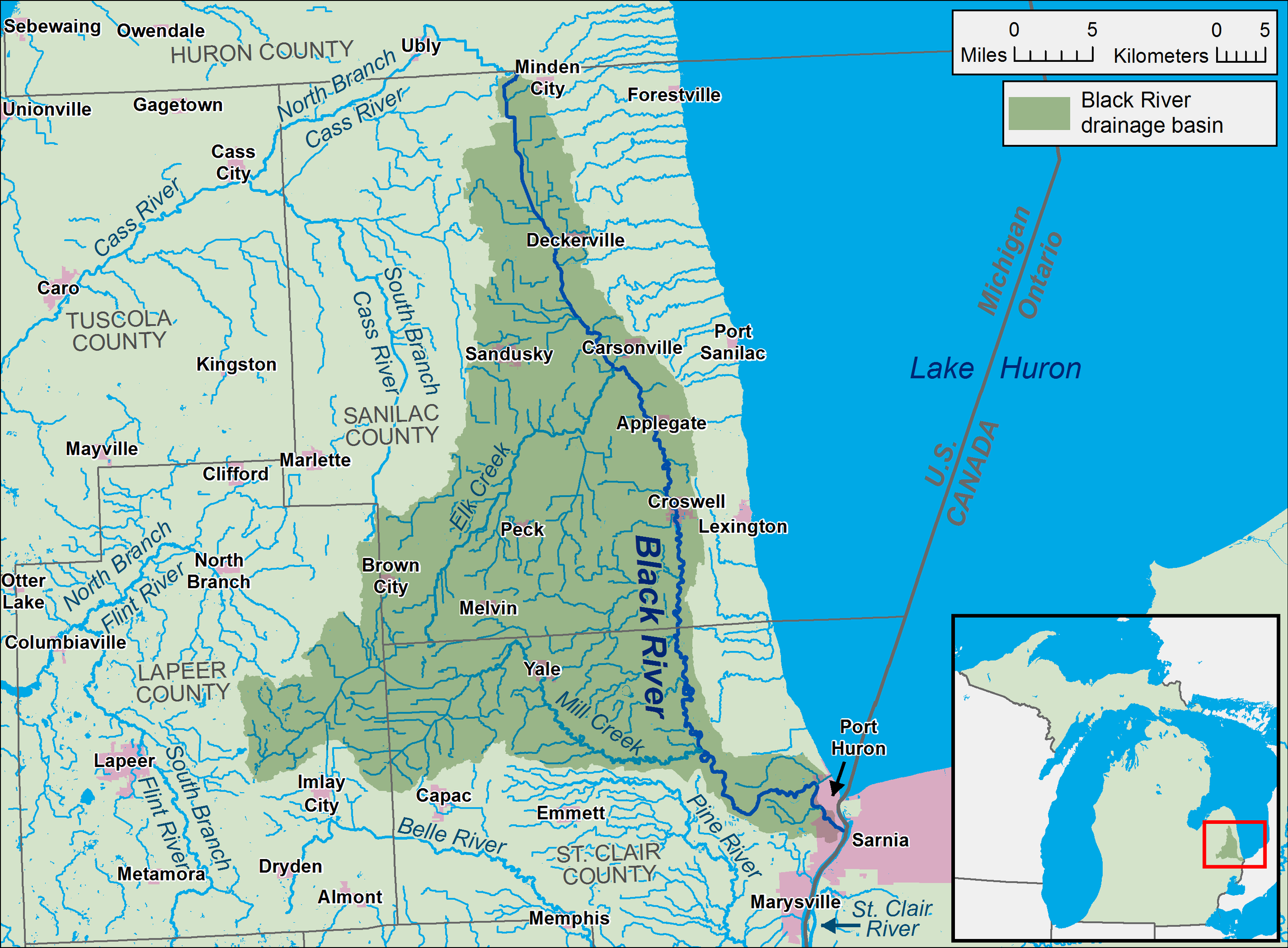
English: A map of the Black River and its watershed (USGS HUC-10 codes 0409000101 and 0409000102) in Sanilac and St. Clair counties in Michigan. |
| Date | |
| Source | Own work, data from w:The National Map |
| Author | Tim Kiser (TimK MSI) |
Licensing edit
.png&action=edit§ion=2)
I, the copyright holder of this work, hereby publish it under the following license:
This file is licensed under the Creative Commons Attribution-Share Alike 4.0 International license.
- You are free:
- to share – to copy, distribute and transmit the work
- to remix – to adapt the work
- Under the following conditions:
- attribution – You must give appropriate credit, provide a link to the license, and indicate if changes were made. You may do so in any reasonable manner, but not in any way that suggests the licensor endorses you or your use.
- share alike – If you remix, transform, or build upon the material, you must distribute your contributions under the same or compatible license as the original.
File history
Click on a date/time to view the file as it appeared at that time.
| Date/Time | Thumbnail | Dimensions | User | Comment | |
|---|---|---|---|---|---|
| current | 18:55, 27 November 2016 | | 2,850 × 2,100 (422 KB) | TimK MSI (talk | contribs) | readability improvements |
| 17:42, 26 November 2016 |  | 2,850 × 2,100 (436 KB) | TimK MSI (talk | contribs) | {{Information |Description ={{en|1=A map of the Black River and its watershed (USGS HUC-10 codes 0409000101 and 0409000102) in Sanilac and [[w:... |
You cannot overwrite this file.
File usage on Commons
There are no pages that use this file.
File usage on other wikis
The following other wikis use this file:
- Usage on bn.wikipedia.org
- Usage on en.wikipedia.org
- Usage on xmf.wikipedia.org
.png&oldid=825134568)