File:Blair Missouri 2011 2.jpg

Size of this preview: 593 × 599 pixels. Other resolutions: 238 × 240 pixels | 475 × 480 pixels | 760 × 768 pixels | 1,270 × 1,283 pixels.
Original file (1,270 × 1,283 pixels, file size: 224 KB, MIME type: image/jpeg)
Captions
Captions
Add a one-line explanation of what this file represents
Summary
edit
| Description |
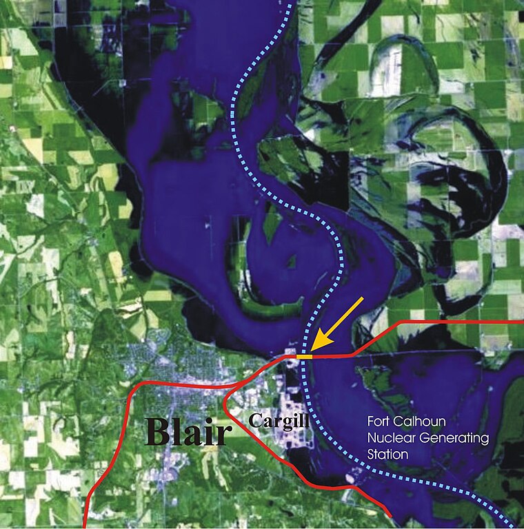
English: Part of Landsat 5 photo of 2011-06-30 flood from Blair Nebaska through Omaha to Plattsmouth Nebraska |
| Date | |
| Source |
This file was derived from: Landsat5-omaha-2011-06-30.jpg |
| Author | NASA |
Licensing
edit
| This file is in the public domain in the United States because it was solely created by NASA. NASA copyright policy states that "NASA material is not protected by copyright unless noted". (See Template:PD-USGov, NASA copyright policy page or JPL Image Use Policy.) | ||
 |
Warnings:
|
File history
Click on a date/time to view the file as it appeared at that time.
| Date/Time | Thumbnail | Dimensions | User | Comment | |
|---|---|---|---|---|---|
| current | 13:38, 9 April 2018 | | 1,270 × 1,283 (224 KB) | Krib (talk | contribs) | Mark "Cargill" and "Fort Calhoun Nuclear Generating Station" |
| 13:04, 6 April 2018 |  | 1,270 × 1,286 (216 KB) | Krib (talk | contribs) | smaller lines | |
| 10:40, 6 April 2018 |  | 1,270 × 1,286 (217 KB) | Krib (talk | contribs) | "Blair" mark smaller | |
| 09:23, 6 April 2018 |  | 1,270 × 1,286 (216 KB) | Krib (talk | contribs) | mark missouri and rail lines | |
| 20:18, 5 April 2018 |  | 1,253 × 1,269 (343 KB) | Krib (talk | contribs) | User created page with UploadWizard |
You cannot overwrite this file.
File usage on Commons
The following 3 pages use this file:
File usage on other wikis
The following other wikis use this file:
- Usage on de.wikipedia.org