File:Blank map of Mpumalanga (2016).svg
(Redirected from File:Blank map of Mpumalanga.svg)

Size of this PNG preview of this SVG file: 559 × 599 pixels. Other resolutions: 224 × 240 pixels | 448 × 480 pixels | 717 × 768 pixels | 955 × 1,024 pixels | 1,911 × 2,048 pixels | 683 × 732 pixels.
Original file (SVG file, nominally 683 × 732 pixels, file size: 345 KB)
Captions
Captions
Add a one-line explanation of what this file represents
Summary
edit.svg&action=edit§ion=1)
| Description |
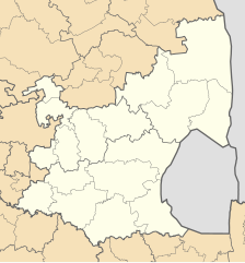
English: Blank map of Mpumalanga province of South Africa, with municipal boundaries as they are after the municipal elections of 3 August 2016. Equirectangular projection; map shows 28° to 32.25° E and 23.75° to 27.75° S. |
| Date | |
| Source | Own work |
| Author | Htonl |
Licensing
edit.svg&action=edit§ion=2)
I, the copyright holder of this work, hereby publish it under the following licenses:

|
Permission is granted to copy, distribute and/or modify this document under the terms of the GNU Free Documentation License, Version 1.2 or any later version published by the Free Software Foundation; with no Invariant Sections, no Front-Cover Texts, and no Back-Cover Texts. A copy of the license is included in the section entitled GNU Free Documentation License. |
This file is licensed under the Creative Commons Attribution-Share Alike Attribution-Share Alike 4.0 International, 3.0 Unported, 2.5 Generic, 2.0 Generic and 1.0 Generic license.
- You are free:
- to share – to copy, distribute and transmit the work
- to remix – to adapt the work
- Under the following conditions:
- attribution – You must give appropriate credit, provide a link to the license, and indicate if changes were made. You may do so in any reasonable manner, but not in any way that suggests the licensor endorses you or your use.
- share alike – If you remix, transform, or build upon the material, you must distribute your contributions under the same or compatible license as the original.
You may select the license of your choice.
File history
Click on a date/time to view the file as it appeared at that time.
| Date/Time | Thumbnail | Dimensions | User | Comment | |
|---|---|---|---|---|---|
| current | 01:26, 18 August 2016 | | 683 × 732 (345 KB) | Htonl (talk | contribs) | == {{int:filedesc}} == {{Information |Description ={{en|1=Blank map of Mpumalanga province of South Africa, with municipal boundaries as they are after the municipal elections of 3 August 2016. Equirectan... |
You cannot overwrite this file.
File usage on Commons
The following 3 pages use this file:
File usage on other wikis
The following other wikis use this file:
- Usage on af.wikipedia.org
- Mpumalanga
- Ehlanzeni-distriksmunisipaliteit
- Nkangala-distriksmunisipaliteit
- Gert Sibande-distriksmunisipaliteit
- Mbombela Plaaslike Munisipaliteit
- Umjindi Plaaslike Munisipaliteit
- Thaba Chweu Plaaslike Munisipaliteit
- Nkomazi Plaaslike Munisipaliteit
- Bosbokrand Plaaslike Munisipaliteit
- Steve Tshwete Plaaslike Munisipaliteit
- Emalahleni Plaaslike Munisipaliteit, Mpumalanga
- Victor Khanye Plaaslike Munisipaliteit
- Thembisile Hani Plaaslike Munisipaliteit
- Govan Mbeki Plaaslike Munisipaliteit
- Lekwa Plaaslike Munisipaliteit
- Albert Luthuli Plaaslike Munisipaliteit
- Dipaleseng Plaaslike Munisipaliteit
- Msukaligwa Plaaslike Munisipaliteit
- Mkhondo Plaaslike Munisipaliteit
- Pixley ka Seme Plaaslike Munisipaliteit
- Emakhazeni Plaaslike Munisipaliteit
- Dr. J.S. Moroka Plaaslike Munisipaliteit
- Sjabloon:Mpumalanga Munisipaliteite
- Usage on cs.wikipedia.org
- Usage on de.wikipedia.org
- Usage on en.wikipedia.org
- Usage on fa.wikipedia.org
- Usage on id.wikipedia.org
- Usage on ms.wikipedia.org
- Usage on xh.wikipedia.org
- Usage on yo.wikipedia.org
- Usage on zu.wikipedia.org
.svg&oldid=825335486)