File:Bludenz Kath. PK Zum Unbefleckten Herzen Mariens.JPG
Size of this preview: 799 × 599 pixels. Other resolutions: 320 × 240 pixels | 640 × 480 pixels | 1,024 × 768 pixels | 1,280 × 960 pixels | 2,560 × 1,920 pixels | 3,797 × 2,848 pixels.
Original file (3,797 × 2,848 pixels, file size: 1.71 MB, MIME type: image/jpeg)
Captions
Captions
Add a one-line explanation of what this file represents
| Description |
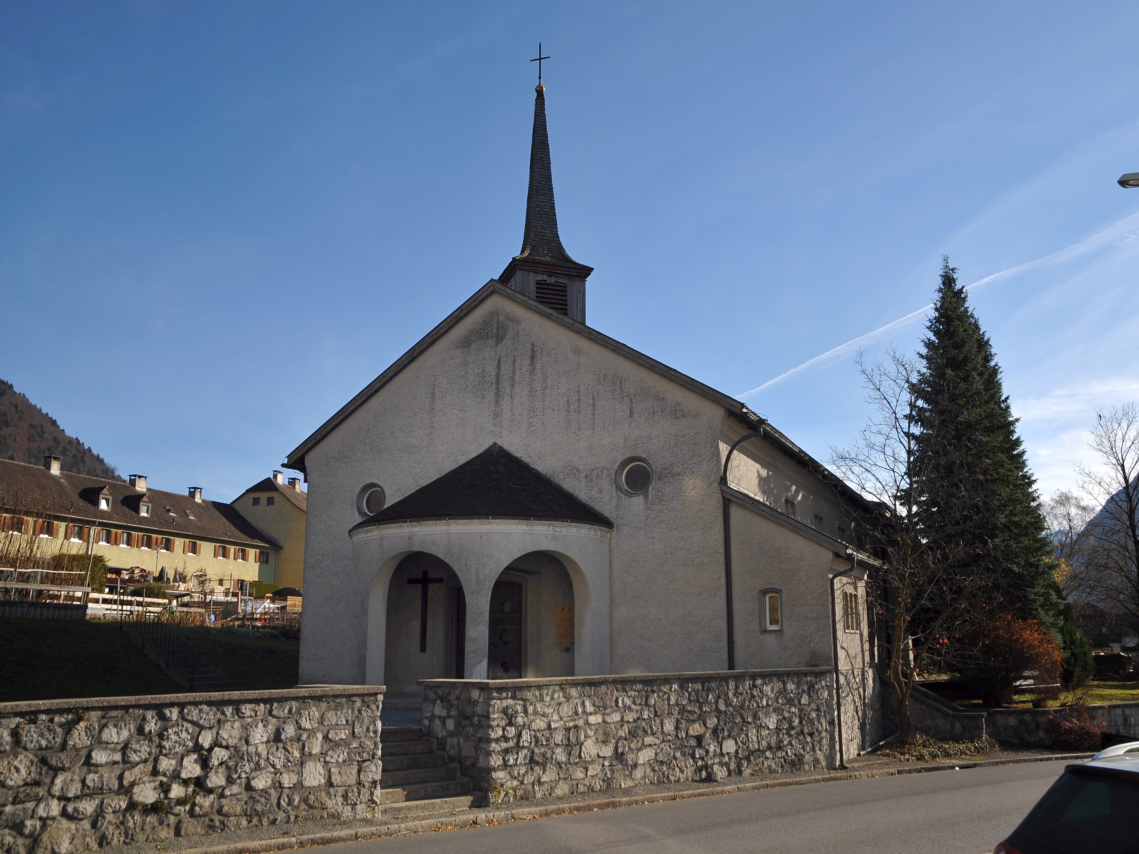
Deutsch: Die Stadtpfarrkirche Herz Mariä, auch Fatima-Kirche, ist eine römisch-katholische Kirche in der österreichischen Stadt Bludenz in der Sonnenbergstraße 14. Die Kirche erscheint stark ländlich, und wurde mit einer Unterkirche und Gemeinschaftsräumen als erster Kirchenneubau Vorarlbergs nach dem Krieg in den Jahren 1948 bis 1950 errichtet. Architekt war Otto Linder, welcher bereits die Hl. Kreuz Kirche geplant hat.
|
||
| Date | |||
| Source | Own work | ||
| Author | böhringer friedrich | ||
| Permission (Reusing this file) |
I, the copyright holder of this work, hereby publish it under the following licenses:
This file is licensed under the Creative Commons Attribution-Share Alike 3.0 Austria license.
 You may select the license of your choice. |

This Photo was taken by Böhringer Friedrich.
|
Feel free to use my photos, but please mention me as the author and if you want send me a message. or (rufre@lenz-nenning.at) |
| Camera location | | View this and other nearby images on: OpenStreetMap |
|---|
| Object location | | View this and other nearby images on: OpenStreetMap |
|---|
File history
Click on a date/time to view the file as it appeared at that time.
| Date/Time | Thumbnail | Dimensions | User | Comment | |
|---|---|---|---|---|---|
| current | 21:27, 1 December 2012 | | 3,797 × 2,848 (1.71 MB) | Böhringer (talk | contribs) | {{Information |Description={{de| '''Die '''Stadtpfarrkirche Herz Mariä''', auch '''Fatima-Kirche''', ist eine römisch-katholische Kirche in der österreichischen Stadt Bludenz in der [[:de:Grafschaf... |
You cannot overwrite this file.
File usage on Commons
The following page uses this file:
File usage on other wikis
The following other wikis use this file:
- Usage on de.wikipedia.org
- Usage on www.wikidata.org