File:Blue Marble Next Generation + topography + bathymetry.jpg

Size of this preview: 800 × 400 pixels. Other resolutions: 320 × 160 pixels | 640 × 320 pixels | 1,024 × 512 pixels | 1,280 × 640 pixels | 3,600 × 1,800 pixels.
Original file (3,600 × 1,800 pixels, file size: 1.93 MB, MIME type: image/jpeg)
Captions
Captions
Add a one-line explanation of what this file represents
Summary
edit
| Description |
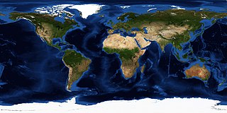
English: Blue Marble: Next Generation + topography + bathymetry. Equirectangular projection. Produced by Reto Stöckli, NASA Earth Observatory (NASA Goddard Space Flight Center) |
| Date | |
| Source | https://neo.sci.gsfc.nasa.gov |
| Author | Reto Stöckli, NASA Earth Observatory, modified by NordNordWest |
Licensing
edit
| This file is in the public domain in the United States because it was solely created by NASA. NASA copyright policy states that "NASA material is not protected by copyright unless noted". (See Template:PD-USGov, NASA copyright policy page or JPL Image Use Policy.) | ||
 |
Warnings:
|
File history
Click on a date/time to view the file as it appeared at that time.
| Date/Time | Thumbnail | Dimensions | User | Comment | |
|---|---|---|---|---|---|
| current | 15:42, 18 November 2019 | | 3,600 × 1,800 (1.93 MB) | NordNordWest (talk | contribs) | {{Information | Description = {{en|1=Blue Marble: Next Generation + topography + bathymetry. Equirectangular projection. Produced by Reto Stöckli, NASA Earth Observatory (NASA Goddard Space Flight Center)}} | Source = [https://neo.sci.gsfc.nasa.gov/view.php?datasetId=BlueMarbleNG-TB&date=2004-08-01 https://neo.sci.gsfc.nasa.gov] | Date = {{Date|2004|08}} | Author = Reto Stöckli, NASA Earth Observatory, modified by {{U|NordNordWest}} | permission = | oth... |
You cannot overwrite this file.
File usage on Commons
The following 2 pages use this file:
File usage on other wikis
The following other wikis use this file:
- Usage on arz.wikipedia.org
- شهرستان رستم
- شهرستان قير وكارزين
- دهقايد
- ونایى
- سرابتاوه
- غلدار سبز
- كناره
- قاسمآباد (قريه ايرانيه فى دهستان هجمتانه)
- علیآباد دمق
- بزین
- علیآباد پشتشهر
- قصر قمشه
- رشج شاوور
- شهرستان دشت آزادجان
- شهرستان مباركه
- شهرستان بشاجرد (استان هرمزجان)
- شهرستان لنجه
- شهرستان خمیر
- شهرستان خمین
- شهرستان فریدونشهر
- شهرستان رودان
- شهرستان زریندشت
- شهرستان دهاقان
- شهرستان قشم
- شهرستان مشجینشهر
- شهرستان شوش
- شهرستان خمینیشهر
- شهرستان جلپایجان
- شهرستان حاجیآباد
- شهرستان شهرضا
- شهرستان اصفهان
- شهرستان فریدن
- شهرستان آشتیان
- شهرستان دلیجان
- شهرستان فلاورجان
- شهرستان ابوموسی
- شهرستان كاشان
- شهرستان دلفان
- شهرستان اردبیل
- شهرستان بروجرد
- شهرستان دورود
- شهرستان باغملك
- شهرستان هندیجان
- شهرستان ماهشهر
- شهرستان شادجان
- شهرستان خرمشهر
- شهرستان رامهرمز
- شهرستان اردستان
- شهرستان برخوار
- شهرستان جاجرم
View more global usage of this file.