File:Bohus1678-3.jpg

Size of this preview: 571 × 600 pixels. Other resolutions: 228 × 240 pixels | 457 × 480 pixels | 731 × 768 pixels | 975 × 1,024 pixels | 2,361 × 2,480 pixels.
Original file (2,361 × 2,480 pixels, file size: 750 KB, MIME type: image/jpeg)
Captions
Captions
Add a one-line explanation of what this file represents
Summary
edit
| Description |
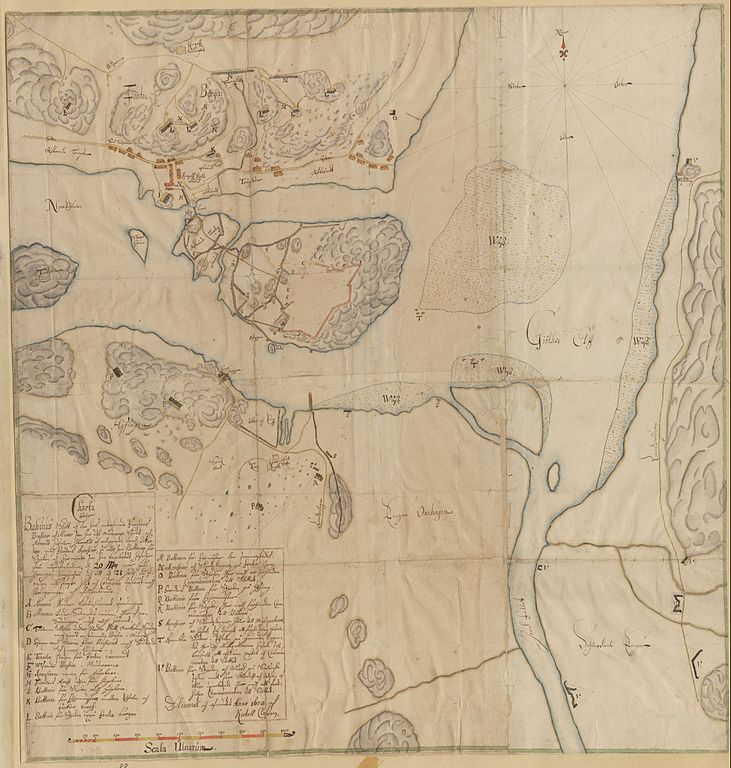
English: Map of Bohus castle, and surroundings, after the danish/norwegian siege in 1678.
Svenska: Karta över Bohus med omgivningar efter den belägringen 1678. Norska kanonbatterier på Fontinberget norr om fästningen. Danska kanonbatterier söder om fästningen på Hisingen. Svenska kanonbatterier på fästningen och på östra stranden av Göta älv. |
| Date | |
| Source | Karta 0424:009:088 från Krigsarkivet, https://sok.riksarkivet.se/arkiv/L2Tkgb7Mk4zVlEvfQKt7h1 |
| Author | Kietell Classon |
Licensing
edit
|
This work is in the public domain in its country of origin and other countries and areas where the copyright term is the author's life plus 100 years or fewer. | |
| This file has been identified as being free of known restrictions under copyright law, including all related and neighboring rights. | |
File history
Click on a date/time to view the file as it appeared at that time.
| Date/Time | Thumbnail | Dimensions | User | Comment | |
|---|---|---|---|---|---|
| current | 19:21, 1 February 2012 | | 2,361 × 2,480 (750 KB) | Dagjoh (talk | contribs) | {{Information |Description ={{en|1=Map of Bohus castle, and surroundings, after the danish/norwegian siege in 1678.}} {{sv|1=Karta över Bohus med omgivningar efter den belägringen 1678. Norska kanonbatterier på Fontinberget norr om fästningen. Dans |
You cannot overwrite this file.
File usage on Commons
There are no pages that use this file.
File usage on other wikis
The following other wikis use this file:
- Usage on sv.wikipedia.org