File:Borderization South Ossetia near Saribari village.jpg

Size of this preview: 800 × 536 pixels. Other resolutions: 320 × 214 pixels | 640 × 428 pixels | 1,024 × 685 pixels | 1,280 × 857 pixels | 2,560 × 1,714 pixels | 3,872 × 2,592 pixels.
Original file (3,872 × 2,592 pixels, file size: 4.61 MB, MIME type: image/jpeg)
Captions
Captions
Add a one-line explanation of what this file represents
Summary edit
| Description |
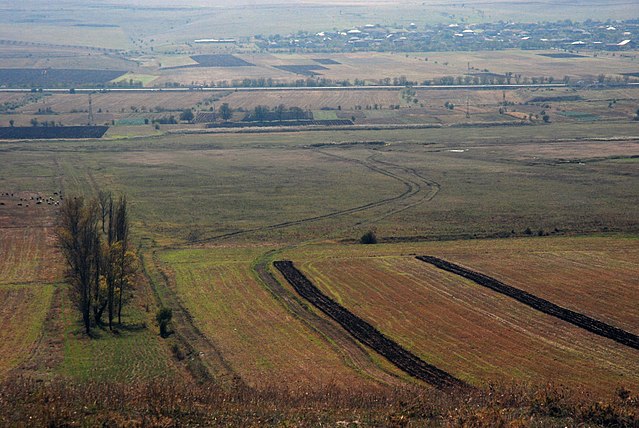
English: Borderization South Ossetia in process and its impact. The Administrative Boundary Line runs through fields and is unrecognizable in the land. Russian and South Ossetian border troops demarcate the boundary line by dragging lines in the ground, which discourages (Georgian) farmers and owners of the land to go to the part behind the lines, otherwise risking detention. |
| Date | |
| Source | https://flickr.com/photos/34523388@N06/30299422725 |
| Author | Jelger Groeneveld |
Licensing edit
I, the copyright holder of this work, hereby publish it under the following license:
This file is licensed under the Creative Commons Attribution 4.0 International license.
- You are free:
- to share – to copy, distribute and transmit the work
- to remix – to adapt the work
- Under the following conditions:
- attribution – You must give appropriate credit, provide a link to the license, and indicate if changes were made. You may do so in any reasonable manner, but not in any way that suggests the licensor endorses you or your use.
File history
Click on a date/time to view the file as it appeared at that time.
| Date/Time | Thumbnail | Dimensions | User | Comment | |
|---|---|---|---|---|---|
| current | 10:46, 12 July 2017 | | 3,872 × 2,592 (4.61 MB) | Labrang (talk | contribs) | User created page with UploadWizard |
You cannot overwrite this file.
File usage on Commons
There are no pages that use this file.
File usage on other wikis
The following other wikis use this file:
- Usage on ka.wikipedia.org