File:Borohun.png

Size of this preview: 800 × 434 pixels. Other resolutions: 320 × 174 pixels | 640 × 347 pixels | 1,024 × 556 pixels | 1,423 × 772 pixels.
Original file (1,423 × 772 pixels, file size: 316 KB, MIME type: image/png)
Captions
Captions
Add a one-line explanation of what this file represents
Summary
edit
| Description | Template:DeS |
| Date | |
| Source | Open Street Map |
| Author | Open Street Map |
| Description |
This map was created from OpenStreetMap project data, collected by the community. This map may be incomplete, and may contain errors. Don't rely solely on it for navigation. |
|||
| Date | (see file history) | |||
| Source | openstreetmap.org | |||
| Creator |
OpenStreetMap contributors |
|||
| Permission (Reusing this file) |
OpenStreetMap data is available under the Open Database License (details). Map tiles are licensed under the Creative Commons Attribution-ShareAlike 2.0 license (CC-BY-SA 2.0).
This file is licensed under the Creative Commons Attribution-Share Alike 2.0 Generic license.
|
|||
| Georeferencing | If inappropriate please set warp_status = skip to hide. |
File history
Click on a date/time to view the file as it appeared at that time.
| Date/Time | Thumbnail | Dimensions | User | Comment | |
|---|---|---|---|---|---|
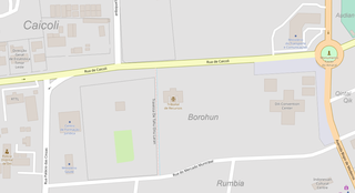
| current | 09:22, 17 October 2020 | | 1,423 × 772 (316 KB) | J. Patrick Fischer (talk | contribs) | {{Information |Description={{deS|Stadtteil Borohun, Dili}} |Source=Open Street Map |Date=2020-10-17 |Author=Open Street Map |Permission= |other_versions= }} {{OpenStreetMap}} Category:Maps of Dili Category:Caicoli |
You cannot overwrite this file.
File usage on Commons
There are no pages that use this file.
File usage on other wikis
The following other wikis use this file:
- Usage on de.wikipedia.org