File:Boston Post Road Bridge with Rye Station in background. Rye, Westchester Co., NY. Sec. 9108, MP 24.22. - Northeast Railroad Corridor, Amtrak Route between New Jersey-New York HAER NY,31-NEYO,167-51.tif
Size of this JPG preview of this TIF file: 774 × 600 pixels. Other resolutions: 310 × 240 pixels | 620 × 480 pixels | 992 × 768 pixels | 1,280 × 991 pixels | 2,560 × 1,983 pixels | 5,000 × 3,873 pixels.
Original file (5,000 × 3,873 pixels, file size: 18.47 MB, MIME type: image/tiff)
Captions
Captions
Add a one-line explanation of what this file represents
Summary edit
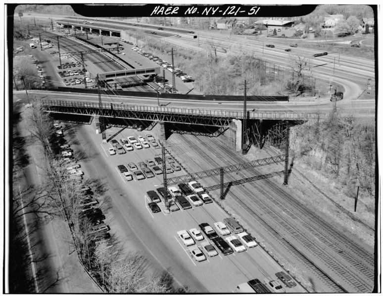
| Boston Post Road Bridge with Rye Station in background. Rye, Westchester Co., NY. Sec. 9108, MP 24.22. - Northeast Railroad Corridor, Amtrak Route between New Jersey-New York and New York-Connecticut State Lines, New York, New York County, NY | ||||
|---|---|---|---|---|
| Photographer |
Related names:
|
|||
| Title |
Boston Post Road Bridge with Rye Station in background. Rye, Westchester Co., NY. Sec. 9108, MP 24.22. - Northeast Railroad Corridor, Amtrak Route between New Jersey-New York and New York-Connecticut State Lines, New York, New York County, NY |
|||
| Depicted place | New York; New York County; New York | |||
| Date | Documentation compiled after 1968 | |||
| Dimensions | 4 x 5 in. | |||
| Current location |
Library of Congress Prints and Photographs Division Washington, D.C. 20540 USA http://hdl.loc.gov/loc.pnp/pp.print |
|||
| Accession number |
HAER NY,31-NEYO,167-51 |
|||
| Credit line |
|
|||
| Notes |
|
|||
| Source | https://www.loc.gov/pictures/item/ny1317.photos.119242p | |||
| Permission (Reusing this file) |
|
|||

| Camera location | | View this and other nearby images on: OpenStreetMap |
|---|
File history
Click on a date/time to view the file as it appeared at that time.
| Date/Time | Thumbnail | Dimensions | User | Comment | |
|---|---|---|---|---|---|
| current | 16:39, 29 July 2014 |  | 5,000 × 3,873 (18.47 MB) | Fæ (talk | contribs) | GWToolset: Creating mediafile for Fæ. HABS 24 July 2014 (2301:2600) |
You cannot overwrite this file.
File usage on Commons
The following page uses this file: