File:Bowling shipyard's not so Frisky now - geograph.org.uk - 961096.jpg
No higher resolution available.
Bowling_shipyard's_not_so_Frisky_now_-_geograph.org.uk_-_961096.jpg (640 × 480 pixels, file size: 69 KB, MIME type: image/jpeg)
Captions
Captions
Add a one-line explanation of what this file represents
Summary edit
| Description |
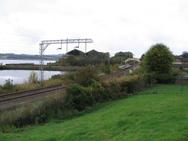
English: Bowling shipyard's not so Frisky now On the left is the west end of Bowling Harbour, a tidal basin still containing a number of abandoned boats and into which the final lock of the Forth & Clyde Canal descends, and above that is the River Clyde. Right of centre is the former North British Railway station at Bowling on the electrified line from Glasgow to Dumbarton, Balloch and Helensburgh. Between the railway and the river the derelict tall black sheds were Frisky Wharf shipyard. Less than a year after the photograph was taken the area was even more derelict following the total demolition of all buildings and trees and the blocking of the railway level crossing that gave access. |
| Date | |
| Source | From geograph.org.uk |
| Author | A-M-Jervis |
| Attribution (required by the license) | A-M-Jervis / Bowling shipyard's not so Frisky now / |
| Camera location | | View this and other nearby images on: OpenStreetMap |
|---|
_heading:225.00&language=en)
| Object location | | View this and other nearby images on: OpenStreetMap |
|---|
_heading:225.00&language=en)
Licensing edit

|
This image was taken from the Geograph project collection. See this photograph's page on the Geograph website for the photographer's contact details. The copyright on this image is owned by A-M-Jervis and is licensed for reuse under the Creative Commons Attribution-ShareAlike 2.0 license.
|
This file is licensed under the Creative Commons Attribution-Share Alike 2.0 Generic license.
Attribution: A-M-Jervis
- You are free:
- to share – to copy, distribute and transmit the work
- to remix – to adapt the work
- Under the following conditions:
- attribution – You must give appropriate credit, provide a link to the license, and indicate if changes were made. You may do so in any reasonable manner, but not in any way that suggests the licensor endorses you or your use.
- share alike – If you remix, transform, or build upon the material, you must distribute your contributions under the same or compatible license as the original.
File history
Click on a date/time to view the file as it appeared at that time.
| Date/Time | Thumbnail | Dimensions | User | Comment | |
|---|---|---|---|---|---|
| current | 16:14, 22 February 2011 | | 640 × 480 (69 KB) | GeographBot (talk | contribs) | == {{int:filedesc}} == {{Information |description={{en|1=Bowling shipyard's not so Frisky now On the left is the west end of Bowling Harbour, a tidal basin still containing a number of abandoned boats and into which the final lock of the Forth & Clyde Can |
You cannot overwrite this file.
File usage on Commons
There are no pages that use this file.