File:Brabantiae Batavae Pars Orientalis.jpg

Size of this preview: 707 × 600 pixels. Other resolutions: 283 × 240 pixels | 566 × 480 pixels | 905 × 768 pixels | 1,207 × 1,024 pixels | 2,413 × 2,048 pixels | 7,503 × 6,367 pixels.
Original file (7,503 × 6,367 pixels, file size: 15.99 MB, MIME type: image/jpeg)
Captions
Captions
Add a one-line explanation of what this file represents
Summary
edit
| Description |
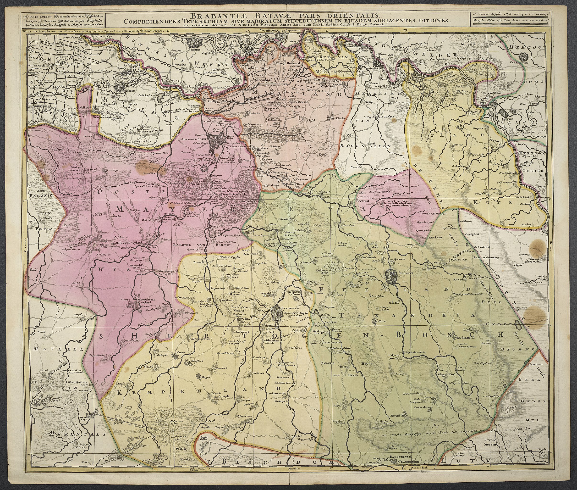
Deutsch: 1Kt. : teilw. kolor. (57 x 47 cm) ; Koordinaten E 4°55'23"-E 6°03'22"/N 51°49'58"-N 51°18'02" ; Vermutlich aus: Atlas maior sive collectio mapparum variis autoribus / 3 ; 104. - Maßstab in graph. Form (Gemeene Duytsche Myle, Fransche Mylen oste Uren Gaans). - Titel oben Mitte. - Maßstab oben rechts. - Legende oben links. - Relief: Einzelberge |
| Date | Zwischen 1677 u. 1679 |
| Source | Leibniz-Institut für Länderkunde e.V., Leipzig |
| Author | Visscher, Nicolaes (d. J.) |
Altkarte
Licensing
edit
| This file is made available under the Creative Commons CC0 1.0 Universal Public Domain Dedication. | |
| The person who associated a work with this deed has dedicated the work to the public domain by waiving all of their rights to the work worldwide under copyright law, including all related and neighboring rights, to the extent allowed by law. You can copy, modify, distribute and perform the work, even for commercial purposes, all without asking permission.
|
File history
Click on a date/time to view the file as it appeared at that time.
| Date/Time | Thumbnail | Dimensions | User | Comment | |
|---|---|---|---|---|---|
| current | 10:42, 6 December 2018 | | 7,503 × 6,367 (15.99 MB) | Higgenhorscht (talk | contribs) | User created page with UploadWizard |
You cannot overwrite this file.
File usage on Commons
The following page uses this file: