File:Brainerd Micropolitan Area.png
No higher resolution available.
Brainerd_Micropolitan_Area.png (440 × 498 pixels, file size: 24 KB, MIME type: image/png)
Captions
Captions
Add a one-line explanation of what this file represents
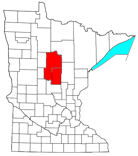
| Description | Locator map of the Brainerd Micropolitan Statistical Area in the southern part of the U.S. state of Minnesota. | ||
| Date | |||
| Source | Modified from this United States Census Bureau file, based on this Census definitions list. | ||
| Author | User:Nyttend | ||
| Permission (Reusing this file) |
US Government work is public domain, and my work is
|
File history
Click on a date/time to view the file as it appeared at that time.
| Date/Time | Thumbnail | Dimensions | User | Comment | |
|---|---|---|---|---|---|
| current | 14:42, 27 July 2008 | | 440 × 498 (24 KB) | Nyttend (talk | contribs) | {{Information |Description=Locator map of the {{w|Brainerd, MN µSA|Brainerd Micropolitan Statistical Area}} in the southern part of the {{w|U.S. state}} of {{w|Minnesota}}. |Source=Modified from [http://www2.census.gov/geo/maps/general_ref/cousub_outline |
You cannot overwrite this file.
File usage on Commons
There are no pages that use this file.
File usage on other wikis
The following other wikis use this file:
- Usage on en.wikipedia.org
- Crow Wing County, Minnesota
- Cass County, Minnesota
- Backus, Minnesota
- Boy River, Minnesota
- Cass Lake, Minnesota
- Chickamaw Beach, Minnesota
- East Gull Lake, Minnesota
- Hackensack, Minnesota
- Lake Shore, Minnesota
- Longville, Minnesota
- Pillager, Minnesota
- Pine River, Minnesota
- Remer, Minnesota
- Baxter, Minnesota
- Brainerd, Minnesota
- Breezy Point, Minnesota
- Crosby, Minnesota
- Crosslake, Minnesota
- Cuyuna, Minnesota
- Deerwood, Minnesota
- Emily, Minnesota
- Fort Ripley, Minnesota
- Garrison, Minnesota
- Ironton, Minnesota
- Jenkins, Minnesota
- Manhattan Beach, Minnesota
- Nisswa, Minnesota
- Pequot Lakes, Minnesota
- Riverton, Minnesota
- Trommald, Minnesota
- Bena, Minnesota
- Federal Dam, Minnesota
- Walker, Minnesota
- Fifty Lakes, Minnesota
- Motley, Minnesota
- Brainerd micropolitan area
- Merrifield, Minnesota
- Whipholt, Minnesota
- Template:Brainerd micropolitan area