File:Brazil Acre location map.svg

Size of this PNG preview of this SVG file: 800 × 449 pixels. Other resolutions: 320 × 180 pixels | 640 × 359 pixels | 1,024 × 575 pixels | 1,280 × 718 pixels | 2,560 × 1,437 pixels | 1,194 × 670 pixels.
Original file (SVG file, nominally 1,194 × 670 pixels, file size: 129 KB)
Captions
Captions
Add a one-line explanation of what this file represents
| Description |
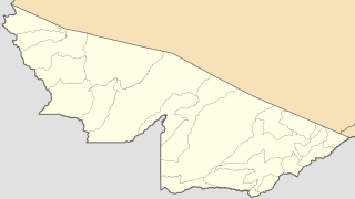
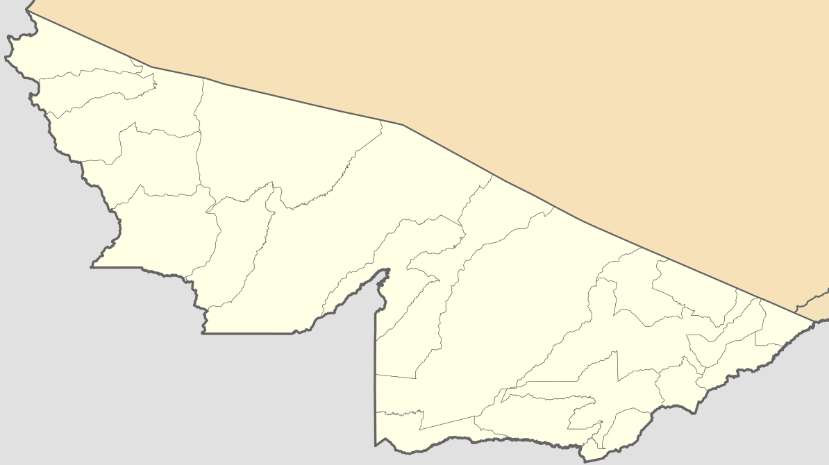
Location map of Acre state. Geographic limits of the map:
|
| Date | (UTC) |
| Source | |
| Author |
|
I, the copyright holder of this work, hereby publish it under the following licenses:
This file is licensed under the Creative Commons Attribution 2.5 Generic license.
- You are free:
- to share – to copy, distribute and transmit the work
- to remix – to adapt the work
- Under the following conditions:
- attribution – You must give appropriate credit, provide a link to the license, and indicate if changes were made. You may do so in any reasonable manner, but not in any way that suggests the licensor endorses you or your use.
| This file is licensed under the Creative Commons Attribution-Share Alike 3.0 Unported license. | ||
| ||
| This licensing tag was added to this file as part of the GFDL licensing update. |

|
Permission is granted to copy, distribute and/or modify this document under the terms of the GNU Free Documentation License, Version 1.2 or any later version published by the Free Software Foundation; with no Invariant Sections, no Front-Cover Texts, and no Back-Cover Texts. A copy of the license is included in the section entitled GNU Free Documentation License. |
You may select the license of your choice.
Uploaded with derivativeFX
File history
Click on a date/time to view the file as it appeared at that time.
| Date/Time | Thumbnail | Dimensions | User | Comment | |
|---|---|---|---|---|---|
| current | 20:25, 20 January 2019 | | 1,194 × 670 (129 KB) | Milenioscuro (talk | contribs) | Does not match with the color conventions |
| 23:15, 19 January 2019 |  | 900 × 507 (158 KB) | Allice Hunter (talk | contribs) | Gráficos | |
| 09:43, 10 February 2012 |  | 1,194 × 670 (129 KB) | Milenioscuro (talk | contribs) | some error ? | |
| 01:54, 8 February 2012 |  | 1,194 × 670 (129 KB) | Milenioscuro (talk | contribs) | boundaries | |
| 16:02, 17 December 2011 |  | 1,194 × 670 (127 KB) | NordNordWest (talk | contribs) | back to original size | |
| 15:58, 17 December 2011 |  | 955 × 536 (127 KB) | NordNordWest (talk | contribs) | fix of a problem, see http://de.wikipedia.org/w/index.php?title=Benutzer_Diskussion%3ANordNordWest&action=historysubmit&diff=97213122&oldid=97190474 | |
| 19:54, 12 August 2011 |  | 1,194 × 670 (157 KB) | Milenioscuro (talk | contribs) | {{Information |Description=Location map of Acre state (Brazil) |Source=*File:Acre_MesoMicroMunicip.svg |Date=2011-08-12 19:53 (UTC) |Author=*File:Acre_MesoMicroMunicip.svg: Raphael Lorenzeto de Abreu *derivative work: ~~~ |Permission= |other_v |
You cannot overwrite this file.
File usage on Commons
The following 22 pages use this file:
- File:Mapa do IDH do Acre (2010).svg
- File:Região Imediata de Brasiléia, Acre.svg
- File:Região Imediata de Cruzeiro do Sul, Acre.svg
- File:Região Imediata de Rio Branco, Acre.svg
- File:Região Imediata de Sena Madureira, Acre.svg
- File:Região Imediata de Tarauacá, Acre.svg
- File:Região Intermediária de Cruzeiro do Sul, Acre.svg
- File:Região Intermediária de Rio Branco, Acre.svg
- File:Regiões Geográficas do Estado do Acre.svg
- Category:Acre (state)
- Category:Airports in Acre (state)
- Category:Association football clubs in Acre (state)
- Category:Association football venues in Acre
- Category:Births in Acre (state)
- Category:Bridges in Acre (state)
- Category:Culture of Acre (state)
- Category:Deaths in Acre (state)
- Category:Hospitals in Acre
- Category:Maps of Acre (state)
- Category:People of Acre (state)
- Category:Politicians of Acre (state)
- Category:Women of Acre (state)
.svg)
File usage on other wikis
The following other wikis use this file:
- Usage on ast.wikipedia.org
- Usage on az.wikipedia.org
- Usage on be.wikipedia.org
- Usage on ca.wikipedia.org
- Usage on de.wikipedia.org
- Usage on en.wikipedia.org
- Usage on es.wikipedia.org
- Usage on fr.wikipedia.org
- Usage on ga.wikipedia.org
- Usage on gl.wikipedia.org
- Usage on he.wikipedia.org
- Usage on hy.wikipedia.org
- Usage on ia.wikipedia.org
- Usage on kbd.wikipedia.org
- Usage on os.wikipedia.org
- Usage on pl.wikipedia.org
View more global usage of this file.