File:Brazos River South of Sugar Land, Texas (16074201380).jpg
Original file (4,000 × 3,000 pixels, file size: 1.89 MB, MIME type: image/jpeg)
Captions
Captions
Summary edit
.jpg&action=edit§ion=1)
| Description |
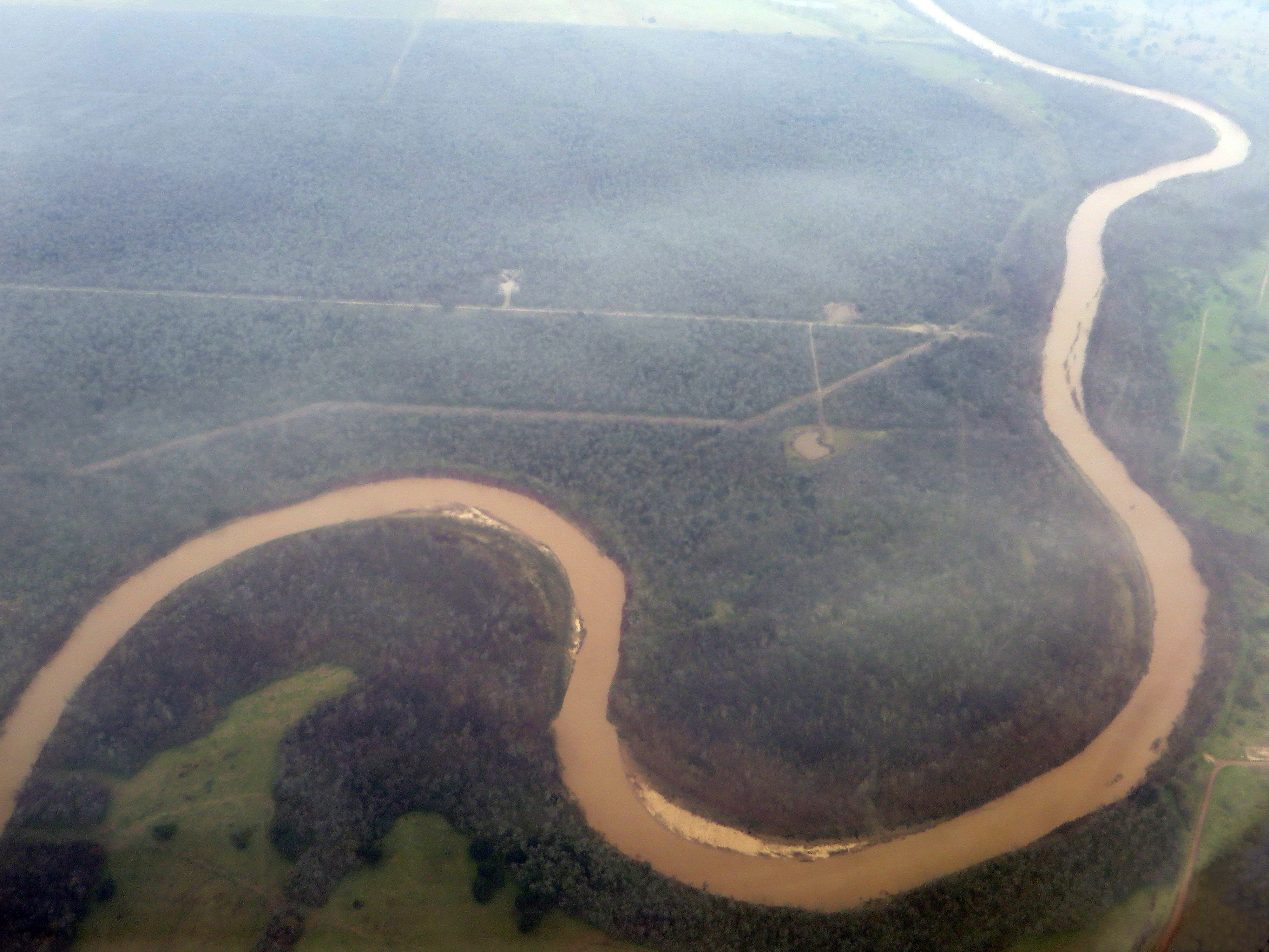
The Brazos River, called the Rio de los Brazos de Dios by early Spanish explorers (translated as "The River of the Arms of God") and the 11th longest river in the United States at 2,060 km (1,280 mi) from its headwater source at the head of Blackwater Draw, Curry County, New Mexico to its mouth at the Gulf of Mexico with a 116,000 km2 (45,000 sq mi) drainage basin. The Brazos proper begins at the confluence of the Salt Fork and Double Mountain Fork, two tributaries of the Upper Brazos that rise on the high plains of the Llano Estacado, flowing 840 mi (1,350 km) through the center of Texas. Another major tributary of the Upper Brazos is the Clear Fork Brazos River, which passes by Abilene and joins the main river near Graham. Important tributaries of the Lower Brazos include the Bosque River, Little River, Yegua Creek, Nolan River, and the Navasota River. Initially running east towards Dallas-Fort Worth, the Brazos turns south, passing through Waco and the Baylor University campus, further south to near Calvert, Texas then past Bryan and College Station, then through Richmond, Texas in Fort Bend County, and into the Gulf of Mexico in the marshes just south of Freeport. Brazos River was the scene of a battle between the Texas Navy and Mexican Navy during the Texas Revolution. Texas Navy ship Independence was defeated by two Mexican vessels. While the river was important for navigation before the American Civil War, it is primarily important today as a source of water for power and irrigation. The water is administered by the Brazos River Authority. The river also features prominently in a number of prison songs, because at one time nearly every prison in Texas was near the Brazos. en.wikipedia.org/wiki/Brazos_River en.wikipedia.org/wiki/Wikipedia:Text_of_Creative_Commons_... |
| Date | |
| Source | Brazos River South of Sugar Land, Texas |
| Author | Ken Lund from Reno, Nevada, USA |
| Camera location | | View this and other nearby images on: OpenStreetMap |
|---|
.jpg¶ms=029.442867_N_-095.541679_E_globe:Earth_type:camera_source:Flickr_&language=en)
Licensing edit
.jpg&action=edit§ion=2)
- You are free:
- to share – to copy, distribute and transmit the work
- to remix – to adapt the work
- Under the following conditions:
- attribution – You must give appropriate credit, provide a link to the license, and indicate if changes were made. You may do so in any reasonable manner, but not in any way that suggests the licensor endorses you or your use.
- share alike – If you remix, transform, or build upon the material, you must distribute your contributions under the same or compatible license as the original.
| This image was originally posted to Flickr by Ken Lund at https://flickr.com/photos/75683070@N00/16074201380. It was reviewed on 4 December 2015 by FlickreviewR and was confirmed to be licensed under the terms of the cc-by-sa-2.0. |
File history
Click on a date/time to view the file as it appeared at that time.
| Date/Time | Thumbnail | Dimensions | User | Comment | |
|---|---|---|---|---|---|
| current | 20:21, 26 February 2016 | | 4,000 × 3,000 (1.89 MB) | INeverCry (talk | contribs) | light/contrast adjustment |
| 04:29, 4 December 2015 |  | 4,000 × 3,000 (1.83 MB) | INeverCry (talk | contribs) | Transferred from Flickr via Flickr2Commons |
You cannot overwrite this file.
File usage on Commons
The following page uses this file:
.jpg&oldid=831915447)