File:Bremen 1796 Murtfeld Domshof Wall.jpg
Size of this preview: 788 × 600 pixels. Other resolutions: 315 × 240 pixels | 631 × 480 pixels | 942 × 717 pixels.
Original file (942 × 717 pixels, file size: 804 KB, MIME type: image/jpeg)
Captions
Captions
Add a one-line explanation of what this file represents
Summary
edit
| Description |
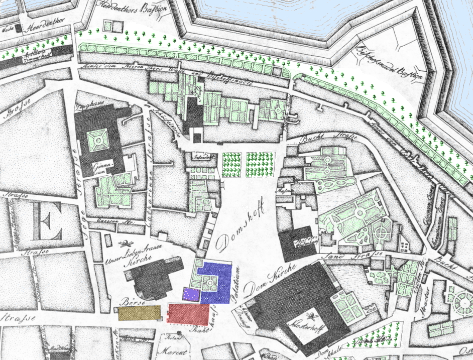
adapted cut of the citymap of Bremen printed in 1796
|
| Date | 1796, adaption 2015-01-07 |
| Source | collotype of the original map, available in Staatsarchiv Bremen |
| Author | de:Carl Ludwig Murtfeldt |
| Other versions |
|
Licensing
edit
|
This work is in the public domain in its country of origin and other countries and areas where the copyright term is the author's life plus 100 years or fewer. | |
| This file has been identified as being free of known restrictions under copyright law, including all related and neighboring rights. | |
File history
Click on a date/time to view the file as it appeared at that time.
| Date/Time | Thumbnail | Dimensions | User | Comment | |
|---|---|---|---|---|---|
| current | 14:12, 14 January 2015 | | 942 × 717 (804 KB) | Ulamm (talk | contribs) | {{Information |Description= adapted cut of the citymap of Bremen printed in 1796 * red = Rathaus (townhall), * blue = Palatium (episcopal palace), that time residence of an administrator of the Hanoveran enclave inside the city, * ochre = Börse (sto... |
You cannot overwrite this file.
File usage on Commons
There are no pages that use this file.
File usage on other wikis
The following other wikis use this file:
- Usage on de.wikipedia.org