File:Bresle.jpg

Size of this preview: 551 × 599 pixels. Other resolutions: 221 × 240 pixels | 441 × 480 pixels | 706 × 768 pixels | 942 × 1,024 pixels | 1,490 × 1,620 pixels.
Original file (1,490 × 1,620 pixels, file size: 1.13 MB, MIME type: image/jpeg)
Captions
Captions
Add a one-line explanation of what this file represents
Summary edit
| Description |
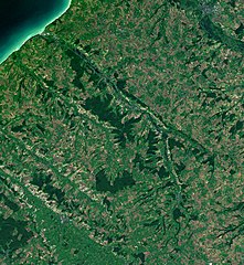
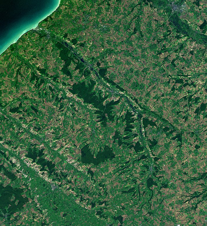
English: Photographs of the Bresle river, between Picardie and Haute-Normandie, France.
Français : Photographies de la Bresle, rivière entre la Picardie et la Haute-Normandie, France. |
| Date | 2007-11-18, the photographs were taken between 2000 and 2004. |
| Source | Nasa World Wind |
| Author | Sémhur ·✉·✍· |
| Camera location | | View this and other nearby images on: OpenStreetMap |
|---|
Licensing edit
| This image is in the public domain because it is a screenshot from NASA’s globe software World Wind using a public domain layer, such as Blue Marble, MODIS, Landsat, SRTM, USGS or GLOBE.
|
 |
File history
Click on a date/time to view the file as it appeared at that time.
| Date/Time | Thumbnail | Dimensions | User | Comment | |
|---|---|---|---|---|---|
| current | 10:35, 18 November 2007 | | 1,490 × 1,620 (1.13 MB) | Sémhur (talk | contribs) | {{Information |Description= {{en}}Photographs of the Bresle river, between Picardie and Haute-Normandie, France. {{fr}}Photographies de la Bresle, rivière entre la Picardie et la Haute-Normandie, France. |Source=[http://worldwind.arc.nasa.gov Nasa World |
You cannot overwrite this file.
File usage on Commons
There are no pages that use this file.
File usage on other wikis
The following other wikis use this file:
- Usage on en.wikipedia.org
- Usage on fr.wikipedia.org
- Usage on pcd.wikipedia.org