File:Bridge view (3416997880).jpg
Size of this preview: 800 × 537 pixels. Other resolutions: 320 × 215 pixels | 640 × 430 pixels | 1,024 × 687 pixels | 1,280 × 859 pixels | 2,896 × 1,944 pixels.
Original file (2,896 × 1,944 pixels, file size: 4.19 MB, MIME type: image/jpeg)
Captions
Captions
Add a one-line explanation of what this file represents
Summary edit
.jpg&action=edit§ion=1)
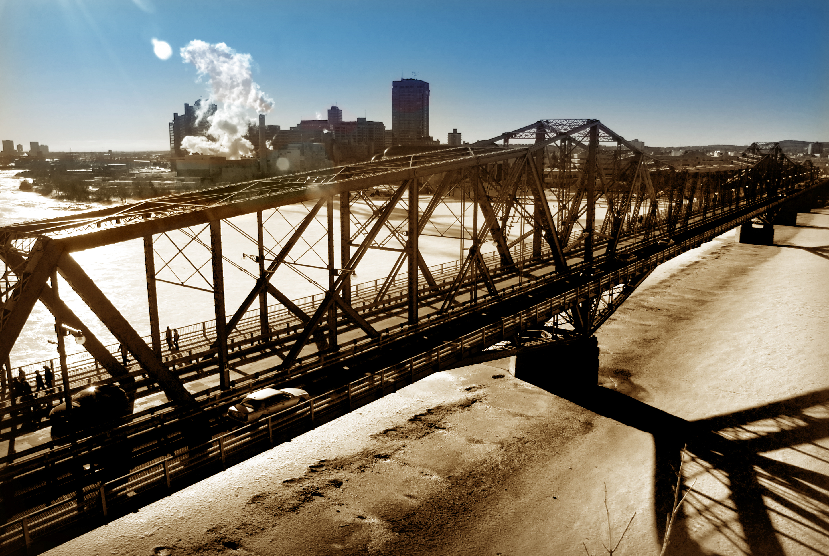
| Description | A view of the Alexandra Bridge under not so favourable light. Built between 1898 and 1900, the Royal Alexandra Interprovincial Bridge spans the Ottawa River between Ottawa, Ontario and Gatineau, Quebec. |
| Date | |
| Source | Bridge view |
| Author | Vince Alongi from Delta, B.C., Canada |
| Camera location | | View this and other nearby images on: OpenStreetMap |
|---|
.jpg¶ms=045.437008_N_-075.700135_E_globe:Earth_type:camera_source:Flickr_&language=en)
Licensing edit
.jpg&action=edit§ion=2)
This file is licensed under the Creative Commons Attribution 2.0 Generic license.
- You are free:
- to share – to copy, distribute and transmit the work
- to remix – to adapt the work
- Under the following conditions:
- attribution – You must give appropriate credit, provide a link to the license, and indicate if changes were made. You may do so in any reasonable manner, but not in any way that suggests the licensor endorses you or your use.
| This image was originally posted to Flickr by Vince Alongi at https://flickr.com/photos/90963248@N00/3416997880. It was reviewed on 30 June 2023 by FlickreviewR 2 and was confirmed to be licensed under the terms of the cc-by-2.0. |
File history
Click on a date/time to view the file as it appeared at that time.
| Date/Time | Thumbnail | Dimensions | User | Comment | |
|---|---|---|---|---|---|
| current | 14:13, 30 June 2023 | | 2,896 × 1,944 (4.19 MB) | Mindmatrix (talk | contribs) | Transferred from Flickr via #flickr2commons |
You cannot overwrite this file.
File usage on Commons
The following page uses this file:
.jpg&oldid=833328197)