File:British Dominions (map by William Doyle and J. Prockter, 1770).jpg
No higher resolution available.
British_Dominions_(map_by_William_Doyle_and_J._Prockter,_1770).jpg (325 × 204 pixels, file size: 102 KB, MIME type: image/jpeg)
Captions
Captions
Add a one-line explanation of what this file represents
Summary edit
.jpg&action=edit§ion=1)
| Description |
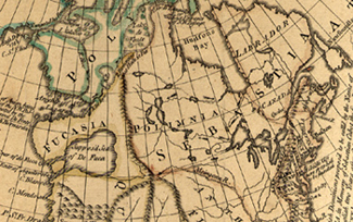
English: Portion of the map British Dominions by William Doyle and J. Prockter, 1770 |
|||
| Date | ||||
| Source |
Provincial Archives of Alberta Accession 71.430/4.
|
|||
| Author | Government of Alberta |
Licensing edit
.jpg&action=edit§ion=2)
| I, the copyright holder of this work, release this work into the public domain. This applies worldwide. In some countries this may not be legally possible; if so: I grant anyone the right to use this work for any purpose, without any conditions, unless such conditions are required by law. |
File history
Click on a date/time to view the file as it appeared at that time.
| Date/Time | Thumbnail | Dimensions | User | Comment | |
|---|---|---|---|---|---|
| current | 18:13, 11 September 2008 | | 325 × 204 (102 KB) | Kenny Lane (talk | contribs) | {{Information |Description= |Source=I created this work entirely by myself. |Date= |Author=~~~ |other_versions= }} |
You cannot overwrite this file.
File usage on Commons
There are no pages that use this file.
File usage on other wikis
The following other wikis use this file:
- Usage on en.wikipedia.org
.jpg&oldid=834287423)