File:British Empire in 1914.png
Size of this preview: 800 × 366 pixels. Other resolutions: 320 × 146 pixels | 640 × 292 pixels | 1,357 × 620 pixels.
Original file (1,357 × 620 pixels, file size: 35 KB, MIME type: image/png)
Captions
Captions
Add a one-line explanation of what this file represents
Summary
edit

|
This locator map image could be re-created using vector graphics as an SVG file. This has several advantages; see Commons:Media for cleanup for more information. If an SVG form of this image is available, please upload it and afterwards replace this template with
{{vector version available|new image name}}.
It is recommended to name the SVG file “British Empire in 1914.svg”—then the template Vector version available (or Vva) does not need the new image name parameter. |
| Description |
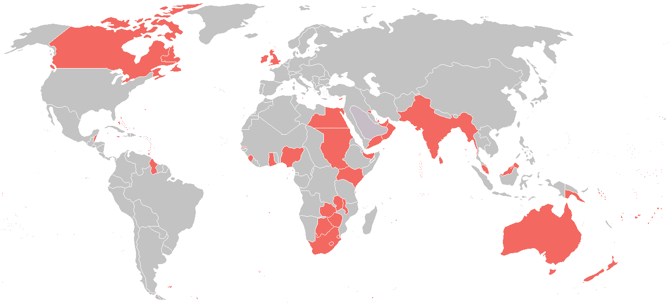
English: A map of the British Empire as it was in 1914, just before the outbreak of the First World War. |
| Date | |
| Source | File:World_1914_empires_colonies_territory.PNG |
| Author | User:Andrew0921 |
| Permission (Reusing this file) |
File:World_1914_empires_colonies_territory.PNG |
Licensing
edit
This file is licensed under the Creative Commons Attribution-Share Alike 3.0 Unported license.
- You are free:
- to share – to copy, distribute and transmit the work
- to remix – to adapt the work
- Under the following conditions:
- attribution – You must give appropriate credit, provide a link to the license, and indicate if changes were made. You may do so in any reasonable manner, but not in any way that suggests the licensor endorses you or your use.
- share alike – If you remix, transform, or build upon the material, you must distribute your contributions under the same or compatible license as the original.
File history
Click on a date/time to view the file as it appeared at that time.
| Date/Time | Thumbnail | Dimensions | User | Comment | |
|---|---|---|---|---|---|
| current | 08:12, 31 October 2021 | | 1,357 × 620 (35 KB) | Randomastwritter (talk | contribs) | dervish |
| 13:20, 4 July 2016 |  | 1,357 × 620 (38 KB) | Snow Lion Fenian (talk | contribs) | {{subst:Upload marker added by en.wp UW}} {{Information |Description = {{en|A map of the British Empire as it was in 1914, just before the outbreak of the First World War.}} |Source = https://commons.wikimedia.org/wiki/File:World_1914_empires_colonies_... |
You cannot overwrite this file.
File usage on Commons
There are no pages that use this file.
File usage on other wikis
The following other wikis use this file:
- Usage on ar.wikipedia.org
- Usage on bn.wikipedia.org
- Usage on en.wikipedia.org
- Usage on mk.wikipedia.org
- Usage on nl.wikipedia.org
- Usage on pnb.wikipedia.org
- Usage on so.wikipedia.org
- Usage on th.wikipedia.org
- Usage on tr.wikipedia.org
- Usage on ur.wikipedia.org