File:British Isles location.svg

Size of this PNG preview of this SVG file: 600 × 600 pixels. Other resolutions: 240 × 240 pixels | 480 × 480 pixels | 768 × 768 pixels | 1,024 × 1,024 pixels | 2,048 × 2,048 pixels | 1,255 × 1,255 pixels.
Original file (SVG file, nominally 1,255 × 1,255 pixels, file size: 485 KB)
Captions
Captions
Add a one-line explanation of what this file represents
Summary edit
| Description |
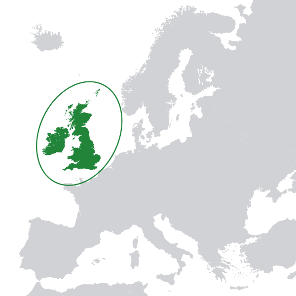
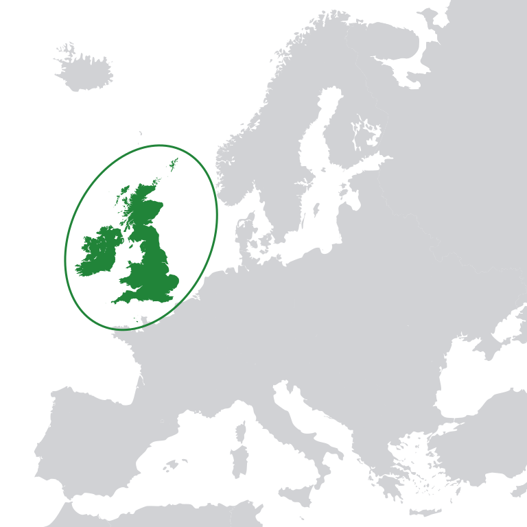
English: Location of the British Isles on the European Continent
Bahasa Indonesia: Lokasi Kepulauan Britania di benua Eropa |
| Date | |
| Source |
Own work |
| Author | TWCarlson |
| SVG development |
This file supersedes the file LocationBritishIsles-noborders.png. It is recommended to use this file rather than the other one.
|

|
Licensing edit
I, the copyright holder of this work, hereby publish it under the following licenses:

|
Permission is granted to copy, distribute and/or modify this document under the terms of the GNU Free Documentation License, Version 1.2 or any later version published by the Free Software Foundation; with no Invariant Sections, no Front-Cover Texts, and no Back-Cover Texts. A copy of the license is included in the section entitled GNU Free Documentation License. |
This file is licensed under the Creative Commons Attribution-Share Alike 3.0 Unported license.
- You are free:
- to share – to copy, distribute and transmit the work
- to remix – to adapt the work
- Under the following conditions:
- attribution – You must give appropriate credit, provide a link to the license, and indicate if changes were made. You may do so in any reasonable manner, but not in any way that suggests the licensor endorses you or your use.
- share alike – If you remix, transform, or build upon the material, you must distribute your contributions under the same or compatible license as the original.
You may select the license of your choice.
File history
Click on a date/time to view the file as it appeared at that time.
| Date/Time | Thumbnail | Dimensions | User | Comment | |
|---|---|---|---|---|---|
| current | 17:45, 31 August 2011 | | 1,255 × 1,255 (485 KB) | TWCarlson (talk | contribs) | Added Iceland; fixed white background |
| 17:21, 31 August 2011 |  | 1,255 × 1,255 (478 KB) | TWCarlson (talk | contribs) | Anglesey was put back in the correct location. | |
| 17:11, 31 August 2011 |  | 1,255 × 1,255 (475 KB) | TWCarlson (talk | contribs) | {{Information |Description ={{en|1=Location of the British Isles on the European Continent}} |Source ={{own}} {{attribSVG|Location_European_nation_states.svg}} {{attribSVG|British_Isles_all.svg}} |Author =TWCarlson |D |
You cannot overwrite this file.
File usage on Commons
The following 3 pages use this file:
File usage on other wikis
The following other wikis use this file:
- Usage on de.wikipedia.org
- Usage on en.wikipedia.org
- Usage on fr.wikipedia.org
- Usage on id.wikipedia.org
- Usage on it.wikipedia.org
- Usage on min.wikipedia.org
- Usage on pl.wikipedia.org
- Usage on pl.wiktionary.org
- Usage on ru.wikivoyage.org
- Usage on tr.wikipedia.org
- Usage on zh.wikipedia.org