File:British Virgin Islands regions map.png
Size of this preview: 742 × 600 pixels. Other resolutions: 297 × 240 pixels | 594 × 480 pixels | 950 × 768 pixels | 1,267 × 1,024 pixels | 2,534 × 2,048 pixels | 3,008 × 2,431 pixels.
Original file (3,008 × 2,431 pixels, file size: 917 KB, MIME type: image/png)
Captions
Captions
Add a one-line explanation of what this file represents
Summary
edit
| Description |
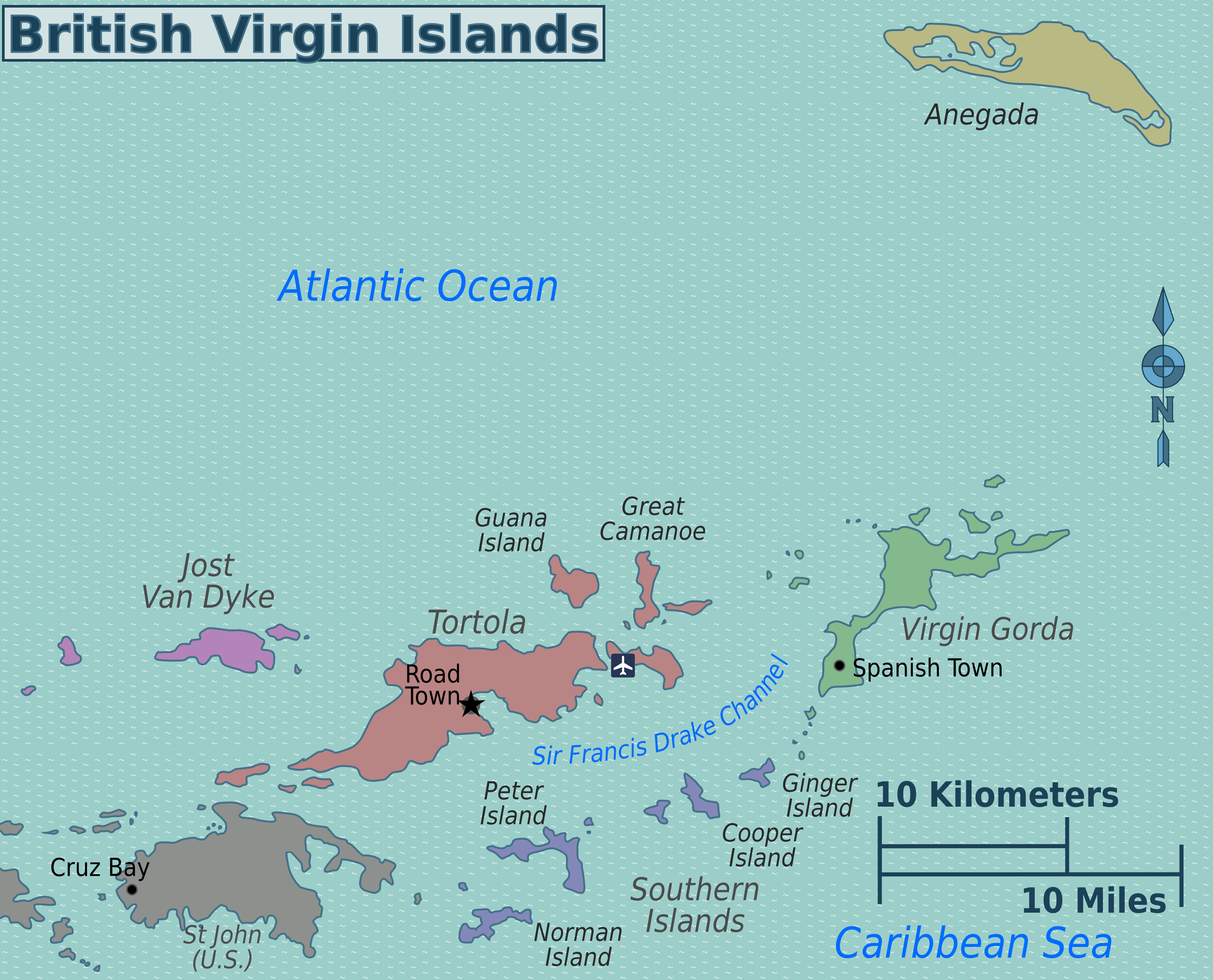
English: British Virgin Islands regions map. English version. |
| Date | |
| Source | Own work - Image:British Virgin Islands regions map.svg |
| Author | Peter Fitzgerald |
| Other versions |
 |
Licensing
edit
This file is licensed under the Creative Commons Attribution 3.0 Unported license.
- You are free:
- to share – to copy, distribute and transmit the work
- to remix – to adapt the work
- Under the following conditions:
- attribution – You must give appropriate credit, provide a link to the license, and indicate if changes were made. You may do so in any reasonable manner, but not in any way that suggests the licensor endorses you or your use.
Original upload log
edit
| This file was imported from Wikivoyage WTS. |
The original description page was here. All following user names refer to wts.wikivoyage-old.
- 2010-07-19 22:04 (WT-shared) Peterfitzgerald archive copy at the Wayback Machine 3008×2431 (938795 bytes) == Summary == {{Imagecredit|credit=Peter Fitzgerald|captureDate=19 July 2010|location=British Virgin Islands|source=[[:Image:British Virgin (Import from wikitravel.org/shared)
File history
Click on a date/time to view the file as it appeared at that time.
| Date/Time | Thumbnail | Dimensions | User | Comment | |
|---|---|---|---|---|---|
| current | 22:58, 17 November 2012 | | 3,008 × 2,431 (917 KB) | MGA73bot2 (talk | contribs) | {{BotMoveToCommons|wts.oldwikivoyage|year={{subst:CURRENTYEAR}}|month={{subst:CURRENTMONTHNAME}}|day={{subst:CURRENTDAY}}}} == {{int:filedesc}} == {{Information |description=British Virgin Islands regions map. English version, British Virgin Islands * ... |
You cannot overwrite this file.
File usage on Commons
The following page uses this file:
File usage on other wikis
The following other wikis use this file:
- Usage on el.wikivoyage.org
- Usage on en.wikivoyage.org
- Usage on fa.wikipedia.org
- Usage on he.wikivoyage.org
- Usage on incubator.wikimedia.org
- Usage on it.wikivoyage.org
- Usage on zh.wikivoyage.org