File:British kingdoms c 800.png
Size of this preview: 454 × 599 pixels. Other resolutions: 182 × 240 pixels | 364 × 480 pixels | 1,000 × 1,320 pixels.
Original file (1,000 × 1,320 pixels, file size: 1.59 MB, MIME type: image/png)
Captions
Captions
Add a one-line explanation of what this file represents
Summary
edit
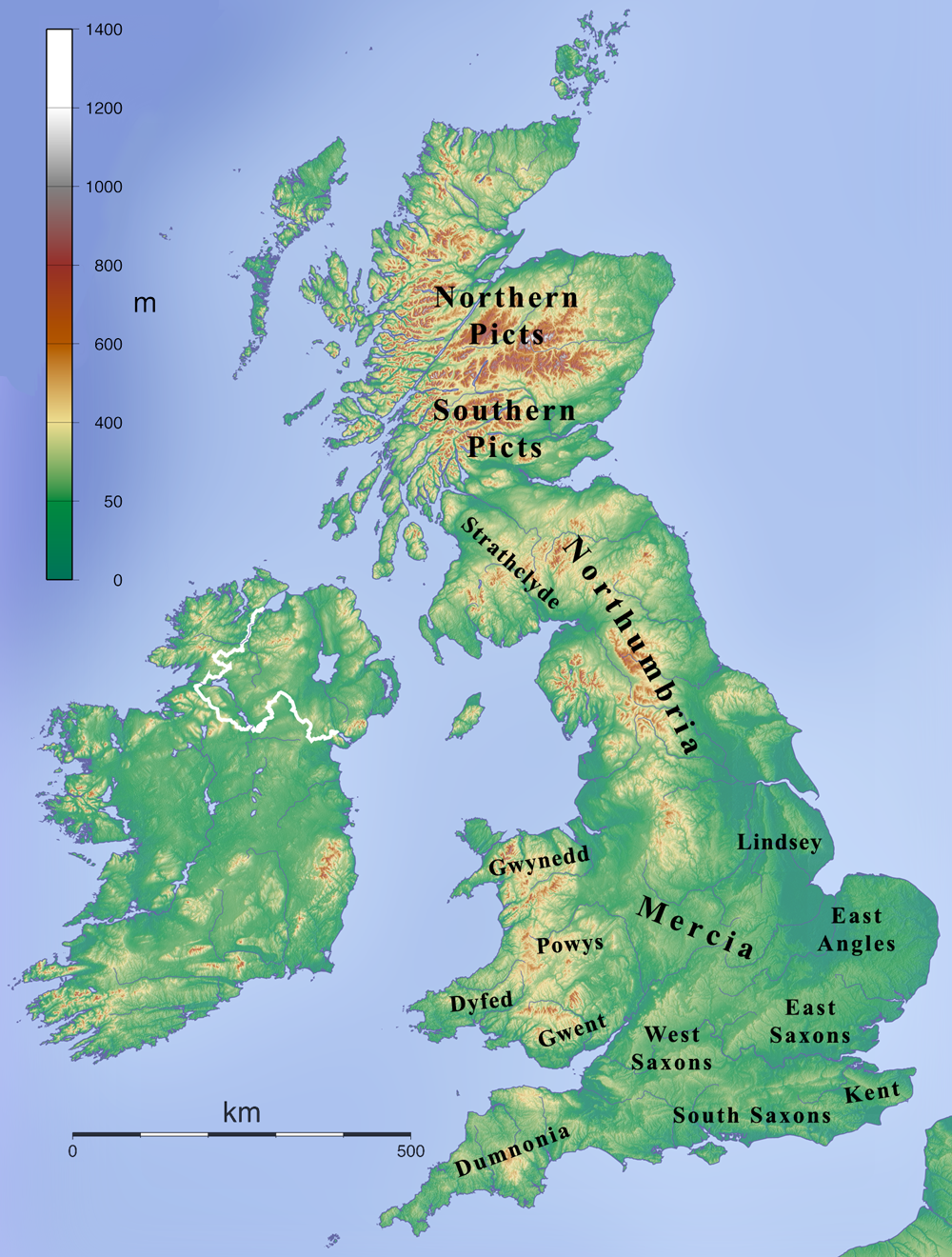
| Description | Map depicting the British Isles during the 7th century. |
| Date | |
| Source | Own work created by combining File:Topographic Map of the UK - Blank.png and en:File:British 7C kingdoms with Bernicia and Deira.gif and removing the Bernicia and Deira labels. |
| Author | Kmusser |
Licensing
edit
I, the copyright holder of this work, hereby publish it under the following license:
This file is licensed under the Creative Commons Attribution-Share Alike 3.0 Unported license.
- You are free:
- to share – to copy, distribute and transmit the work
- to remix – to adapt the work
- Under the following conditions:
- attribution – You must give appropriate credit, provide a link to the license, and indicate if changes were made. You may do so in any reasonable manner, but not in any way that suggests the licensor endorses you or your use.
- share alike – If you remix, transform, or build upon the material, you must distribute your contributions under the same or compatible license as the original.
File history
Click on a date/time to view the file as it appeared at that time.
| Date/Time | Thumbnail | Dimensions | User | Comment | |
|---|---|---|---|---|---|
| current | 13:24, 12 January 2009 | | 1,000 × 1,320 (1.59 MB) | Kmusser (talk | contribs) | == Summary == {{Information |Description=Map depicting the British Islands during the 7th century. |Source=Own work created by combining File:Topographic Map of the UK - Blank.png and en:File:British 7C kingdoms with Bernicia and Deira.gif and r |
You cannot overwrite this file.
File usage on Commons
There are no pages that use this file.
File usage on other wikis
The following other wikis use this file:
- Usage on arz.wikipedia.org
- Usage on ca.wikipedia.org
- Usage on de.wikipedia.org
- Usage on en.wikipedia.org
- Usage on es.wikipedia.org
- Usage on gl.wikipedia.org
- Usage on got.wikipedia.org
- Usage on id.wikipedia.org
- Usage on it.wikipedia.org