File:Brooklyn Bridge Park td (2019-08-23) 100 - Pier 1.jpg

Size of this preview: 800 × 533 pixels. Other resolutions: 320 × 213 pixels | 640 × 427 pixels | 1,024 × 683 pixels | 1,280 × 853 pixels | 2,560 × 1,707 pixels | 5,472 × 3,648 pixels.
Original file (5,472 × 3,648 pixels, file size: 6.34 MB, MIME type: image/jpeg)
Captions
Captions
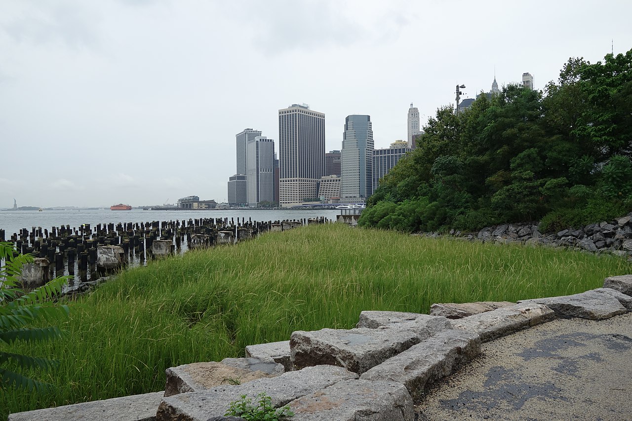
Constructed Wetland, Pier 1, Brooklyn Bridge Park, Dumbo, Brooklyn.
Summary edit
_100_-_Pier_1.jpg&action=edit§ion=1)
| Description |
English: Walking through the south end of Pier 1 towards Pier 2 of Brooklyn Bridge Park, along the East River on Furman Street at approximately Middagh Street and Cranberry Street in Dumbo / Brooklyn Heights, Brooklyn. Pictured is the constructed wetland at the south end of the pier, acting as a storm surge barrier. Similar design is found at Hunter's Point South Park in Queens. |
| Date | |
| Source | Own work |
| Author | Tdorante10 |
| Camera location | | View this and other nearby images on: OpenStreetMap |
|---|
_100_-_Pier_1.jpg¶ms=040.701215_N_-073.996831_E_globe:Earth_type:camera__&language=en)
Licensing edit
_100_-_Pier_1.jpg&action=edit§ion=2)
I, the copyright holder of this work, hereby publish it under the following license:
This file is licensed under the Creative Commons Attribution-Share Alike 4.0 International license.
- You are free:
- to share – to copy, distribute and transmit the work
- to remix – to adapt the work
- Under the following conditions:
- attribution – You must give appropriate credit, provide a link to the license, and indicate if changes were made. You may do so in any reasonable manner, but not in any way that suggests the licensor endorses you or your use.
- share alike – If you remix, transform, or build upon the material, you must distribute your contributions under the same or compatible license as the original.
File history
Click on a date/time to view the file as it appeared at that time.
| Date/Time | Thumbnail | Dimensions | User | Comment | |
|---|---|---|---|---|---|
| current | 01:50, 26 September 2020 | | 5,472 × 3,648 (6.34 MB) | Tdorante10 (talk | contribs) | Uploaded own work with UploadWizard |
You cannot overwrite this file.
File usage on Commons
There are no pages that use this file.
_100_-_Pier_1.jpg&oldid=835137181)